TopoQuest Logo
Do you find TopoQuest useful?
Help keep TopoQuest running and adding new maps/features by donating!
Bitcoin:  19c7KJd3qBynnjoSw5npx9KScwjBe4ifkT
Litecoin:  LXs6TkuXGGXo1vDsWCkWVdjQX94eUKd6ui
Home View Maps Find Maps Find Places Resources & Links


Garden Prairie, Illinois Topographic Map

USGS Map Title: Garden Prairie, IL
USGS Map MRC: 42088C6
DRG (GeoTIFF) Download: o42088c6.tif


Neighboring USGS Topographic Map Quads:


  Belvidere NE, IL  
42088D7
 

  Capron, IL  
42088D6
 

  Harvard, IL  
42088D5
 

  Belvidere North, IL  
42088C7
 

  Garden Prairie, IL  
42088C6
 

  Marengo North, IL  
42088C5
 

  Belvidere South, IL  
42088B7
 

  Riley, IL  
42088B6
 

  Marengo South, IL  
42088B5


Map MRC Location:

N43°
W89°
N43°
W88°
H8 H7 H6 H5 H4 H3 H2 H1
G8 G7 G6 G5 G4 G3 G2 G1
F8 F7 F6 F5 F4 F3 F2 F1
E8 E7 E6 E5 E4 E3 E2 E1
D8 D7 D6 D5 D4 D3 D2 D1
C8 C7 C6 C5 C4 C3 C2 C1
B8 B7 B6 B5 B4 B3 B2 B1
A8 A7 A6 A5 A4 A3 A2 A1
N42°
W89°
N42°
W88°

Garden Prairie, IL USGS 1:24K Topographic Map Preview:
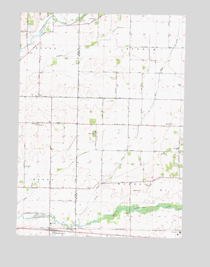
Garden Prairie, IL USGS Topographic Map
Click on map above to begin viewing in our Map Viewer.

This topographic map contains these locations and features:
Feature Name Type Latitude Longitude GNIS ID View Map
Adkins RLA AirportAirportN42.3550°W88.6358°427355View Map
County Line CemeteryCemeteryN42.3706°W88.7062°406654View Map
County Line School (historical)SchoolN42.3475°W88.7054°1695287View Map
Deneen FarmsLocaleN42.3086°W88.6297°2705963View Map
East Bonus CemeteryCemeteryN42.3128°W88.7351°407603View Map
Garden PrairiePopulated PlaceN42.2534°W88.7248°408880View Map
Garden Prairie CemeteryCemeteryN42.2531°W88.7062°408881View Map
Garden Prairie Census Designated PlaceCensusN42.2534°W88.7179°2675242View Map
Garden Prairie Post OfficePost OfficeN42.2537°W88.7230°1764566View Map
Hawthorne Elementary SchoolSchoolN42.3009°W88.6284°409952View Map
Hoppen School (historical)SchoolN42.3136°W88.7257°1695275View Map
Island School (historical)SchoolN42.3425°W88.6740°1695295View Map
Kaufield AirportAirportN42.2652°W88.7282°2679027View Map
Kishwaukee Elementary SchoolSchoolN42.2572°W88.7243°411556View Map
Marengo FarmsLocaleN42.2711°W88.6756°2705968View Map
Mill School (historical)SchoolN42.3686°W88.7251°1695276View Map
Nolan School (historical)SchoolN42.2984°W88.6593°1695300View Map
Olcott School (historical)SchoolN42.3134°W88.6829°1695303View Map
Pierce FarmsLocaleN42.2792°W88.6844°2705970View Map
Porter School (historical)SchoolN42.2767°W88.7248°1695277View Map
Poyer School (historical)SchoolN42.2803°W88.6818°1695304View Map
Rush CreekStreamN42.2564°W88.7029°417053View Map
Shanks FarmLocaleN42.3408°W88.6744°2559588View Map
Stimes School (historical)SchoolN42.3747°W88.7495°1695278View Map
Stone School (historical)SchoolN42.3722°W88.6918°1695309View Map
Stone School CemeteryCemeteryN42.3711°W88.6931°419171View Map
Thorne School (historical)SchoolN42.2517°W88.6759°1695310View Map
Township of BooneCivilN42.3714°W88.7448°428694View Map
Township of DunhamCivilN42.3713°W88.6473°428918View Map
Township of MarengoCivilN42.2843°W88.6472°429322View Map
Village of Garden Prairie (historical)CivilN42.2536°W88.7129°2512769View Map
Willard School (historical)SchoolN42.3281°W88.7257°1695279View Map

Note: Coordinates in the location and feature list above are referenced to NAD83 datum.


Copyright (C) 2008-2025 Ryan Niemi / Sunset Dynamics ... All Rights Reserved