TopoQuest Logo
Do you find TopoQuest useful?
Help keep TopoQuest running and adding new maps/features by donating!
Bitcoin:  19c7KJd3qBynnjoSw5npx9KScwjBe4ifkT
Litecoin:  LXs6TkuXGGXo1vDsWCkWVdjQX94eUKd6ui
Home View Maps Find Maps Find Places Resources & Links


Garfias Mountain, Arizona Topographic Map

USGS Map Title: Garfias Mountain, AZ
USGS Map MRC: 33112H4
DRG (GeoTIFF) Download: o33112h4.tif


Neighboring USGS Topographic Map Quads:


  Morgan Butte, AZ  
34112A5
 

  Copperopolis, AZ  
34112A4
 

  Columbia, AZ  
34112A3
 

  Red Picacho, AZ  
33112H5
 

  Garfias Mountain, AZ  
33112H4
 

  Governors Peak, AZ  
33112H3
 

  Wittmann, AZ  
33112G5
 

  Hieroglyphic Mountains SW, AZ  
33112G4
 

  Baldy Mountain, AZ  
33112G3


Map MRC Location:

N34°
W113°
N34°
W112°
H8 H7 H6 H5 H4 H3 H2 H1
G8 G7 G6 G5 G4 G3 G2 G1
F8 F7 F6 F5 F4 F3 F2 F1
E8 E7 E6 E5 E4 E3 E2 E1
D8 D7 D6 D5 D4 D3 D2 D1
C8 C7 C6 C5 C4 C3 C2 C1
B8 B7 B6 B5 B4 B3 B2 B1
A8 A7 A6 A5 A4 A3 A2 A1
N33°
W113°
N33°
W112°

Garfias Mountain, AZ USGS 1:24K Topographic Map Preview:
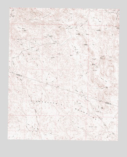
Garfias Mountain, AZ USGS Topographic Map
Click on map above to begin viewing in our Map Viewer.

This topographic map contains these locations and features:
Feature Name Type Latitude Longitude GNIS ID View Map
A D WashStreamN33.9836°W112.3824°459View Map
Alberts TankReservoirN33.9995°W112.4133°568View Map
Big Hells GateGapN33.9756°W112.4202°1319View Map
Big Reef MillPopulated PlaceN33.9648°W112.4849°24321View Map
Bog RanchLocaleN33.8809°W112.3752°1780View Map
Buckhorn MountainsSummitN33.9900°W112.4657°2096View Map
Burro FlatsFlatN33.9325°W112.3927°2251View Map
Burro SpringSpringN33.9255°W112.3908°2262View Map
Cedar BasinBasinN33.9623°W112.4229°2605View Map
Cedar Basin TankReservoirN33.9607°W112.4264°2613View Map
Cross F SpringSpringN33.9203°W112.4754°36962View Map
Dorothy CanyonValleyN33.9942°W112.3771°4035View Map
Eleven L RanchLocaleN33.9811°W112.4335°4405View Map
Garfias MountainSummitN33.9473°W112.4066°4950View Map
Grandview TankReservoirN33.9621°W112.4758°5233View Map
Hell CanyonGapN33.9542°W112.3949°5702View Map
Hellgate MountainSummitN33.9659°W112.4157°5705View Map
Hells Canyon WildernessReserveN33.9447°W112.3853°2760104View Map
Hieroglyphic MountainsRangeN33.9223°W112.4910°5786View Map
Horse CreekStreamN33.9525°W112.3979°5961View Map
Horse Creek TankReservoirN33.9357°W112.4179°5962View Map
Horse SpringSpringN33.9423°W112.4053°5991View Map
J L Bar SpringSpringN33.9911°W112.4983°6300View Map
Layton TankReservoirN33.9824°W112.4302°6926View Map
Little Hells GateGapN33.9798°W112.3966°7122View Map
Morgan City MineMineN33.9031°W112.3979°8285View Map
Mud TankReservoirN33.9852°W112.4171°8390View Map
Pikes PeakSummitN33.9061°W112.3921°9422View Map
Rags CanyonValleyN33.9964°W112.3785°9905View Map
Ramon TankReservoirN33.9660°W112.4064°9937View Map
Rincon BasinBasinN33.9806°W112.4868°10290View Map
Rincon SpringSpringN33.9789°W112.4840°10299View Map
Saint Anthony MineMineN33.9728°W112.4574°10696View Map
Saint Anthony SpringSpringN33.9732°W112.4555°10697View Map
Shirttail HillsSummitN33.8875°W112.4032°11232View Map

Note: Coordinates in the location and feature list above are referenced to NAD83 datum.


Copyright (C) 2008-2025 Ryan Niemi / Sunset Dynamics ... All Rights Reserved