TopoQuest Logo
Do you find TopoQuest useful?
Help keep TopoQuest running and adding new maps/features by donating!
Bitcoin:  19c7KJd3qBynnjoSw5npx9KScwjBe4ifkT
Litecoin:  LXs6TkuXGGXo1vDsWCkWVdjQX94eUKd6ui
Home View Maps Find Maps Find Places Resources & Links


Governors Peak, Arizona Topographic Map

USGS Map Title: Governors Peak, AZ
USGS Map MRC: 33112H3
DRG (GeoTIFF) Download: o33112h3.tif


Neighboring USGS Topographic Map Quads:


  Copperopolis, AZ  
34112A4
 

  Columbia, AZ  
34112A3
 

  Black Canyon City, AZ  
34112A2
 

  Garfias Mountain, AZ  
33112H4
 

  Governors Peak, AZ  
33112H3
 

  New River, AZ  
33112H2
 

  Hieroglyphic Mountains SW, AZ  
33112G4
 

  Baldy Mountain, AZ  
33112G3
 

  Biscuit Flat, AZ  
33112G2


Map MRC Location:

N34°
W113°
N34°
W112°
H8 H7 H6 H5 H4 H3 H2 H1
G8 G7 G6 G5 G4 G3 G2 G1
F8 F7 F6 F5 F4 F3 F2 F1
E8 E7 E6 E5 E4 E3 E2 E1
D8 D7 D6 D5 D4 D3 D2 D1
C8 C7 C6 C5 C4 C3 C2 C1
B8 B7 B6 B5 B4 B3 B2 B1
A8 A7 A6 A5 A4 A3 A2 A1
N33°
W113°
N33°
W112°

Governors Peak, AZ USGS 1:24K Topographic Map Preview:
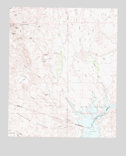
Governors Peak, AZ USGS Topographic Map
Click on map above to begin viewing in our Map Viewer.

This topographic map contains these locations and features:
Feature Name Type Latitude Longitude GNIS ID View Map
Alkali SpringSpringN33.9922°W112.3705°591View Map
Bitter CreekStreamN33.9850°W112.3702°1451View Map
Casa RosaPopulated PlaceN33.9475°W112.3357°24345View Map
Castle CreekStreamN33.8995°W112.2963°2525View Map
Castle Hot SpringsPopulated PlaceN33.9834°W112.3604°2533View Map
Coles WashStreamN33.9045°W112.2785°3118View Map
Cottonwood CreekStreamN33.8923°W112.2935°3337View Map
Cottonwood CreekStreamN33.9831°W112.2941°3338View Map
Cow CreekStreamN33.9742°W112.2941°3443View Map
Crater CanyonValleyN33.9850°W112.3707°3545View Map
Dripping SpringSpringN33.9546°W112.3346°4109View Map
Dry WashStreamN33.9642°W112.2910°4169View Map
Four Tanks CanyonValleyN33.9723°W112.3593°4783View Map
French CreekStreamN33.9286°W112.3160°4846View Map
Garfias WashStreamN33.9303°W112.3221°4951View Map
Governors PeakSummitN33.9742°W112.3724°5199View Map
Hot SpringSpringN33.9856°W112.3602°6035View Map
Humbug CreekStreamN33.9053°W112.2618°30285View Map
Lake Pleasant Regional ParkParkN33.9009°W112.2693°6845View Map
Mitchell SpringSpringN33.9159°W112.3300°8134View Map
Mud SpringSpringN33.9560°W112.3191°8364View Map
Pipeline CanyonValleyN33.8884°W112.2938°9529View Map
Rich GulchValleyN33.9653°W112.2910°10247View Map
Salvation PeakSummitN33.9798°W112.3685°10791View Map
Solo SpringSpringN33.9514°W112.2668°11540View Map
Spring ValleyValleyN33.9231°W112.3624°11715View Map
Squaw MesaFlatN33.9717°W112.3502°11738View Map
Tule SpringSpringN33.8777°W112.3621°12829View Map

Note: Coordinates in the location and feature list above are referenced to NAD83 datum.


Copyright (C) 2008-2025 Ryan Niemi / Sunset Dynamics ... All Rights Reserved