TopoQuest Logo
Do you find TopoQuest useful?
Help keep TopoQuest running and adding new maps/features by donating!
Bitcoin:  19c7KJd3qBynnjoSw5npx9KScwjBe4ifkT
Litecoin:  LXs6TkuXGGXo1vDsWCkWVdjQX94eUKd6ui
Home View Maps Find Maps Find Places Resources & Links


Garretts Bend, West Virginia Topographic Map

USGS Map Title: Garretts Bend, WV
USGS Map MRC: 38081C8
DRG (GeoTIFF) Download: o38081c8.tif


Neighboring USGS Topographic Map Quads:


  Hurricane, WV  
38082D1
 

  Scott Depot, WV  
38081D8
 

  Saint Albans, WV  
38081D7
 

  Hamlin, WV  
38082C1
 

  Garretts Bend, WV  
38081C8
 

  Alum Creek, WV  
38081C7
 

  Hager, WV  
38082B1
 

  Griffithsville, WV  
38081B8
 

  Julian, WV  
38081B7


Map MRC Location:

N39°
W82°
N39°
W81°
H8 H7 H6 H5 H4 H3 H2 H1
G8 G7 G6 G5 G4 G3 G2 G1
F8 F7 F6 F5 F4 F3 F2 F1
E8 E7 E6 E5 E4 E3 E2 E1
D8 D7 D6 D5 D4 D3 D2 D1
C8 C7 C6 C5 C4 C3 C2 C1
B8 B7 B6 B5 B4 B3 B2 B1
A8 A7 A6 A5 A4 A3 A2 A1
N38°
W82°
N38°
W81°

Garretts Bend, WV USGS 1:24K Topographic Map Preview:
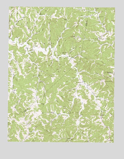
Garretts Bend, WV USGS Topographic Map
Click on map above to begin viewing in our Map Viewer.

This topographic map contains these locations and features:
Feature Name Type Latitude Longitude GNIS ID View Map
Adkins ForkStreamN38.3718°W81.8982°1534840View Map
Bird CemeteryCemeteryN38.3312°W81.9512°1536035View Map
Bridge CreekStreamN38.3368°W81.9476°1536336View Map
Browns Creek ChurchChurchN38.3659°W81.8940°1536436View Map
Bryan BranchStreamN38.3698°W81.8968°1536525View Map
Buck BranchStreamN38.2993°W81.9193°1536548View Map
Central School (historical)SchoolN38.3462°W81.9996°1537174View Map
Curry DistrictCivilN38.3593°W81.9854°1928201View Map
Donley ForkStreamN38.2790°W81.8893°1538267View Map
Dry BranchStreamN38.2748°W81.9401°1538337View Map
Dry Branch School (historical)SchoolN38.2754°W81.9415°1538346View Map
Elizabeth ChurchChurchN38.3056°W81.9129°1538609View Map
Fairview School (historical)SchoolN38.2745°W81.9146°1538834View Map
Flint HollowValleyN38.3551°W81.9318°1539091View Map
Garretts BendPopulated PlaceN38.3040°W81.9149°1539350View Map
Garretts Bend School (historical)SchoolN38.3056°W81.9129°1741623View Map
Good Hope ChurchChurchN38.3109°W81.9651°1539502View Map
Hayzlett ForkStreamN38.3056°W81.9110°1540096View Map
Hazlette CemeteryCemeteryN38.2979°W81.8993°2586187View Map
Highland School (historical)SchoolN38.2845°W81.9576°1540271View Map
Hilbert Wildlife Management AreaParkN38.2554°W81.9062°1741634View Map
Joes CreekStreamN38.2931°W81.9187°1540930View Map
Joes Creek ChurchChurchN38.2532°W81.9287°1540932View Map
Kellys CreekStreamN38.3537°W81.9968°1541144View Map
King Creek School (historical)SchoolN38.2751°W81.8896°1541208View Map
Laurel ForkStreamN38.2618°W81.9179°1540711View Map
Lefthand Fork Turkey CreekStreamN38.3073°W81.9637°1541768View Map
Lick BranchStreamN38.2909°W81.8971°1541859View Map
Lick CreekStreamN38.3406°W81.9787°1541883View Map
Long BranchStreamN38.3501°W81.9724°1542352View Map
Martin RunStreamN38.3379°W81.9524°1542817View Map
Mount Moriah CemeteryCemeteryN38.3364°W81.9732°2586217View Map
Mount Moriah ChurchChurchN38.3356°W81.9743°1543676View Map
Mount Zion ChurchChurchN38.2970°W81.9932°1543820View Map
Nelson CemeteryCemeteryN38.2668°W81.9757°1544091View Map
New Hope School (historical)SchoolN38.2512°W81.9043°1544126View Map
Pleasant View School (historical)SchoolN38.3676°W81.9640°1545049View Map
Providence ChurchChurchN38.3062°W81.9626°1545296View Map
Raccoon HollowValleyN38.3293°W81.9296°1545362View Map
Road ForkStreamN38.2581°W81.9751°1545805View Map
Robinson School (historical)SchoolN38.3729°W81.8979°1545880View Map
Rockhouse BranchStreamN38.2793°W81.9257°1545972View Map
Rocky KnobSummitN38.3476°W81.9246°1546028View Map
Sanson CemeteryCemeteryN38.2754°W81.9264°2574020View Map
Spring Hollow School (historical)SchoolN38.3323°W81.9365°1553003View Map
Sunnydale School (historical)SchoolN38.2923°W81.8965°1547753View Map
TangoPopulated PlaceN38.2523°W81.9262°1555779View Map
Tango BranchStreamN38.2520°W81.9260°1547887View Map
Tango School (historical)SchoolN38.2520°W81.9254°1741687View Map
Toms BranchStreamN38.2868°W81.9232°1548132View Map
Tony BranchStreamN38.3101°W81.9179°1548168View Map
Trace BranchStreamN38.3143°W81.9193°1548194View Map
Trace CreekStreamN38.3448°W81.9979°1548203View Map
Turkey CreekStreamN38.3315°W81.9782°1548331View Map
Twomile BranchStreamN38.3281°W81.9249°1548427View Map
Watts CemeteryCemeteryN38.2533°W81.8856°2570580View Map
Youngs ChapelChurchN38.3634°W81.9315°1549471View Map

Note: Coordinates in the location and feature list above are referenced to NAD83 datum.


Copyright (C) 2008-2024 Ryan Niemi / Sunset Dynamics ... All Rights Reserved