TopoQuest Logo
Do you find TopoQuest useful?
Help keep TopoQuest running and adding new maps/features by donating!
Bitcoin:  19c7KJd3qBynnjoSw5npx9KScwjBe4ifkT
Litecoin:  LXs6TkuXGGXo1vDsWCkWVdjQX94eUKd6ui
Home View Maps Find Maps Find Places Resources & Links


Hamlin, West Virginia Topographic Map

USGS Map Title: Hamlin, WV
USGS Map MRC: 38082C1
DRG (GeoTIFF) Download: o38082c1.tif


Neighboring USGS Topographic Map Quads:


  Milton, WV  
38082D2
 

  Hurricane, WV  
38082D1
 

  Scott Depot, WV  
38081D8
 

  West Hamlin, WV  
38082C2
 

  Hamlin, WV  
38082C1
 

  Garretts Bend, WV  
38081C8
 

  Branchland, WV  
38082B2
 

  Hager, WV  
38082B1
 

  Griffithsville, WV  
38081B8


Map MRC Location:

N39°
W83°
N39°
W82°
H8 H7 H6 H5 H4 H3 H2 H1
G8 G7 G6 G5 G4 G3 G2 G1
F8 F7 F6 F5 F4 F3 F2 F1
E8 E7 E6 E5 E4 E3 E2 E1
D8 D7 D6 D5 D4 D3 D2 D1
C8 C7 C6 C5 C4 C3 C2 C1
B8 B7 B6 B5 B4 B3 B2 B1
A8 A7 A6 A5 A4 A3 A2 A1
N38°
W83°
N38°
W82°

Hamlin, WV USGS 1:24K Topographic Map Preview:
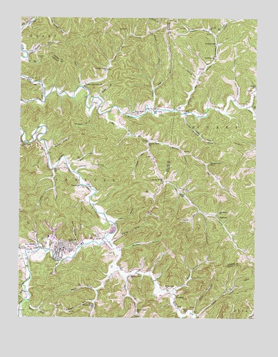
Hamlin, WV USGS Topographic Map
Click on map above to begin viewing in our Map Viewer.

This topographic map contains these locations and features:
Feature Name Type Latitude Longitude GNIS ID View Map
Baker HollowValleyN38.2806°W82.0937°1535147View Map
Big CreekStreamN38.2526°W82.1237°1535825View Map
Big CreekStreamN38.3356°W82.0787°1535826View Map
Big Creek ChurchChurchN38.2945°W82.0196°1535829View Map
BowlesPopulated PlaceN38.3237°W82.0568°1549606View Map
Buckeye HollowValleyN38.3343°W82.0879°1536591View Map
Burns CreekStreamN38.2570°W82.1196°1536753View Map
Buzzard CreekStreamN38.3354°W82.0382°1536812View Map
Camp CreekStreamN38.2518°W82.0310°1536909View Map
Carroll District (historical)CivilN38.2859°W82.0934°1928179View Map
Cherry RunStreamN38.2945°W82.0301°1537247View Map
Clymer CreekStreamN38.3373°W82.0043°1537435View Map
Coon CreekStreamN38.3462°W82.0915°1537620View Map
Cowhide CreekStreamN38.3109°W82.0965°1537751View Map
Crazy Horse AirportAirportN38.3472°W82.1143°2717118View Map
Curry Chapel SchoolSchoolN38.3218°W82.1243°1537930View Map
Davis Trace BranchStreamN38.2615°W82.0435°1538055View Map
District 3CivilN38.2622°W82.1048°2727449View Map
EggletonPopulated PlaceN38.2931°W82.0207°1549669View Map
HamlinPopulated PlaceN38.2787°W82.1029°1539881View Map
Hamlin CemeteryCemeteryN38.2787°W82.1029°1539882View Map
Hamlin Elementary School (historical)SchoolN38.2791°W82.1010°2088219View Map
Hamlin High School (historical)SchoolN38.2792°W82.1014°2088220View Map
Hamlin Police DepartmentBuildingN38.2764°W82.1058°2727998View Map
Hamlin Post OfficePost OfficeN38.2784°W82.1025°1741631View Map
Hamlin Volunteer Fire DepartmentBuildingN38.2754°W82.1042°2577667View Map
Harvey CreekStreamN38.3234°W82.0574°1540042View Map
Harvey Creek ChurchChurchN38.3079°W82.0485°1540043View Map
Harvey Creek School (historical)SchoolN38.3151°W82.0240°1540044View Map
Harvey Creek School (historical)SchoolN38.3234°W82.0560°1540045View Map
Harveys Creek CemeteryCemeteryN38.3056°W82.0504°1741633View Map
Heck BranchStreamN38.2756°W82.1235°1540116View Map
Hungry CreekStreamN38.3368°W82.0560°1540586View Map
Jaynes BranchStreamN38.2615°W82.0837°1540841View Map
Lake BranchStreamN38.2893°W82.0746°1541316View Map
Laurel CreekStreamN38.3115°W82.1076°1541406View Map
Laurel School (historical)SchoolN38.3115°W82.1065°1541548View Map
Laywell BranchStreamN38.3673°W82.0215°1541571View Map
Laywell ChurchChurchN38.3704°W82.0251°1541572View Map
Lincoln County CourthouseBuildingN38.2786°W82.1056°2727851View Map
Lincoln County High SchoolSchoolN38.2758°W82.1160°2489163View Map
Lincoln County Sheriff's OfficeBuildingN38.2793°W82.1053°2728000View Map
Lincoln Emergency Medical ServicesBuildingN38.2790°W82.1205°2581196View Map
Lincoln Memorial CemeteryCemeteryN38.2795°W82.0960°1541986View Map
Lower Coon Creek School (historical)SchoolN38.3476°W82.0907°1542531View Map
Mahone CreekStreamN38.2756°W82.1201°1542698View Map
Meadow BranchStreamN38.2768°W82.0740°1543053View Map
Middle CreekStreamN38.2668°W82.0687°1543160View Map
Middle Creek ChurchChurchN38.2679°W82.0654°1543163View Map
Middle Creek School (historical)SchoolN38.2534°W82.0626°1543164View Map
Middle Fork ChurchChurchN38.2623°W82.0468°1543177View Map
Middle Fork Mud RiverStreamN38.2851°W82.0768°1543189View Map
Miller School (historical)SchoolN38.2531°W82.0357°1543398View Map
Moore School (historical)SchoolN38.3015°W82.0376°1543518View Map
Nelson HollowValleyN38.3409°W82.0107°1544094View Map
New HamlinPopulated PlaceN38.2790°W82.1143°1544118View Map
NyePopulated PlaceN38.3359°W82.0368°1549855View Map
Nye Valley School (historical)SchoolN38.3365°W82.0546°1544266View Map
Paddy BranchStreamN38.3418°W82.0837°1544513View Map
Panther LickStreamN38.3609°W82.1218°1544553View Map
Patters RunStreamN38.3195°W82.0565°1544620View Map
Peaceful Valley ChurchChurchN38.3537°W82.0793°1544668View Map
Pleasant Hill ChurchChurchN38.3048°W82.0910°1544993View Map
Powell CemeteryCemeteryN38.2840°W82.0835°1545214View Map
Right Fork Hungry CreekStreamN38.3462°W82.0543°1545651View Map
Roberts CemeteryCemeteryN38.3404°W82.0840°1545842View Map
Rock CreekStreamN38.3465°W82.0929°1545902View Map
Roses RunStreamN38.3137°W82.0999°1546083View Map
Scary CreekStreamN38.2506°W82.0393°1546485View Map
Simon CreekStreamN38.2818°W82.0765°1546806View Map
SweetlandPopulated PlaceN38.2595°W82.0421°1549948View Map
Sweetland Post OfficePost OfficeN38.2598°W82.0421°1741684View Map
Sycamore CemeteryCemeteryN38.3588°W82.0237°2586144View Map
Sycamore ChurchChurchN38.3584°W82.0224°1547822View Map
Sycamore CreekStreamN38.3365°W82.0407°1547832View Map
Sycamore School (historical)SchoolN38.3645°W82.0215°1547850View Map
Tincture ForkStreamN38.2576°W82.0843°1548103View Map
Town of HamlinCivilN38.2781°W82.1029°2390227View Map
Trace CreekStreamN38.2709°W82.0721°1548202View Map
Trace ForkStreamN38.3415°W82.1115°1548225View Map
Trace Fork CemeteryCemeteryN38.3358°W82.0636°2574021View Map
Trace Fork ChurchChurchN38.3351°W82.0635°1548235View Map
Trace Fork Mud RiverStreamN38.3415°W82.1118°1549548View Map
Uncles BranchStreamN38.2526°W82.0329°1548457View Map
Walnut Grove ChurchChurchN38.2554°W82.0849°1548761View Map
West Virginia State Police Troop 5 - Hamlin DetachmentBuildingN38.2787°W82.1045°2727999View Map
Zirkle BranchStreamN38.3201°W82.1104°1549499View Map

Note: Coordinates in the location and feature list above are referenced to NAD83 datum.


Copyright (C) 2008-2025 Ryan Niemi / Sunset Dynamics ... All Rights Reserved