TopoQuest Logo
Do you find TopoQuest useful?
Help keep TopoQuest running and adding new maps/features by donating!
Bitcoin:  19c7KJd3qBynnjoSw5npx9KScwjBe4ifkT
Litecoin:  LXs6TkuXGGXo1vDsWCkWVdjQX94eUKd6ui
Home View Maps Find Maps Find Places Resources & Links


Griffithsville, West Virginia Topographic Map

USGS Map Title: Griffithsville, WV
USGS Map MRC: 38081B8
DRG (GeoTIFF) Download: o38081b8.tif


Neighboring USGS Topographic Map Quads:


  Hamlin, WV  
38082C1
 

  Garretts Bend, WV  
38081C8
 

  Alum Creek, WV  
38081C7
 

  Hager, WV  
38082B1
 

  Griffithsville, WV  
38081B8
 

  Julian, WV  
38081B7
 

  Big Creek, WV  
38082A1
 

  Mud, WV  
38081A8
 

  Madison, WV  
38081A7


Map MRC Location:

N39°
W82°
N39°
W81°
H8 H7 H6 H5 H4 H3 H2 H1
G8 G7 G6 G5 G4 G3 G2 G1
F8 F7 F6 F5 F4 F3 F2 F1
E8 E7 E6 E5 E4 E3 E2 E1
D8 D7 D6 D5 D4 D3 D2 D1
C8 C7 C6 C5 C4 C3 C2 C1
B8 B7 B6 B5 B4 B3 B2 B1
A8 A7 A6 A5 A4 A3 A2 A1
N38°
W82°
N38°
W81°

Griffithsville, WV USGS 1:24K Topographic Map Preview:
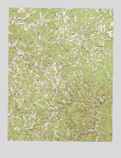
Griffithsville, WV USGS Topographic Map
Click on map above to begin viewing in our Map Viewer.

This topographic map contains these locations and features:
Feature Name Type Latitude Longitude GNIS ID View Map
AlkolPopulated PlaceN38.1629°W81.9249°1534877View Map
Alkol Post OfficePost OfficeN38.1651°W81.9216°1741585View Map
Alum Creek Volunteer Fire Department Station 3BuildingN38.2400°W81.8844°2775493View Map
Barkcamp BranchStreamN38.1365°W81.9712°1535218View Map
Bays CemeteryCemeteryN38.2431°W81.9429°1535324View Map
Bear BranchStreamN38.1584°W81.8979°1535342View Map
Bear ForkStreamN38.2323°W81.9685°1535359View Map
Beech Grove CemeteryCemeteryN38.2029°W81.9168°1535535View Map
Beech Grove ChurchChurchN38.1970°W81.9357°1535537View Map
Bell CemeteryCemeteryN38.2212°W81.9396°1535600View Map
Big BranchStreamN38.1651°W81.9210°1535796View Map
Black CemeteryCemeteryN38.2354°W81.9679°1536047View Map
Blue KnobSummitN38.1465°W81.9515°1536126View Map
BreecePopulated PlaceN38.1370°W81.8962°1553970View Map
Brumfield CemeteryCemeteryN38.1312°W81.9896°1536459View Map
Brushy ForkStreamN38.1640°W81.9176°1536496View Map
Brushy Fork School (historical)SchoolN38.1834°W81.9185°1536512View Map
Buck KnobSummitN38.2126°W81.9096°1554016View Map
Buck Knob Lookout TowerLocaleN38.2126°W81.9096°1741600View Map
BulgerPopulated PlaceN38.1334°W81.9812°1549616View Map
Bulger CemeteryCemeteryN38.1348°W81.9812°1536683View Map
Bulger School (historical)SchoolN38.1284°W81.9715°1536684View Map
Charley HollowValleyN38.1634°W81.9985°1537218View Map
Church of ChristChurchN38.2373°W81.9874°1741605View Map
Cobb Creek ChurchChurchN38.2420°W81.8768°1537482View Map
Coon HollowValleyN38.1259°W81.9374°1537632View Map
District 1CivilN38.2057°W81.9355°2727444View Map
Dodson ForkStreamN38.1365°W81.8954°1538228View Map
Dodson JunctionPopulated PlaceN38.1332°W81.9090°1538229View Map
Dogbone BranchStreamN38.1337°W81.9804°1538245View Map
Dotson CemeteryCemeteryN38.1315°W81.9962°1538282View Map
Duval District Volunteer Fire DepartmentBuildingN38.2383°W81.9904°2577715View Map
Duval High School (historical)SchoolN38.2386°W81.9935°1538478View Map
Duval PK - 8 SchoolSchoolN38.2388°W81.9929°2489153View Map
East (historical)Populated PlaceN38.2195°W81.9360°1556728View Map
Eden ChurchChurchN38.2354°W81.9990°1538548View Map
Egnor CemeteryCemeteryN38.1418°W81.9929°1538569View Map
Egnor CemeteryCemeteryN38.1906°W81.9707°1538570View Map
Egnor CemeteryCemeteryN38.2079°W81.9935°1538571View Map
Ely School (historical)SchoolN38.2112°W81.8887°1538701View Map
Flat CreekStreamN38.1470°W81.9818°1539045View Map
Fork JunctionPopulated PlaceN38.1573°W81.8971°1554487View Map
Griffith CemeteryCemeteryN38.1309°W81.9593°1539744View Map
Griffith CemeteryCemeteryN38.2184°W81.9685°1539745View Map
Griffith CemeteryCemeteryN38.2220°W81.9526°1539746View Map
GriffithsvillePopulated PlaceN38.2387°W81.9893°1539750View Map
Griffithsville Elementary School (historical)SchoolN38.2422°W81.9941°1741627View Map
Griffithsville Post OfficePost OfficeN38.2389°W81.9918°1741628View Map
Gritter HollowValleyN38.1334°W81.9576°1539759View Map
Hager CemeteryCemeteryN38.1309°W81.9746°1539833View Map
Harless CemeteryCemeteryN38.1579°W81.8987°1539962View Map
Holstein CemeteryCemeteryN38.2223°W81.8840°1540408View Map
Jack HollowValleyN38.1259°W81.9951°1540762View Map
Jack Smith BranchStreamN38.1326°W81.9098°1540767View Map
Johnson CemeteryCemeteryN38.1815°W81.9473°1540972View Map
Laurel ForkStreamN38.1612°W81.8912°1541434View Map
LayvillePopulated PlaceN38.1268°W81.9340°1554927View Map
Left Fork ChurchChurchN38.1357°W81.9696°1541642View Map
Lincoln Emergency Medical Services Yawkey SubstationBuildingN38.2246°W81.9637°2581197View Map
Linville CemeteryCemeteryN38.1590°W81.9715°1542004View Map
Linville CemeteryCemeteryN38.1704°W81.9954°1542005View Map
Linville CemeteryCemeteryN38.1709°W81.9871°1542006View Map
Long BranchStreamN38.1265°W81.8935°1542360View Map
Martin CemeteryCemeteryN38.1395°W81.9715°1542805View Map
Martin School (historical)SchoolN38.1365°W81.9701°1542818View Map
Maul ForkStreamN38.1945°W81.9624°1542881View Map
Maul Fork School (historical)SchoolN38.1943°W81.9632°1542882View Map
May CemeteryCemeteryN38.2362°W81.9996°1542893View Map
McClure CemeteryCemeteryN38.2159°W81.9401°1542942View Map
McClure HollowValleyN38.2176°W81.9396°1542944View Map
McNealy CemeteryCemeteryN38.1373°W81.9390°1543035View Map
Meadows CemeteryCemeteryN38.1643°W81.9535°1543088View Map
Meadows CemeteryCemeteryN38.1665°W81.9518°1543089View Map
Meadows CemeteryCemeteryN38.1720°W81.9432°1543090View Map
Meadows HollowValleyN38.1584°W81.9329°1543094View Map
Midkiff CemeteryCemeteryN38.2306°W81.9079°1543233View Map
Milk BranchStreamN38.1543°W81.9385°1543280View Map
Miller CemeteryCemeteryN38.1362°W81.9299°1543368View Map
Moore CemeteryCemeteryN38.2256°W81.9090°1543512View Map
Moore CemeteryCemeteryN38.2129°W81.9096°1741656View Map
MorrisvalePopulated PlaceN38.1359°W81.9123°1555162View Map
Morrisvale School (historical)SchoolN38.1365°W81.9040°1543591View Map
Morrisvale Volunteer Fire DepartmentBuildingN38.1338°W81.9067°2577872View Map
Old House BranchStreamN38.1470°W81.9937°1544361View Map
Old House BranchStreamN38.1468°W81.8910°1741660View Map
Orchard Hill Memorial GardensCemeteryN38.2261°W81.9214°2727561View Map
Owen CemeteryCemeteryN38.2490°W81.8921°1544482View Map
Owl CreekStreamN38.1598°W81.9724°1544490View Map
Pauley CemeteryCemeteryN38.1898°W81.8979°1544636View Map
Pauley CemeteryCemeteryN38.2276°W81.8907°1544637View Map
Peters Cave ForkStreamN38.1584°W81.8973°1544746View Map
Peterson CemeteryCemeteryN38.1443°W81.9457°1544755View Map
Pigpen HollowValleyN38.1532°W81.9393°1544842View Map
Porter ForkStreamN38.2243°W81.9660°1545163View Map
Porter Fork ChurchChurchN38.2195°W81.9362°1545164View Map
Rattlesnake HollowValleyN38.1365°W81.9168°1545421View Map
Rock BranchStreamN38.2054°W81.9774°1545889View Map
Ryan CemeteryCemeteryN38.1351°W81.9062°1546198View Map
Ryan CemeteryCemeteryN38.1459°W81.9421°1546199View Map
Ryan CemeteryCemeteryN38.1520°W81.9426°1546200View Map
Ryan CemeteryCemeteryN38.1554°W81.9396°1546201View Map
Ryan CemeteryCemeteryN38.1559°W81.9804°1546202View Map
Ryan HollowValleyN38.1584°W81.9329°1546205View Map
Sams BranchStreamN38.2412°W81.9885°1546327View Map
Sand ForkStreamN38.2068°W81.9862°1546346View Map
Sand Fork ChurchChurchN38.2051°W81.9876°1546355View Map
Sand Fork School (historical)SchoolN38.1968°W81.9937°1546356View Map
Sandy Gap Church of GodChurchN38.2187°W81.9074°1741672View Map
Saw Pit HollowValleyN38.1345°W81.9549°1546455View Map
Sias CemeteryCemeteryN38.1337°W81.9557°1546762View Map
SnowdenPopulated PlaceN38.1976°W81.9374°1549935View Map
SodPopulated PlaceN38.2443°W81.8762°1547051View Map
Sod ChurchChurchN38.2407°W81.8896°1547052View Map
Sod Post OfficePost OfficeN38.2442°W81.8765°2774635View Map
Spring BranchStreamN38.1426°W81.8946°1547171View Map
Spurlock CemeteryCemeteryN38.1495°W81.9946°1547285View Map
Spurlock CemeteryCemeteryN38.1573°W81.9918°1547286View Map
Stinson School (historical)SchoolN38.1690°W81.9949°1547429View Map
Stone CemeteryCemeteryN38.1490°W81.9749°1547448View Map
Stowers CemeteryCemeteryN38.1654°W81.9868°1547542View Map
Sugarcamp BranchStreamN38.1357°W81.9126°1547665View Map
Sulphur Spring ForkStreamN38.1626°W81.9262°1547719View Map
SumercoPopulated PlaceN38.2312°W81.9115°1547726View Map
Sumerco ChurchChurchN38.2259°W81.9215°1547727View Map
Sumerco Post OfficePost OfficeN38.2374°W81.8950°1741683View Map
SummitPopulated PlaceN38.2198°W81.9068°1555744View Map
Sycamore ForkStreamN38.1470°W81.9943°1547835View Map
Sycamore Grove ChurchChurchN38.1629°W81.9235°1547840View Map
Tackett ForkStreamN38.2495°W81.9024°1547865View Map
Trent CemeteryCemeteryN38.1495°W81.9704°1548263View Map
Turkeypen RunStreamN38.1751°W81.9032°1548373View Map
Upper Buckeye School (historical)SchoolN38.2284°W81.8935°1548508View Map
Valley ForkStreamN38.2381°W81.9904°1548592View Map
Vickers CemeteryCemeteryN38.1534°W81.9529°1548653View Map
White CemeteryCemeteryN38.2429°W81.9421°1549018View Map
Wolfden HollowValleyN38.1540°W81.9396°1549328View Map
Wolpen BranchStreamN38.1554°W81.9771°1549362View Map
WoodvillePopulated PlaceN38.1615°W81.8921°1549388View Map
Woodville Post OfficePost OfficeN38.1604°W81.8976°1741696View Map
Woodville School (historical)SchoolN38.1615°W81.9051°1549389View Map
YawkeyPopulated PlaceN38.2251°W81.9649°1549448View Map
Yawkey Post OfficePost OfficeN38.2240°W81.9627°1741697View Map
Yawkey United Methodist ChurchChurchN38.2245°W81.9646°1741698View Map

Note: Coordinates in the location and feature list above are referenced to NAD83 datum.


Copyright (C) 2008-2024 Ryan Niemi / Sunset Dynamics ... All Rights Reserved