TopoQuest Logo
Do you find TopoQuest useful?
Help keep TopoQuest running and adding new maps/features by donating!
Bitcoin:  19c7KJd3qBynnjoSw5npx9KScwjBe4ifkT
Litecoin:  LXs6TkuXGGXo1vDsWCkWVdjQX94eUKd6ui
Home View Maps Find Maps Find Places Resources & Links


Scott Depot, West Virginia Topographic Map

USGS Map Title: Scott Depot, WV
USGS Map MRC: 38081D8
DRG (GeoTIFF) Download: o38081d8.tif


Neighboring USGS Topographic Map Quads:


  Mount Olive, WV  
38082E1
 

  Winfield, WV  
38081E8
 

  Bancroft, WV  
38081E7
 

  Hurricane, WV  
38082D1
 

  Scott Depot, WV  
38081D8
 

  Saint Albans, WV  
38081D7
 

  Hamlin, WV  
38082C1
 

  Garretts Bend, WV  
38081C8
 

  Alum Creek, WV  
38081C7


Map MRC Location:

N39°
W82°
N39°
W81°
H8 H7 H6 H5 H4 H3 H2 H1
G8 G7 G6 G5 G4 G3 G2 G1
F8 F7 F6 F5 F4 F3 F2 F1
E8 E7 E6 E5 E4 E3 E2 E1
D8 D7 D6 D5 D4 D3 D2 D1
C8 C7 C6 C5 C4 C3 C2 C1
B8 B7 B6 B5 B4 B3 B2 B1
A8 A7 A6 A5 A4 A3 A2 A1
N38°
W82°
N38°
W81°

Scott Depot, WV USGS 1:24K Topographic Map Preview:
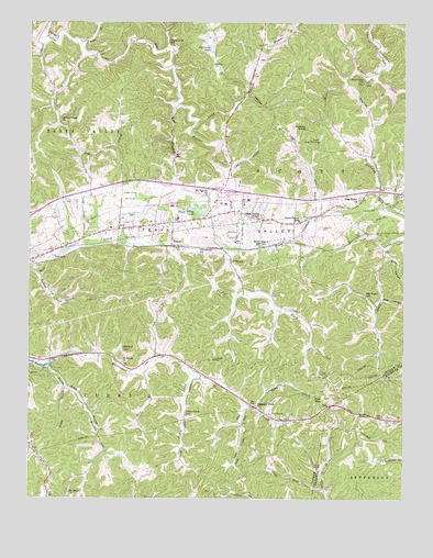
Scott Depot, WV USGS Topographic Map
Click on map above to begin viewing in our Map Viewer.

This topographic map contains these locations and features:
Feature Name Type Latitude Longitude GNIS ID View Map
Autumn WyndsPopulated PlaceN38.4440°W81.9918°1740647View Map
Belle AcresPopulated PlaceN38.4529°W81.8971°1740650View Map
Big Scary School (historical)SchoolN38.4281°W81.8876°1535966View Map
Black Lick EstatesPopulated PlaceN38.4706°W81.8882°1740653View Map
Black Lick School (historical)SchoolN38.4948°W81.9543°1536055View Map
Bowling CemeteryCemeteryN38.4901°W81.9235°1740654View Map
Bruce Hunt SpringSpringN38.4131°W81.9062°1678249View Map
Buffs BranchStreamN38.4093°W81.9935°1536671View Map
Calvary Baptist AcademySchoolN38.4444°W81.9746°1740664View Map
Camp Happy ValleyLocaleN38.4193°W81.9332°1740667View Map
Candlewyck PlacePopulated PlaceN38.4551°W81.9499°1740668View Map
Catholic Church of the AscensionChurchN38.4390°W81.9993°1740669View Map
Charleston Area Medical Center Teays Valley HospitalHospitalN38.4516°W81.9524°2578159View Map
Cherry GrovePopulated PlaceN38.4395°W81.9221°1740670View Map
Cheyenne ValleyPopulated PlaceN38.4515°W81.9596°1740671View Map
Coal MountainSummitN38.4012°W81.9021°1537462View Map
Colonial GardensPopulated PlaceN38.4454°W81.9765°1740672View Map
Cottle SpringSpringN38.4612°W81.9087°1678237View Map
Cottle SpringSpringN38.4595°W81.9062°1678238View Map
Country VillasPopulated PlaceN38.4495°W81.9610°1740676View Map
Cow CreekStreamN38.4920°W81.9832°1537736View Map
Crooked CreekStreamN38.4401°W81.9329°1537834View Map
Dickinson LakeReservoirN38.4933°W81.9396°1538181View Map
Dogwood EstatesPopulated PlaceN38.4487°W81.9760°1740677View Map
Englewood EstatesPopulated PlaceN38.4359°W81.9971°1740687View Map
Ensell Mercer SpringSpringN38.3829°W81.9624°1678257View Map
Ensell Mercer SpringSpringN38.3812°W81.9585°1678258View Map
Ervan Coiner Junior SpringSpringN38.4473°W81.9890°1678242View Map
FairviewPopulated PlaceN38.4462°W81.9749°1740689View Map
Fairway GardensPopulated PlaceN38.4468°W81.9671°1740690View Map
Farley SpringSpringN38.3973°W81.9271°1678254View Map
Fields BrookStreamN38.3781°W81.9026°1538951View Map
Good Shepherd Southern Baptist ChurchChurchN38.4495°W81.9107°1740700View Map
Grobes BranchStreamN38.4040°W81.9876°1539760View Map
Henson SpringSpringN38.4076°W81.9387°1678251View Map
Hickory HillPopulated PlaceN38.4437°W81.9512°1740703View Map
Hickory KnobSummitN38.4726°W81.9082°1554697View Map
Hidden Valley EstatesPopulated PlaceN38.4520°W81.9168°1740704View Map
Hodges CemeteryCemeteryN38.4017°W81.8970°2586384View Map
Hubert Beaver SpringSpringN38.4315°W81.9287°1678248View Map
Hurricane City ParkParkN38.4398°W81.9901°1740711View Map
Hurricane LakeReservoirN38.4418°W81.9749°1559261View Map
Hurricane Water Supply Reservoir DamDamN38.4418°W81.9749°1559260View Map
I-64 LakeReservoirN38.4603°W81.9664°1559257View Map
Interchange 39CrossingN38.4559°W81.9354°1740723View Map
J L Bowling CemeteryCemeteryN38.4840°W81.9239°2586134View Map
Joes BranchStreamN38.4079°W81.9618°1540928View Map
Johnsotons ChurchChurchN38.4404°W81.9435°1540994View Map
Kanawha County Emergency Ambulance Authority Station 542BuildingN38.4483°W81.9401°2581211View Map
Kenmar Trailer ParkPopulated PlaceN38.4398°W81.9443°1740729View Map
Kirk HollowValleyN38.4384°W81.8799°1541239View Map
Lake Ann TormeyReservoirN38.4695°W81.9031°1541313View Map
Lake Oakwood DamDamN38.4134°W81.9732°1559258View Map
Lawrence CemeteryCemeteryN38.4462°W81.9032°1541559View Map
Leadman CemeteryCemeteryN38.4966°W81.9163°2586315View Map
Lexington EstatesPopulated PlaceN38.4112°W81.9832°1740734View Map
Leyton Fisher SpringSpringN38.4129°W81.9776°1678250View Map
Liberty Square Shopping CenterLocaleN38.4570°W81.9326°1740737View Map
Lick BranchStreamN38.4609°W81.9357°1541865View Map
Lick BranchStreamN38.4784°W81.9512°1541866View Map
Lois Umberger SpringSpringN38.4426°W81.9810°1678244View Map
Long BranchStreamN38.4737°W81.9454°1542355View Map
Mercer SpringSpringN38.3995°W81.9554°1678252View Map
Mercer SpringSpringN38.3895°W81.9607°1678253View Map
Middleton CemeteryCemeteryN38.4865°W81.9365°2586383View Map
Mill CreekStreamN38.4348°W81.9996°1543312View Map
Morrison ForkStreamN38.4870°W81.8837°1543587View Map
Mount Olive CemeteryCemeteryN38.3774°W81.9857°2586219View Map
Mount Olive ChurchChurchN38.3765°W81.9865°1543705View Map
Mount Salem ChurchChurchN38.4104°W81.9685°1543758View Map
Mount Vernon CemeteryCemeteryN38.4543°W81.9410°2586221View Map
Mount Vernon ChurchChurchN38.4545°W81.9415°1543789View Map
Mount Vernon MeadowsPopulated PlaceN38.4487°W81.9554°1740747View Map
Mountain View Elementary SchoolSchoolN38.4466°W81.9428°2631511View Map
Mynes SpringSpringN38.3909°W81.9387°1678255View Map
Oakwood EstatesPopulated PlaceN38.4520°W81.9218°1740750View Map
Oakwood LakeReservoirN38.4142°W81.9695°1544321View Map
Pentecostal Church of ChristChurchN38.4593°W81.9799°1740755View Map
Peoples Baptist ChurchChurchN38.4465°W81.9385°1740756View Map
Pine Grove ChurchChurchN38.4531°W81.8904°1544879View Map
Pleasant View ChurchChurchN38.3995°W81.9243°1545043View Map
Providence ChurchChurchN38.4843°W81.8885°1545297View Map
Putnam Christian ChurchChurchN38.4501°W81.9043°1740769View Map
Putnam County Convention & Visitors BureauBuildingN38.4427°W81.9938°2727405View Map
Putnam County Public LibraryBuildingN38.4597°W81.9331°2727369View Map
Putnam General HospitalHospitalN38.4517°W81.9523°1740772View Map
Putnam Village Shopping CenterLocaleN38.4570°W81.9276°1740773View Map
Ranch Lake EstatesPopulated PlaceN38.4743°W81.8829°1740777View Map
Rider CreekStreamN38.4076°W81.9465°1545573View Map
Rider Creek School (historical)SchoolN38.3973°W81.9476°1545574View Map
Rolling MeadowsPopulated PlaceN38.4431°W81.9057°1740787View Map
Russell Mercer SpringSpringN38.3868°W81.9524°1678256View Map
Saint Timothy in the Valley Episcopal ChurchChurchN38.4381°W81.9990°1740789View Map
Sams ForkStreamN38.4001°W81.9285°1546331View Map
Saunders AdditionPopulated PlaceN38.4548°W81.8757°1740790View Map
Scott DepotPopulated PlaceN38.4418°W81.9168°1546516View Map
Scott Depot Post OfficePost OfficeN38.4509°W81.9310°1740793View Map
Scott DistrictCivilN38.4846°W81.9136°1928349View Map
Scott Teays Elementary SchoolSchoolN38.4482°W81.9102°1546524View Map
Scott VillagePopulated PlaceN38.4443°W81.9101°1740794View Map
Shermans Place SpringSpringN38.4415°W81.9882°1678247View Map
Sleepy Hollow Golf Club Reservoir DamDamN38.4584°W81.9665°1559256View Map
Sleepy Hollow Golf CourseLocaleN38.4543°W81.9665°1557890View Map
Sleepy Hollow TownshipPopulated PlaceN38.4515°W81.9721°1740799View Map
Snag CreekStreamN38.3987°W81.9254°1547018View Map
Spring Creek ChurchChurchN38.4745°W81.9899°1547187View Map
Springdale EstatesPopulated PlaceN38.4509°W81.9851°1740800View Map
Sugar BranchStreamN38.4931°W81.9840°1547623View Map
Sun Valley EstatesPopulated PlaceN38.4531°W81.8954°1740802View Map
Tackett BranchStreamN38.4334°W81.9962°1547863View Map
TeaysPopulated PlaceN38.4418°W81.9529°1547947View Map
Teays DistrictCivilN38.4317°W81.9425°1928378View Map
Teays FarmPopulated PlaceN38.4859°W81.9026°1740803View Map
Teays MeadowPopulated PlaceN38.4298°W81.9304°1740804View Map
Teays Post OfficePost OfficeN38.4561°W81.9269°1740805View Map
Teays ValleyPopulated PlaceN38.4501°W81.9293°1867651View Map
Teays Valley Census Designated PlaceCensusN38.4483°W81.9241°2390379View Map
Teays Valley Christian SchoolSchoolN38.4491°W81.9031°2088369View Map
Teays Valley EstatesPopulated PlaceN38.4393°W81.9501°1740806View Map
Teays Valley Industrial ParkLocaleN38.4529°W81.9276°1740807View Map
Teays Valley LakesReservoirN38.4495°W81.9418°1547950View Map
Teays Valley MeadowsPopulated PlaceN38.4487°W81.9790°1740808View Map
Teays Valley Presbyterian ChurchChurchN38.4487°W81.9237°1547949View Map
Teays Valley Volunteer Fire Department Station 1BuildingN38.4479°W81.9397°2577838View Map
Teays VillaPopulated PlaceN38.4529°W81.8993°1740810View Map
Teays VillagePopulated PlaceN38.4426°W81.9418°1740811View Map
The Ridge EstatesPopulated PlaceN38.4601°W81.9490°1740812View Map
Valley View EstatesPopulated PlaceN38.4543°W81.9826°1740819View Map
WCHS-TV (Charleston)TowerN38.4079°W81.9035°1559858View Map
Wells HollowValleyN38.4276°W81.8818°1548904View Map
West Teays Elementary SchoolSchoolN38.4462°W81.9729°1740821View Map
Winsor CourtPopulated PlaceN38.4529°W81.9807°1740835View Map
WKLC-FM (Saint Albans)TowerN38.4209°W81.9240°1559842View Map
WKRP-TV (Charleston)TowerN38.4190°W81.9226°1559861View Map
Woodcliffe ChasePopulated PlaceN38.4504°W81.9804°1740839View Map
Woods and IronsPopulated PlaceN38.4556°W81.9612°1740841View Map
Woods and Irons EastPopulated PlaceN38.4554°W81.9568°1740840View Map
Woods and Irons SouthPopulated PlaceN38.4529°W81.9612°1740842View Map
WVAH-TV (Charleston)TowerN38.4209°W81.9240°1559859View Map
Wyant SpringSpringN38.4565°W81.9701°1678239View Map

Note: Coordinates in the location and feature list above are referenced to NAD83 datum.


Copyright (C) 2008-2024 Ryan Niemi / Sunset Dynamics ... All Rights Reserved