TopoQuest Logo
Do you find TopoQuest useful?
Help keep TopoQuest running and adding new maps/features by donating!
Bitcoin:  19c7KJd3qBynnjoSw5npx9KScwjBe4ifkT
Litecoin:  LXs6TkuXGGXo1vDsWCkWVdjQX94eUKd6ui
Home View Maps Find Maps Find Places Resources & Links


Gary, West Virginia Topographic Map

USGS Map Title: Gary, WV
USGS Map MRC: 37081C5
DRG (GeoTIFF) Download: o37081c5.tif


Neighboring USGS Topographic Map Quads:


  Davy, WV  
37081D6
 

  Welch, WV  
37081D5
 

  Keystone, WV  
37081D4
 

  War, WV  
37081C6
 

  Gary, WV  
37081C5
 

  Anawalt, WV  
37081C4
 

  Amonate, VA  
37081B6
 

  Tazewell North, VA  
37081B5
 

  Tiptop, VA  
37081B4


Map MRC Location:

N38°
W82°
N38°
W81°
H8 H7 H6 H5 H4 H3 H2 H1
G8 G7 G6 G5 G4 G3 G2 G1
F8 F7 F6 F5 F4 F3 F2 F1
E8 E7 E6 E5 E4 E3 E2 E1
D8 D7 D6 D5 D4 D3 D2 D1
C8 C7 C6 C5 C4 C3 C2 C1
B8 B7 B6 B5 B4 B3 B2 B1
A8 A7 A6 A5 A4 A3 A2 A1
N37°
W82°
N37°
W81°

Gary, WV USGS 1:24K Topographic Map Preview:
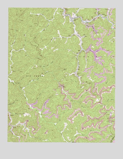
Gary, WV USGS Topographic Map
Click on map above to begin viewing in our Map Viewer.

This topographic map contains these locations and features:
Feature Name Type Latitude Longitude GNIS ID View Map
Adkin BranchStreamN37.3662°W81.5471°1534813View Map
AlpheusPopulated PlaceN37.3682°W81.5609°1560637View Map
Belcher BranchStreamN37.3623°W81.5340°1535583View Map
Camp Big CreekLocaleN37.3059°W81.6212°1536891View Map
City of GaryCivilN37.3627°W81.5337°2390592View Map
Cucumber Census Designated PlaceCensusN37.2786°W81.6241°2586793View Map
Cucumber CreekStreamN37.2646°W81.6187°1537901View Map
Dauss ForkStreamN37.2876°W81.5429°1538010View Map
Dog ForkStreamN37.2843°W81.5984°1538235View Map
Duskins BranchStreamN37.2782°W81.5868°1538461View Map
Eight (historical)Populated PlaceN37.2631°W81.6032°2747239View Map
ElbertPopulated PlaceN37.3354°W81.5393°1554378View Map
Elbert Post OfficePost OfficeN37.3346°W81.5402°1689234View Map
FilbertPopulated PlaceN37.3182°W81.5440°1538960View Map
GaryPopulated PlaceN37.3637°W81.5501°1554536View Map
Gary Elementary School (historical)SchoolN37.3607°W81.5482°1689240View Map
Gary Police DepartmentBuildingN37.3663°W81.5477°2728046View Map
Gary Post OfficePost OfficeN37.3663°W81.5512°1689241View Map
Gary Volunteer Fire DepartmentBuildingN37.3667°W81.5478°2577568View Map
Harmon BranchStreamN37.3662°W81.5101°1539969View Map
Harmon Branch ChurchChurchN37.3734°W81.5070°1539971View Map
Left Fork Mill CreekStreamN37.3632°W81.5765°1541690View Map
Left Fork Sandlick CreekStreamN37.3371°W81.5379°1541717View Map
Leslie BranchStreamN37.3607°W81.5026°1541792View Map
Long BranchStreamN37.3007°W81.6065°1542335View Map
Maxwell GapGapN37.3179°W81.5601°1542887View Map
NewhallPopulated PlaceN37.2637°W81.6187°1555215View Map
Newhall Elementary School (historical)SchoolN37.2640°W81.6198°1689270View Map
Newhall Post OfficePost OfficeN37.2653°W81.6190°1689271View Map
Open ForkStreamN37.2671°W81.5690°1544413View Map
ReamPopulated PlaceN37.3498°W81.5498°1555451View Map
Right Fork Sandlick CreekStreamN37.3523°W81.5468°1545695View Map
Sandlick CreekStreamN37.3657°W81.5518°1546392View Map
Split ForkStreamN37.3359°W81.6193°1547150View Map
Split Tree BranchStreamN37.3157°W81.5804°1547152View Map
ThorpePopulated PlaceN37.3687°W81.5165°1555807View Map
Thorpe Post OfficePost OfficeN37.3667°W81.5102°1689296View Map
Turnhole BranchStreamN37.3682°W81.5193°1548384View Map
Upper Trace ForkStreamN37.2771°W81.6232°1548560View Map
VenusPopulated PlaceN37.3621°W81.5368°1555884View Map

Note: Coordinates in the location and feature list above are referenced to NAD83 datum.


Copyright (C) 2008-2024 Ryan Niemi / Sunset Dynamics ... All Rights Reserved