TopoQuest Logo
Do you find TopoQuest useful?
Help keep TopoQuest running and adding new maps/features by donating!
Bitcoin:  19c7KJd3qBynnjoSw5npx9KScwjBe4ifkT
Litecoin:  LXs6TkuXGGXo1vDsWCkWVdjQX94eUKd6ui
Home View Maps Find Maps Find Places Resources & Links


Gavers, Ohio Topographic Map

USGS Map Title: Gavers, OH
USGS Map MRC: 40080F7
DRG (GeoTIFF) Download: o40080f7.tif


Neighboring USGS Topographic Map Quads:


  Hanoverton, OH  
40080G8
 

  Lisbon, OH  
40080G7
 

  Elkton, OH  
40080G6
 

  Kensington, OH  
40080F8
 

  Gavers, OH  
40080F7
 

  West Point, OH  
40080F6
 

  Bergholz, OH  
40080E8
 

  Salineville, OH  
40080E7
 

  Wellsville, OH  
40080E6


Map MRC Location:

N41°
W81°
N41°
W80°
H8 H7 H6 H5 H4 H3 H2 H1
G8 G7 G6 G5 G4 G3 G2 G1
F8 F7 F6 F5 F4 F3 F2 F1
E8 E7 E6 E5 E4 E3 E2 E1
D8 D7 D6 D5 D4 D3 D2 D1
C8 C7 C6 C5 C4 C3 C2 C1
B8 B7 B6 B5 B4 B3 B2 B1
A8 A7 A6 A5 A4 A3 A2 A1
N40°
W81°
N40°
W80°

Gavers, OH USGS 1:24K Topographic Map Preview:
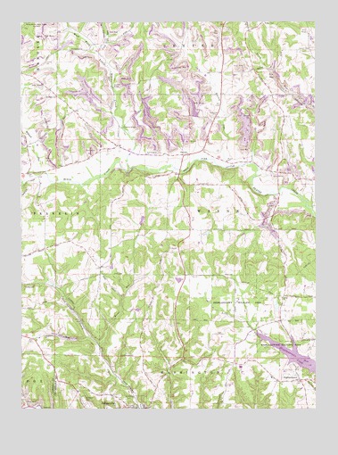
Gavers, OH USGS Topographic Map
Click on map above to begin viewing in our Map Viewer.

This topographic map contains these locations and features:
Feature Name Type Latitude Longitude GNIS ID View Map
Bethel CemeteryCemeteryN40.6606°W80.7654°1807389View Map
Bethel Presbyterian ChurchChurchN40.6609°W80.7640°1037939View Map
Brush CreekStreamN40.7026°W80.8290°1066606View Map
Cold RunStreamN40.7395°W80.8426°1039238View Map
Davis CemeteryCemeteryN40.7020°W80.7623°1039602View Map
Gaskill CemeteryCemeteryN40.7410°W80.7528°1040794View Map
GaversPopulated PlaceN40.7070°W80.8056°1064707View Map
Gavers Post Office (historical)Post OfficeN40.7070°W80.8054°1967247View Map
HighlandtownPopulated PlaceN40.6342°W80.7567°1041567View Map
Highlandtown CemeteryCemeteryN40.6328°W80.7551°1807396View Map
Highlandtown Elementary SchoolSchoolN40.6353°W80.7690°1052134View Map
Highlandtown ReservoirReservoirN40.6423°W80.7592°1056328View Map
Highlandtown Volunteer Fire DepartmentBuildingN40.6360°W80.7586°2550103View Map
Highlandtown Wildlife AreaParkN40.6440°W80.7529°1041568View Map
Highlandtown Wildlife Area PondReservoirN40.6585°W80.7667°1078165View Map
Industrial Mining LakeReservoirN40.7219°W80.8017°1078164View Map
Industrial Mining Lake DamDamN40.7201°W80.8015°1078163View Map
Lee CemeteryCemeteryN40.7379°W80.8137°1807397View Map
McClellan BridgeBridgeN40.7289°W80.8356°1052131View Map
McKaigs Mill BridgeBridgeN40.7159°W80.8320°1052132View Map
Morgan CemeteryCemeteryN40.7112°W80.8036°1043486View Map
New Lebanon CemeteryCemeteryN40.7076°W80.8223°1807401View Map
New Lebanon United Presbyterian ChurchChurchN40.7070°W80.8220°1043838View Map
Roses RunStreamN40.6453°W80.8426°1045200View Map
Rowley RunStreamN40.7031°W80.7887°1045236View Map
Saint Patricks CemeteryCemeteryN40.6281°W80.8309°1045730View Map
Saint Pauls CemeteryCemeteryN40.7262°W80.8598°1045750View Map
Salineville Volunteer Fire DepartmentBuildingN40.6251°W80.8398°2550107View Map
Sandy-Beaver Canal TunnelLocaleN40.7492°W80.8740°1045962View Map
Southern High SchoolSchoolN40.6384°W80.7820°1052133View Map
Township of WashingtonCivilN40.6250°W80.8021°1085904View Map
Township of WayneCivilN40.6900°W80.7940°1085905View Map
Wayne SchoolSchoolN40.7053°W80.7879°1047632View Map
Wayne Township Methodist Episcopal CemeteryCemeteryN40.7199°W80.7942°1807406View Map
Williard RunStreamN40.7017°W80.8665°1067059View Map
Woodland CemeteryCemeteryN40.6278°W80.8484°1048076View Map

Note: Coordinates in the location and feature list above are referenced to NAD83 datum.


Copyright (C) 2008-2025 Ryan Niemi / Sunset Dynamics ... All Rights Reserved