TopoQuest Logo
Do you find TopoQuest useful?
Help keep TopoQuest running and adding new maps/features by donating!
Bitcoin:  19c7KJd3qBynnjoSw5npx9KScwjBe4ifkT
Litecoin:  LXs6TkuXGGXo1vDsWCkWVdjQX94eUKd6ui
Home View Maps Find Maps Find Places Resources & Links


Kensington, Ohio Topographic Map

USGS Map Title: Kensington, OH
USGS Map MRC: 40080F8
DRG (GeoTIFF) Download: o40080f8.tif


Neighboring USGS Topographic Map Quads:


  Homeworth, OH  
40081G1
 

  Hanoverton, OH  
40080G8
 

  Lisbon, OH  
40080G7
 

  Minerva, OH  
40081F1
 

  Kensington, OH  
40080F8
 

  Gavers, OH  
40080F7
 

  Carrollton, OH  
40081E1
 

  Bergholz, OH  
40080E8
 

  Salineville, OH  
40080E7


Map MRC Location:

N41°
W81°
N41°
W80°
H8 H7 H6 H5 H4 H3 H2 H1
G8 G7 G6 G5 G4 G3 G2 G1
F8 F7 F6 F5 F4 F3 F2 F1
E8 E7 E6 E5 E4 E3 E2 E1
D8 D7 D6 D5 D4 D3 D2 D1
C8 C7 C6 C5 C4 C3 C2 C1
B8 B7 B6 B5 B4 B3 B2 B1
A8 A7 A6 A5 A4 A3 A2 A1
N40°
W81°
N40°
W80°

Kensington, OH USGS 1:24K Topographic Map Preview:
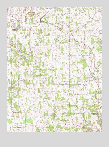
Kensington, OH USGS Topographic Map
Click on map above to begin viewing in our Map Viewer.

This topographic map contains these locations and features:
Feature Name Type Latitude Longitude GNIS ID View Map
Bethesda CemeteryCemeteryN40.7089°W80.8990°1807410View Map
Bethesda ChurchChurchN40.7092°W80.8984°1037961View Map
Buckeye Tree FarmLocaleN40.6750°W80.9586°2650308View Map
DungannonPopulated PlaceN40.7342°W80.8787°1064567View Map
Dungannon Post Office (historical)Post OfficeN40.7334°W80.8790°1967501View Map
Five ForksPopulated PlaceN40.6628°W80.9098°1040478View Map
France LakeReservoirN40.6699°W80.9518°1078425View Map
France Lake DamDamN40.6684°W80.9531°1078424View Map
Franklin Elementary SchoolSchoolN40.6806°W80.8879°1052130View Map
Franklin Township Volunteer Fire DepartmentBuildingN40.6783°W80.8879°2550486View Map
Glade Run CemeteryCemeteryN40.6683°W80.9642°1052407View Map
Glade Run ChurchChurchN40.6684°W80.9645°1040882View Map
KensingtonPopulated PlaceN40.7353°W80.9565°1064926View Map
Kensington Post OfficePost OfficeN40.7348°W80.9568°1967548View Map
LynchburgPopulated PlaceN40.7412°W80.9993°1061452View Map
Manfull LakeReservoirN40.7317°W80.9442°1078167View Map
Manfull Lake DamDamN40.7330°W80.9437°1078166View Map
Maple Cotton Funeral Home Ambulance ServiceBuildingN40.7352°W80.9563°2550961View Map
MillportPopulated PlaceN40.7001°W80.8865°1061525View Map
Millport Post Office (historical)Post OfficeN40.7001°W80.8859°1967627View Map
NorristownPopulated PlaceN40.6653°W80.9515°1065158View Map
Norristown Post Office (historical)Post OfficeN40.6653°W80.9512°1083261View Map
Roudebush CemeteryCemeteryN40.7098°W80.9562°1052408View Map
Saint Johns ChurchChurchN40.6720°W80.8981°1045531View Map
Sandy Beaver CanalCanalN40.7409°W80.8937°1045951View Map
Sandy Springs CemeteryCemeteryN40.7494°W80.9554°1045959View Map
SummitvillePopulated PlaceN40.6781°W80.8862°1061662View Map
Summitville Clay Products LakeReservoirN40.6834°W80.8931°1078169View Map
Summitville Clay Products Lake DamDamN40.6834°W80.8931°1078168View Map
Summitville Clay Works Pond DamDamN40.6501°W80.8831°1079447View Map
Summitville Clay Works Pond DamReservoirN40.6501°W80.8831°1079448View Map
Summitville Post OfficePost OfficeN40.6778°W80.8859°1967554View Map
Township of EastCivilN40.6856°W80.9557°1085827View Map
Township of FranklinCivilN40.6848°W80.8794°1085894View Map
Village of SummitvilleCivilN40.6759°W80.8875°2399931View Map

Note: Coordinates in the location and feature list above are referenced to NAD83 datum.


Copyright (C) 2008-2025 Ryan Niemi / Sunset Dynamics ... All Rights Reserved