TopoQuest Logo
Do you find TopoQuest useful?
Help keep TopoQuest running and adding new maps/features by donating!
Bitcoin:  19c7KJd3qBynnjoSw5npx9KScwjBe4ifkT
Litecoin:  LXs6TkuXGGXo1vDsWCkWVdjQX94eUKd6ui
Home View Maps Find Maps Find Places Resources & Links


Gethsemane, Arkansas Topographic Map

USGS Map Title: Gethsemane, AR
USGS Map MRC: 34091D7
DRG (GeoTIFF) Download: o34091d7.tif


Neighboring USGS Topographic Map Quads:


  England, AR  
34091E8
 

  Humnoke, AR  
34091E7
 

  Geridge, AR  
34091E6
 

  Sherrill, AR  
34091D8
 

  Gethsemane, AR  
34091D7
 

  Humphrey, AR  
34091D6
 

  Rob Roy, AR  
34091C8
 

  Altheimer, AR  
34091C7
 

  Humphrey SW, AR  
34091C6


Map MRC Location:

N35°
W92°
N35°
W91°
H8 H7 H6 H5 H4 H3 H2 H1
G8 G7 G6 G5 G4 G3 G2 G1
F8 F7 F6 F5 F4 F3 F2 F1
E8 E7 E6 E5 E4 E3 E2 E1
D8 D7 D6 D5 D4 D3 D2 D1
C8 C7 C6 C5 C4 C3 C2 C1
B8 B7 B6 B5 B4 B3 B2 B1
A8 A7 A6 A5 A4 A3 A2 A1
N34°
W92°
N34°
W91°

Gethsemane, AR USGS 1:24K Topographic Map Preview:
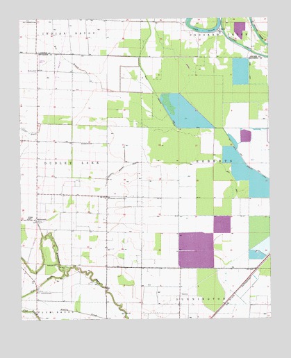
Gethsemane, AR USGS Topographic Map
Click on map above to begin viewing in our Map Viewer.

This topographic map contains these locations and features:
Feature Name Type Latitude Longitude GNIS ID View Map
Bogey School (historical)SchoolN34.4037°W91.8318°63904View Map
Coburn BrakeLakeN34.4951°W91.7835°74731View Map
Coleman ChapelChurchN34.4170°W91.8712°47918View Map
Coon BayouStreamN34.4565°W91.8643°47992View Map
Coy Landing Strip (historical)AirportN34.4993°W91.8701°64101View Map
Diantha (historical)Populated PlaceN34.3854°W91.7682°78900View Map
Flat BayouStreamN34.3940°W91.8532°49087View Map
GethsemanePopulated PlaceN34.4168°W91.8674°49385View Map
Gethsemane ChurchChurchN34.4159°W91.8674°63928View Map
Gethsemane School (historical)SchoolN34.4162°W91.8676°63929View Map
Henderson Landing Strip (historical)AirportN34.4259°W91.8271°63934View Map
Indian Woman BayouStreamN34.4404°W91.8101°50505View Map
Jerusalem ChurchChurchN34.4490°W91.8399°50637View Map
Jerusalem School (historical)SchoolN34.4482°W91.8399°63935View Map
Lateral Number 8CanalN34.4659°W91.7732°60849View Map
Lateral Number 9CanalN34.4557°W91.8301°60848View Map
McClung SchoolSchoolN34.4787°W91.8662°51798View Map
Mile BranchStreamN34.4682°W91.8054°51958View Map
Oak Grove ChurchChurchN34.4262°W91.8315°52907View Map
Oak Grove School (historical)SchoolN34.4259°W91.8126°63970View Map
Saint Lukes Church (historical)ChurchN34.4118°W91.8318°63991View Map
Saint Stephen ChurchChurchN34.4945°W91.7743°54475View Map
Township of RobertsCivilN34.4397°W91.7603°66743View Map
Wabbaseka ChurchChurchN34.3982°W91.8574°55930View Map

Note: Coordinates in the location and feature list above are referenced to NAD83 datum.


Copyright (C) 2008-2025 Ryan Niemi / Sunset Dynamics ... All Rights Reserved