TopoQuest Logo
Do you find TopoQuest useful?
Help keep TopoQuest running and adding new maps/features by donating!
Bitcoin:  19c7KJd3qBynnjoSw5npx9KScwjBe4ifkT
Litecoin:  LXs6TkuXGGXo1vDsWCkWVdjQX94eUKd6ui
Home View Maps Find Maps Find Places Resources & Links


Ulysses Mountain, Idaho Topographic Map

USGS Map Title: Ulysses Mountain, ID
USGS Map MRC: 45114D1
DRG (GeoTIFF) Download: o45114d1.tif


Neighboring USGS Topographic Map Quads:


  Henderson Ridge, ID  
45114E2
 

  Allan Mountain, ID  
45114E1
 

  Gibbonsville, ID  
45113E8
 

  Ulysses, ID  
45114D2
 

  Ulysses Mountain, ID  
45114D1
 

  North Fork, ID  
45113D8
 

  Pine Creek Ridge, ID  
45114C2
 

  Napoleon Hill, ID  
45114C1
 

  Bird Creek, ID  
45113C8


Map MRC Location:

N46°
W115°
N46°
W114°
H8 H7 H6 H5 H4 H3 H2 H1
G8 G7 G6 G5 G4 G3 G2 G1
F8 F7 F6 F5 F4 F3 F2 F1
E8 E7 E6 E5 E4 E3 E2 E1
D8 D7 D6 D5 D4 D3 D2 D1
C8 C7 C6 C5 C4 C3 C2 C1
B8 B7 B6 B5 B4 B3 B2 B1
A8 A7 A6 A5 A4 A3 A2 A1
N45°
W115°
N45°
W114°

Ulysses Mountain, ID USGS 1:24K Topographic Map Preview:
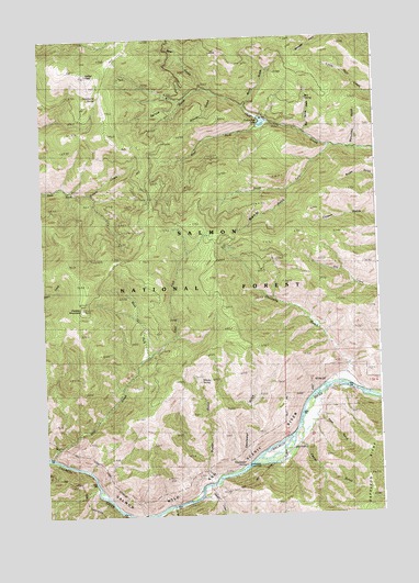
Ulysses Mountain, ID USGS Topographic Map
Click on map above to begin viewing in our Map Viewer.

This topographic map contains these locations and features:
Feature Name Type Latitude Longitude GNIS ID View Map
Bear GulchValleyN45.4869°W114.0648°377151View Map
Beartrap GulchValleyN45.4594°W114.0337°377221View Map
Box SpringSpringN45.4838°W114.0259°378157View Map
Box Spring GulchValleyN45.4752°W114.0267°378158View Map
Burnt GulchValleyN45.4821°W114.0490°378557View Map
Buster GulchValleyN45.3844°W114.0648°378587View Map
Camel GulchValleyN45.3930°W114.0309°378741View Map
Cummings DamDamN45.4783°W114.0409°398858View Map
Cummings LakeReservoirN45.4770°W114.0423°398468View Map
Deadwater CampgroundLocaleN45.3874°W114.0509°394356View Map
Deadwater GulchValleyN45.3885°W114.0517°380341View Map
Deadwater Picnic AreaLocaleN45.3869°W114.0509°376189View Map
Deadwater SpringSpringN45.3881°W114.0515°380342View Map
Donnelly GulchValleyN45.4124°W114.0129°380720View Map
Dump CreekStreamN45.3824°W114.0645°380933View Map
East Fork Sage CreekStreamN45.4166°W114.0879°381168View Map
Fan GulchValleyN45.3774°W114.0790°381590View Map
Grindstone SpringSpringN45.4849°W114.1034°382691View Map
Grouse GulchValleyN45.4849°W114.0606°382746View Map
Hull Creek ReservoirReservoirN45.4779°W114.0425°399581View Map
Indian PeakSummitN45.4908°W114.1084°383699View Map
Monument GulchValleyN45.4710°W114.0084°387113View Map
North Fork Forest Service StationLocaleN45.4074°W114.0020°394725View Map
Rose GulchValleyN45.4008°W114.0251°389605View Map
Sage CreekStreamN45.3908°W114.1245°374838View Map
South Fork Hull CreekStreamN45.4710°W114.0176°390951View Map
Spruce GulchValleyN45.4869°W114.0645°391253View Map
Ulysses MountainSummitN45.4296°W114.1115°392601View Map
West Fork Hull CreekStreamN45.4777°W114.0415°393123View Map
West Fork Sage CreekStreamN45.4166°W114.0879°393187View Map
Whisky SpringSpringN45.4101°W114.0672°393303View Map

Note: Coordinates in the location and feature list above are referenced to NAD83 datum.


Copyright (C) 2008-2024 Ryan Niemi / Sunset Dynamics ... All Rights Reserved