TopoQuest Logo
Do you find TopoQuest useful?
Help keep TopoQuest running and adding new maps/features by donating!
Bitcoin:  19c7KJd3qBynnjoSw5npx9KScwjBe4ifkT
Litecoin:  LXs6TkuXGGXo1vDsWCkWVdjQX94eUKd6ui
Home View Maps Find Maps Find Places Resources & Links


North Fork, Idaho Topographic Map

USGS Map Title: North Fork, ID
USGS Map MRC: 45113D8
DRG (GeoTIFF) Download: o45113d8.tif


Neighboring USGS Topographic Map Quads:


  Allan Mountain, ID  
45114E1
 

  Gibbonsville, ID  
45113E8
 

  Big Hole Pass, ID  
45113E7
 

  Ulysses Mountain, ID  
45114D1
 

  North Fork, ID  
45113D8
 

  Shewag Lake, ID  
45113D7
 

  Napoleon Hill, ID  
45114C1
 

  Bird Creek, ID  
45113C8
 

  Badger Spring Gulch, ID  
45113C7


Map MRC Location:

N46°
W114°
N46°
W113°
H8 H7 H6 H5 H4 H3 H2 H1
G8 G7 G6 G5 G4 G3 G2 G1
F8 F7 F6 F5 F4 F3 F2 F1
E8 E7 E6 E5 E4 E3 E2 E1
D8 D7 D6 D5 D4 D3 D2 D1
C8 C7 C6 C5 C4 C3 C2 C1
B8 B7 B6 B5 B4 B3 B2 B1
A8 A7 A6 A5 A4 A3 A2 A1
N45°
W114°
N45°
W113°

North Fork, ID USGS 1:24K Topographic Map Preview:
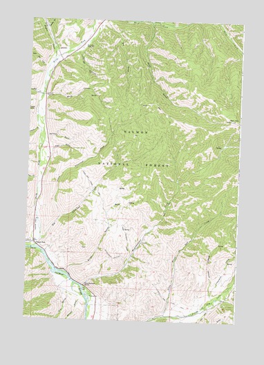
North Fork, ID USGS Topographic Map
Click on map above to begin viewing in our Map Viewer.

This topographic map contains these locations and features:
Feature Name Type Latitude Longitude GNIS ID View Map
Big Silverlead CreekStreamN45.4088°W113.9917°377587View Map
Bills CanyonValleyN45.4680°W113.9901°377631View Map
Burns GulchValleyN45.3955°W113.9767°378533View Map
Carl GulchValleyN45.4866°W113.9720°378931View Map
Cassel GulchLocaleN45.3846°W113.8926°394661View Map
Copper GulchValleyN45.4535°W113.9940°379716View Map
Cottonwood CreekStreamN45.3866°W113.8903°379857View Map
Cumming Triangle Landing Area (historical)AirportN45.4424°W113.9951°397332View Map
Dry CreekStreamN45.4313°W113.9942°380827View Map
Dry GulchValleyN45.4335°W113.9945°395320View Map
Dry GulchValleyN45.4949°W113.9612°397657View Map
Dry GulchValleyN45.3858°W113.9748°397659View Map
Grouse GulchValleyN45.4971°W113.9906°382747View Map
Hughes CreekStreamN45.4760°W113.9898°383518View Map
Hull CreekStreamN45.4677°W113.9931°383524View Map
Lewis and Clark MonumentParkN45.4685°W113.9906°394862View Map
Little Fourth of July CreekStreamN45.3771°W113.9176°384837View Map
Little Hull CreekStreamN45.4810°W113.9906°384864View Map
Little Silverlead CreekStreamN45.4180°W113.9812°384951View Map
Little Thompson GulchValleyN45.4021°W113.9381°384975View Map
Magpie CanyonValleyN45.3835°W113.8887°386358View Map
Maxwell GulchValleyN45.3830°W113.9681°386549View Map
North ForkPopulated PlaceN45.4060°W113.9940°396968View Map
North Fork Fire DistrictBuildingN45.4059°W113.9942°2619035View Map
North Fork Post OfficePost OfficeN45.4066°W113.9954°2766877View Map
North Fork Ranger StationLocaleN45.4891°W113.9679°387759View Map
North Fork Salmon RiverStreamN45.4052°W113.9948°387771View Map
Rathburn GulchValleyN45.4513°W113.9884°389121View Map
Roske GulchValleyN45.4616°W113.9959°389614View Map
Sheep CreekStreamN45.4999°W113.9059°390216View Map
Stein GulchValleyN45.4949°W113.9612°391424View Map
Stein MountainSummitN45.4591°W113.8804°375274View Map
Trail GulchValleyN45.4460°W113.9859°392321View Map
Wagonhammer CampgroundLocaleN45.3849°W113.9615°394362View Map
Wagonhammer CreekStreamN45.4019°W113.9381°392768View Map
Wagonhammer SpringSpringN45.3896°W113.9653°392769View Map

Note: Coordinates in the location and feature list above are referenced to NAD83 datum.


Copyright (C) 2008-2025 Ryan Niemi / Sunset Dynamics ... All Rights Reserved