TopoQuest Logo
Do you find TopoQuest useful?
Help keep TopoQuest running and adding new maps/features by donating!
Bitcoin:  19c7KJd3qBynnjoSw5npx9KScwjBe4ifkT
Litecoin:  LXs6TkuXGGXo1vDsWCkWVdjQX94eUKd6ui
Home View Maps Find Maps Find Places Resources & Links


Gibson, Georgia Topographic Map

USGS Map Title: Gibson, GA
USGS Map MRC: 33082B5
DRG (GeoTIFF) Download: o33082b5.tif


Neighboring USGS Topographic Map Quads:


  Beall Springs, GA  
33082C6
 

  Bastonville, GA  
33082C5
 

  Bowdens Pond, GA  
33082C4
 

  Mitchell, GA  
33082B6
 

  Gibson, GA  
33082B5
 

  Wrens, GA  
33082B4
 

  Downs, GA  
33082A6
 

  Grange, GA  
33082A5
 

  Louisville, GA  
33082A4


Map MRC Location:

N34°
W83°
N34°
W82°
H8 H7 H6 H5 H4 H3 H2 H1
G8 G7 G6 G5 G4 G3 G2 G1
F8 F7 F6 F5 F4 F3 F2 F1
E8 E7 E6 E5 E4 E3 E2 E1
D8 D7 D6 D5 D4 D3 D2 D1
C8 C7 C6 C5 C4 C3 C2 C1
B8 B7 B6 B5 B4 B3 B2 B1
A8 A7 A6 A5 A4 A3 A2 A1
N33°
W83°
N33°
W82°

Gibson, GA USGS 1:24K Topographic Map Preview:
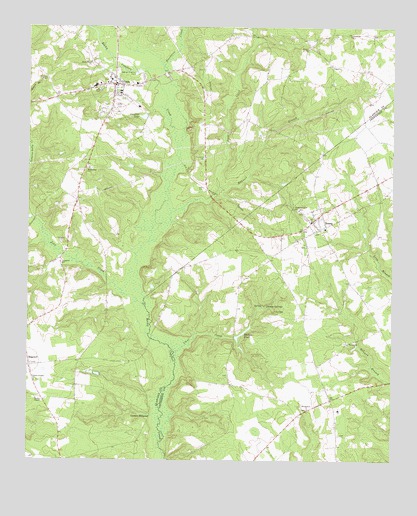
Gibson, GA USGS Topographic Map
Click on map above to begin viewing in our Map Viewer.

This topographic map contains these locations and features:
Feature Name Type Latitude Longitude GNIS ID View Map
AveraPopulated PlaceN33.1940°W82.5271°331069View Map
Avera CemeteryCemeteryN33.1868°W82.5296°345687View Map
Avera ChurchChurchN33.1979°W82.5121°345688View Map
Avera Junior High SchoolSchoolN33.1921°W82.5229°345689View Map
Avera Nazarene ChurchChurchN33.1868°W82.5293°345690View Map
Avera Volunteer Fire DepartmentBuildingN33.1947°W82.5272°2603936View Map
Beechtree CreekStreamN33.2054°W82.5762°354531View Map
Bethel CemeteryCemeteryN33.2443°W82.5290°345626View Map
Bethel ChurchChurchN33.2438°W82.5287°354607View Map
Bethlehem CemeteryCemeteryN33.1399°W82.5290°345693View Map
Bethlehem ChurchChurchN33.1401°W82.5285°354676View Map
Caroline LakeReservoirN33.2242°W82.5855°312350View Map
Chalk Hill BranchStreamN33.2499°W82.6043°312539View Map
Chalker CemeteryCemeteryN33.2376°W82.5651°345630View Map
City of AveraCivilN33.1934°W82.5287°2403142View Map
City of Edge HillCivilN33.1534°W82.6250°2403540View Map
City of GibsonCivilN33.2333°W82.5959°2403695View Map
Clear CreekStreamN33.1560°W82.5743°312711View Map
Corinth Church (historical)ChurchN33.1524°W82.5251°345699View Map
Deep CreekStreamN33.1918°W82.5821°313412View Map
Edge Hill Volunteer Fire DepartmentBuildingN33.1529°W82.6247°2604988View Map
EdgehillPopulated PlaceN33.1524°W82.6243°355642View Map
Edgehill CemeteryCemeteryN33.1526°W82.6235°345633View Map
Edgehill First Church of GodChurchN33.1526°W82.6237°345634View Map
Emanuel ChurchChurchN33.1818°W82.6129°313933View Map
Fellowship CemeteryCemeteryN33.2093°W82.6035°345636View Map
Fellowship ChurchChurchN33.2090°W82.6037°355784View Map
GibsonPopulated PlaceN33.2335°W82.5954°331807View Map
Gibson - Glascock County Fire DepartmentBuildingN33.2325°W82.5944°2604359View Map
Gibson Branch CemeteryCemeteryN33.1479°W82.6218°345641View Map
Gibson Branch ChurchChurchN33.1479°W82.6221°356011View Map
Gibson City CemeteryCemeteryN33.2351°W82.5979°345640View Map
Gibson Police DepartmentBuildingN33.2337°W82.5961°2733584View Map
Glascock CountyCivilN33.2293°W82.6107°345642View Map
Glascock County Consolidated SchoolSchoolN33.2411°W82.6112°345644View Map
Glascock County CourthouseBuildingN33.2332°W82.5949°345643View Map
Glascock County Sheriff's OfficeBuildingN33.2337°W82.5879°2733840View Map
Glascock Fire Department Station 2BuildingN33.2479°W82.5075°2604068View Map
Glover CemeteryCemeteryN33.2146°W82.5646°345645View Map
Glovers MillpondPopulated PlaceN33.1385°W82.5826°331823View Map
Hadden PondReservoirN33.1621°W82.5507°315003View Map
Haddon Pond DamDamN33.1604°W82.5535°340980View Map
Joes CreekStreamN33.1688°W82.5843°316125View Map
Jordan ChapelChurchN33.1424°W82.6215°316266View Map
Jordans Chapel CemeteryCemeteryN33.1429°W82.6221°345654View Map
Magtail BranchStreamN33.2032°W82.5587°317629View Map
McCoy CemeteryCemeteryN33.1451°W82.6098°345659View Map
Omaha SpringsPopulated PlaceN33.1696°W82.5432°332575View Map
Piney Grove CemeteryCemeteryN33.2393°W82.6026°345669View Map
Piney Grove ChurchChurchN33.2399°W82.6035°320718View Map
Pleasant Grove CemeteryCemeteryN33.1976°W82.5312°345753View Map
Pleasant Grove ChurchChurchN33.1974°W82.5318°320827View Map
Tompkins CemeteryCemeteryN33.1821°W82.6143°345681View Map
Waldens CemeteryCemeteryN33.1593°W82.5157°345771View Map
Waldon ChurchChurchN33.1588°W82.5149°324756View Map

Note: Coordinates in the location and feature list above are referenced to NAD83 datum.


Copyright (C) 2008-2024 Ryan Niemi / Sunset Dynamics ... All Rights Reserved