TopoQuest Logo
Do you find TopoQuest useful?
Help keep TopoQuest running and adding new maps/features by donating!
Bitcoin:  19c7KJd3qBynnjoSw5npx9KScwjBe4ifkT
Litecoin:  LXs6TkuXGGXo1vDsWCkWVdjQX94eUKd6ui
Home View Maps Find Maps Find Places Resources & Links


Beall Springs, Georgia Topographic Map

USGS Map Title: Beall Springs, GA
USGS Map MRC: 33082C6
DRG (GeoTIFF) Download: o33082c6.tif


Neighboring USGS Topographic Map Quads:


  Sparta NE, GA  
33082D7
 

  Warrenton, GA  
33082D6
 

  Thomson West, GA  
33082D5
 

  Jewell, GA  
33082C7
 

  Beall Springs, GA  
33082C6
 

  Bastonville, GA  
33082C5
 

  Warthen NE, GA  
33082B7
 

  Mitchell, GA  
33082B6
 

  Gibson, GA  
33082B5


Map MRC Location:

N34°
W83°
N34°
W82°
H8 H7 H6 H5 H4 H3 H2 H1
G8 G7 G6 G5 G4 G3 G2 G1
F8 F7 F6 F5 F4 F3 F2 F1
E8 E7 E6 E5 E4 E3 E2 E1
D8 D7 D6 D5 D4 D3 D2 D1
C8 C7 C6 C5 C4 C3 C2 C1
B8 B7 B6 B5 B4 B3 B2 B1
A8 A7 A6 A5 A4 A3 A2 A1
N33°
W83°
N33°
W82°

Beall Springs, GA USGS 1:24K Topographic Map Preview:
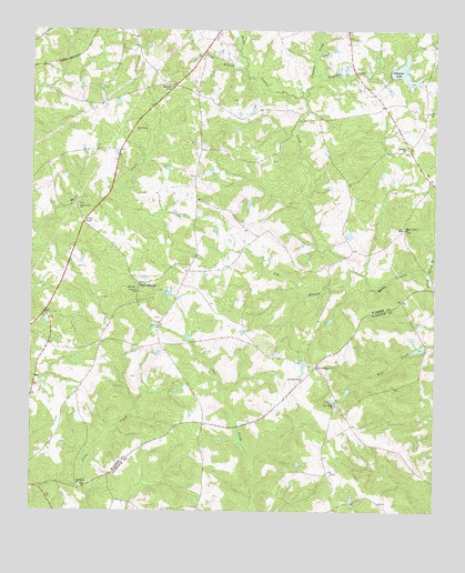
Beall Springs, GA USGS Topographic Map
Click on map above to begin viewing in our Map Viewer.

This topographic map contains these locations and features:
Feature Name Type Latitude Longitude GNIS ID View Map
Acy BranchStreamN33.3118°W82.6457°310383View Map
Baker CemeteryCemeteryN33.3257°W82.7326°347665View Map
Baker-Brinkly CemeteryCemeteryN33.3024°W82.7224°347664View Map
Beall SpringsPopulated PlaceN33.3090°W82.7162°331111View Map
BlumePopulated PlaceN33.2601°W82.6579°345628View Map
Cason CemeteryCemeteryN33.3001°W82.7096°347678View Map
DownsPopulated PlaceN33.2935°W82.7096°347687View Map
Fellowship CemeteryCemeteryN33.2568°W82.7343°347695View Map
Fellowship ChurchChurchN33.2565°W82.7343°355785View Map
Five PointsPopulated PlaceN33.2876°W82.6612°355811View Map
Four PointsPopulated PlaceN33.2935°W82.7443°347696View Map
Fowler CemeteryCemeteryN33.3135°W82.7337°347697View Map
Goldens CreekStreamN33.3582°W82.6651°356044View Map
Johnson CemeteryCemeteryN33.3121°W82.6304°347717View Map
Johnson CemeteryCemeteryN33.3435°W82.6340°347718View Map
Johnson ChurchChurchN33.3446°W82.6335°316161View Map
Johnsons LakeReservoirN33.3645°W82.6347°316191View Map
Johnsons Lake DamDamN33.3635°W82.6387°339082View Map
Kinsey CemeteryCemeteryN33.3412°W82.6754°347721View Map
Lewis CemeteryCemeteryN33.3579°W82.6946°347723View Map
Long BranchStreamN33.3654°W82.6832°317333View Map
Long Creek CemeteryCemeteryN33.3293°W82.7354°347726View Map
Long Creek ChurchChurchN33.3296°W82.7357°317353View Map
Martha Ellen English CemeteryCemeteryN33.3529°W82.6382°347727View Map
McCrary CemeteryCemeteryN33.3371°W82.6996°347731View Map
Mill Creek CemeteryCemeteryN33.2771°W82.6554°345661View Map
Mill Creek ChurchChurchN33.2776°W82.6551°318242View Map
New Salem CemeteryCemeteryN33.3490°W82.7179°347740View Map
New Salem ChurchChurchN33.3499°W82.7176°319537View Map
Norris DivisionCivilN33.3394°W82.7252°1936438View Map
Pate CemeteryCemeteryN33.3679°W82.7346°347746View Map
Sally Grove CemeteryCemeteryN33.3229°W82.6349°347757View Map
Shady Grove ChurchChurchN33.3238°W82.6343°322759View Map
Shelton CemeteryCemeteryN33.3612°W82.7082°347759View Map
Shurley CemeteryCemeteryN33.3496°W82.6610°347763View Map
Stony HillSummitN33.3610°W82.7068°333136View Map
Stony HillPopulated PlaceN33.3607°W82.7057°347768View Map
Storm BranchStreamN33.3107°W82.6260°323656View Map
Taylors CreekStreamN33.3635°W82.6624°323959View Map
Warren County Fire Department Beall Springs StationBuildingN33.3028°W82.7155°2604753View Map
Williams Grove CemeteryCemeteryN33.2854°W82.6665°347783View Map
Williams Grove ChurchChurchN33.2849°W82.6649°325360View Map
Williford CemeteryCemeteryN33.3010°W82.6496°347785View Map

Note: Coordinates in the location and feature list above are referenced to NAD83 datum.


Copyright (C) 2008-2025 Ryan Niemi / Sunset Dynamics ... All Rights Reserved