TopoQuest Logo
Do you find TopoQuest useful?
Help keep TopoQuest running and adding new maps/features by donating!
Bitcoin:  19c7KJd3qBynnjoSw5npx9KScwjBe4ifkT
Litecoin:  LXs6TkuXGGXo1vDsWCkWVdjQX94eUKd6ui
Home View Maps Find Maps Find Places Resources & Links


Sutter Buttes, California Topographic Map

USGS Map Title: Sutter Buttes, CA
USGS Map MRC: 39121B7
DRG (GeoTIFF) Download: o39121b7.tif


Neighboring USGS Topographic Map Quads:


  Sanborn Slough, CA  
39121C8
 

  Pennington, CA  
39121C7
 

  Gridley, CA  
39121C6
 

  Meridian, CA  
39121B8
 

  Sutter Buttes, CA  
39121B7
 

  Sutter, CA  
39121B6
 

  Grimes, CA  
39121A8
 

  Tisdale Weir, CA  
39121A7
 

  Gilsizer Slough, CA  
39121A6


Map MRC Location:

N40°
W122°
N40°
W121°
H8 H7 H6 H5 H4 H3 H2 H1
G8 G7 G6 G5 G4 G3 G2 G1
F8 F7 F6 F5 F4 F3 F2 F1
E8 E7 E6 E5 E4 E3 E2 E1
D8 D7 D6 D5 D4 D3 D2 D1
C8 C7 C6 C5 C4 C3 C2 C1
B8 B7 B6 B5 B4 B3 B2 B1
A8 A7 A6 A5 A4 A3 A2 A1
N39°
W122°
N39°
W121°

Sutter Buttes, CA USGS 1:24K Topographic Map Preview:
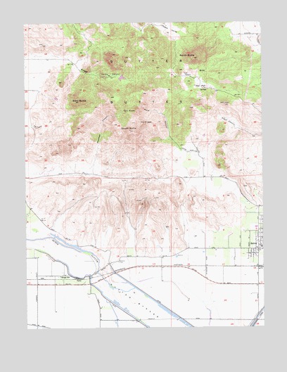
Sutter Buttes, CA USGS Topographic Map
Click on map above to begin viewing in our Map Viewer.

This topographic map contains these locations and features:
Feature Name Type Latitude Longitude GNIS ID View Map
Braggs CanyonValleyN39.2366°W121.8603°219766View Map
Brockman CanyonValleyN39.1927°W121.8402°219866View Map
Butte View High SchoolSchoolN39.1685°W121.7514°1703359View Map
Dean PlacePopulated PlaceN39.2232°W121.7811°1658384View Map
Fig TreeValleyN39.2079°W121.8722°223493View Map
Huff CanyonValleyN39.2268°W121.7858°225731View Map
KCEO-TV (Oroville)TowerN39.2054°W121.8205°1663186View Map
KKCY-FM (Colusa)TowerN39.2057°W121.8208°1662839View Map
KRFD-FM (Marysville)TowerN39.2057°W121.8208°1662963View Map
LiraPopulated PlaceN39.1452°W121.8677°1658964View Map
Long BridgeBridgeN39.1482°W121.8383°252039View Map
Moore CanyonValleyN39.1988°W121.7955°229014View Map
Morehead PitMineN39.1628°W121.8058°2680944View Map
Mount VernonPopulated PlaceN39.1735°W121.7533°1703407View Map
North ButteSummitN39.2357°W121.7861°229614View Map
Old CraggySummitN39.2085°W121.8130°1659288View Map
Slough SchoolSchoolN39.1463°W121.8583°233298View Map
South ButteSummitN39.2057°W121.8202°234944View Map
Stohlman CemeteryCemeteryN39.1516°W121.8272°235510View Map
SutterPopulated PlaceN39.1599°W121.7527°255919View Map
Sutter Assembly of God ChurchChurchN39.1707°W121.7541°1703431View Map
Sutter ButtesRangeN39.2057°W121.8202°1659929View Map
Sutter DivisionCivilN39.2202°W121.8251°1935334View Map
Sutter High SchoolSchoolN39.1660°W121.7544°1703443View Map
Sutter ParkParkN39.1674°W121.7530°1703444View Map
Sutter United Methodist ChurchChurchN39.1574°W121.7530°1703446View Map
TarkePopulated PlaceN39.1452°W121.8491°1659958View Map
The FallsFallsN39.2282°W121.8328°236166View Map
Twin PeaksSummitN39.2146°W121.8172°1660056View Map
West ButteSummitN39.2177°W121.8472°237443View Map

Note: Coordinates in the location and feature list above are referenced to NAD83 datum.


Copyright (C) 2008-2025 Ryan Niemi / Sunset Dynamics ... All Rights Reserved