TopoQuest Logo
Do you find TopoQuest useful?
Help keep TopoQuest running and adding new maps/features by donating!
Bitcoin:  19c7KJd3qBynnjoSw5npx9KScwjBe4ifkT
Litecoin:  LXs6TkuXGGXo1vDsWCkWVdjQX94eUKd6ui
Home View Maps Find Maps Find Places Resources & Links


Glace, West Virginia Topographic Map

USGS Map Title: Glace, WV
USGS Map MRC: 37080F3
DRG (GeoTIFF) Download: o37080f3.tif


Neighboring USGS Topographic Map Quads:


  Lewisburg, WV  
37080G4
 

  White Sulphur Springs, WV  
37080G3
 

  Jerrys Run, VA  
37080G2
 

  Ronceverte, WV  
37080F4
 

  Glace, WV  
37080F3
 

  Alleghany, VA  
37080F2
 

  Gap Mills, WV  
37080E4
 

  Paint Bank, VA  
37080E3
 

  Potts Creek, VA  
37080E2


Map MRC Location:

N38°
W81°
N38°
W80°
H8 H7 H6 H5 H4 H3 H2 H1
G8 G7 G6 G5 G4 G3 G2 G1
F8 F7 F6 F5 F4 F3 F2 F1
E8 E7 E6 E5 E4 E3 E2 E1
D8 D7 D6 D5 D4 D3 D2 D1
C8 C7 C6 C5 C4 C3 C2 C1
B8 B7 B6 B5 B4 B3 B2 B1
A8 A7 A6 A5 A4 A3 A2 A1
N37°
W81°
N37°
W80°

Glace, WV USGS 1:24K Topographic Map Preview:
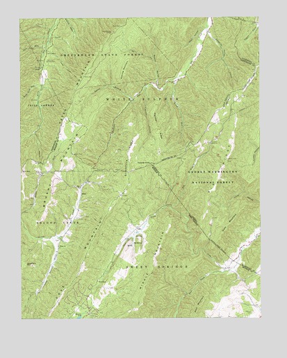
Glace, WV USGS Topographic Map
Click on map above to begin viewing in our Map Viewer.

This topographic map contains these locations and features:
Feature Name Type Latitude Longitude GNIS ID View Map
Alexander HollowValleyN37.7454°W80.2767°1550087View Map
Allegheny TunnelTunnelN37.7490°W80.2595°1550093View Map
Allegheny TunnelTunnelN37.7490°W80.2592°1481278View Map
Antioch ChurchChurchN37.6976°W80.2762°1481327View Map
Back CreekStreamN37.6443°W80.2690°1550133View Map
Back HollowValleyN37.7465°W80.2773°1550139View Map
Big BranchStreamN37.6715°W80.2965°1550285View Map
Big BranchStreamN37.6712°W80.2965°1481709View Map
Big Branch School (historical)SchoolN37.6985°W80.2751°1674000View Map
Big RidgeRidgeN37.6830°W80.2718°1481768View Map
Big Ridge LookoutLocaleN37.6912°W80.2673°1488528View Map
Big SpringSpringN37.6564°W80.3163°1550344View Map
Broad RunStreamN37.7254°W80.2920°1550471View Map
Brushy MountainSummitN37.6935°W80.3476°1554007View Map
Brushy Mountain Lookout TowerLocaleN37.6935°W80.3476°1556421View Map
Catholic CemeteryCemeteryN37.6273°W80.2545°1550654View Map
Cove Creek School (historical)SchoolN37.6460°W80.2670°1556648View Map
Cove Creek SpringSpringN37.6593°W80.3150°1557663View Map
Cove Creek Wildlife Management AreaParkN37.6712°W80.2940°2043520View Map
Daugherty MountainSummitN37.6476°W80.3726°1554260View Map
Dowdy CemeteryCemeteryN37.6868°W80.3490°1556650View Map
Fletcher HollowValleyN37.7218°W80.3095°1551142View Map
Fletcher KnobSummitN37.6896°W80.3070°1494929View Map
Fletcher RidgeRidgeN37.7037°W80.3017°1551143View Map
GlacePopulated PlaceN37.6771°W80.3434°1554558View Map
Glace Post OfficePost OfficeN37.6704°W80.3451°1559405View Map
Glace School (historical)SchoolN37.6790°W80.3440°1556659View Map
Greenbrier State ForestForestN37.7396°W80.3334°1551296View Map
Grindstone RidgeRidgeN37.6854°W80.3187°1551307View Map
Harts Run Camping AreaLocaleN37.7323°W80.3609°1551382View Map
Harts Run School (historical)SchoolN37.7462°W80.3587°1556295View Map
Hilton School (historical)SchoolN37.6551°W80.3556°1556667View Map
Hylton ChurchChurchN37.6554°W80.3551°1551538View Map
Kates Mountain OverlookLocaleN37.7440°W80.3262°1551624View Map
Laurel BranchStreamN37.7160°W80.3159°1551698View Map
Little Laurel CreekStreamN37.6585°W80.3584°1551864View Map
Lynn Lick RunStreamN37.7379°W80.3609°1551976View Map
Moss MountainSummitN37.6282°W80.2828°1552192View Map
Negro MountainSummitN37.6440°W80.2903°1556687View Map
PedroPopulated PlaceN37.6629°W80.3145°1552449View Map
Pentecostal ChurchChurchN37.7348°W80.2806°1556343View Map
Quarry HollowValleyN37.7204°W80.3026°1552571View Map
Rich MountainSummitN37.6860°W80.3742°1557998View Map
Roaring MountainSummitN37.7271°W80.3203°1552687View Map
Rock Lick RunStreamN37.7221°W80.3626°1552700View Map
Slaty MountainSummitN37.6618°W80.2678°1487308View Map
Tuckahoe RunStreamN37.7251°W80.2923°1553279View Map
Upper Tuckahoe School (historical)SchoolN37.7246°W80.2926°1556378View Map
Wylie ChapelChurchN37.6407°W80.3351°1553525View Map
Youngs Nature TrailTrailN37.7290°W80.3512°1553540View Map
Zion ChurchChurchN37.6796°W80.3437°1553544View Map

Note: Coordinates in the location and feature list above are referenced to NAD83 datum.


Copyright (C) 2008-2024 Ryan Niemi / Sunset Dynamics ... All Rights Reserved