TopoQuest Logo
Do you find TopoQuest useful?
Help keep TopoQuest running and adding new maps/features by donating!
Bitcoin:  19c7KJd3qBynnjoSw5npx9KScwjBe4ifkT
Litecoin:  LXs6TkuXGGXo1vDsWCkWVdjQX94eUKd6ui
Home View Maps Find Maps Find Places Resources & Links


Glasgow South, Kentucky Topographic Map

USGS Map Title: Glasgow South, KY
USGS Map MRC: 36085H8
DRG (GeoTIFF) Download: o36085h8.tif


Neighboring USGS Topographic Map Quads:


  Park City, KY  
37086A1
 

  Glasgow North, KY  
37085A8
 

  Hiseville, KY  
37085A7
 

  Lucas, KY  
36086H1
 

  Glasgow South, KY  
36085H8
 

  Temple Hill, KY  
36085H7
 

  Austin, KY  
36086G1
 

  Tracy, KY  
36085G8
 

  Freedom, KY  
36085G7


Map MRC Location:

N37°
W86°
N37°
W85°
H8 H7 H6 H5 H4 H3 H2 H1
G8 G7 G6 G5 G4 G3 G2 G1
F8 F7 F6 F5 F4 F3 F2 F1
E8 E7 E6 E5 E4 E3 E2 E1
D8 D7 D6 D5 D4 D3 D2 D1
C8 C7 C6 C5 C4 C3 C2 C1
B8 B7 B6 B5 B4 B3 B2 B1
A8 A7 A6 A5 A4 A3 A2 A1
N36°
W86°
N36°
W85°

Glasgow South, KY USGS 1:24K Topographic Map Preview:
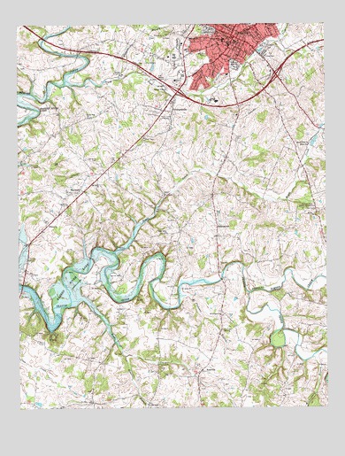
Glasgow South, KY USGS Topographic Map
Click on map above to begin viewing in our Map Viewer.

This topographic map contains these locations and features:
Feature Name Type Latitude Longitude GNIS ID View Map
Adams CemeteryCemeteryN36.9248°W85.9419°1852526View Map
Allen CemeteryCemeteryN36.8803°W85.9739°1852529View Map
Barlow CemeteryCemeteryN36.9823°W85.9397°486362View Map
Barren - Metcalfe County Ambulance ServiceBuildingN36.9903°W85.9009°2719101View Map
Barren CountyCivilN36.9656°W85.9337°516851View Map
Barren County Historical MarkerParkN36.9958°W85.9121°2744048View Map
Barren County Sheriff's OfficeBuildingN36.9963°W85.9121°2767413View Map
Boyds CreekStreamN36.9259°W85.9611°487776View Map
Boyds Creek ChurchChurchN36.9606°W85.8816°487777View Map
BristletownPopulated PlaceN36.9342°W85.9194°507585View Map
Bunche High SchoolSchoolN36.9878°W85.9119°488386View Map
Cedar Grove ChurchChurchN36.9317°W85.9397°489200View Map
Christmas Mishap Historical MarkerParkN36.9957°W85.9130°2744059View Map
Confederate Congressional Medal of Honour Historical MarkerParkN36.9957°W85.9130°2744061View Map
Dover ChurchChurchN36.9342°W85.9872°491070View Map
Elmore BranchStreamN36.8917°W85.9569°491738View Map
Falling Timber CreekStreamN36.9123°W85.9064°491960View Map
First Presbyterian Church Historical MarkerParkN36.9943°W85.9113°2744092View Map
GlasgowPopulated PlaceN36.9959°W85.9119°492876View Map
Glasgow City Fire Department Station 2BuildingN36.9997°W85.9268°2636340View Map
Glasgow DivisionCivilN36.9821°W85.9012°1937021View Map
Glasgow Fire Department Station 1BuildingN36.9943°W85.9116°2636453View Map
Glasgow Police DepartmentBuildingN36.9945°W85.9116°2767608View Map
Gorin ParkParkN36.9928°W85.9003°493035View Map
HaywoodPopulated PlaceN36.9462°W85.9744°493941View Map
Haywood Fire DepartmentBuildingN36.9447°W85.9732°2636302View Map
Home of Arthur Krock Historical MarkerParkN36.9931°W85.9049°2744123View Map
Home of Governor Leslie Historical MarkerParkN36.9937°W85.9063°2744124View Map
Huggins BranchStreamN36.9823°W85.9597°494741View Map
Laurel BluffCliffN36.9002°W85.8899°2742705View Map
Liberty Street SchoolSchoolN36.9948°W85.9164°496392View Map
Luska Joseph Twyman Historical MarkerParkN36.9953°W85.9133°2744159View Map
Matthews HillSummitN36.9228°W85.9128°2742707View Map
Millersburg BranchStreamN36.8912°W85.8805°498364View Map
Morrisey Park Church CampgroundLocaleN36.9406°W85.8828°498625View Map
Mount Pleasant BranchStreamN36.9114°W85.9347°498821View Map
Mount Pleasant ChurchChurchN36.9051°W85.9175°498832View Map
Oak Grove CemeteryCemeteryN36.9553°W85.9678°499656View Map
Oak Grove ChurchChurchN36.9478°W85.9675°499674View Map
PritchardsvillePopulated PlaceN36.9723°W85.9372°501353View Map
Rose CreekStreamN36.9101°W85.9786°502327View Map
RosevillePopulated PlaceN36.8873°W85.9255°502353View Map
Siloan ChurchChurchN36.9601°W85.8822°503504View Map
South Fork Beaver CreekStreamN36.9818°W85.9807°503906View Map
South Fork ChurchChurchN36.9698°W85.9716°503911View Map
Temple Hill Fire DepartmentBuildingN36.8829°W85.9274°2636803View Map
WCDS-AM (Glasgow)TowerN36.9695°W85.9400°517592View Map
Woodland ParkParkN36.9909°W85.9241°507101View Map
WOVO-FM (Glasgow)TowerN36.9014°W85.9153°517694View Map

Note: Coordinates in the location and feature list above are referenced to NAD83 datum.


Copyright (C) 2008-2025 Ryan Niemi / Sunset Dynamics ... All Rights Reserved