TopoQuest Logo
Do you find TopoQuest useful?
Help keep TopoQuest running and adding new maps/features by donating!
Bitcoin:  19c7KJd3qBynnjoSw5npx9KScwjBe4ifkT
Litecoin:  LXs6TkuXGGXo1vDsWCkWVdjQX94eUKd6ui
Home View Maps Find Maps Find Places Resources & Links


Temple Hill, Kentucky Topographic Map

USGS Map Title: Temple Hill, KY
USGS Map MRC: 36085H7
DRG (GeoTIFF) Download: o36085h7.tif


Neighboring USGS Topographic Map Quads:


  Glasgow North, KY  
37085A8
 

  Hiseville, KY  
37085A7
 

  Sulphur Well, KY  
37085A6
 

  Glasgow South, KY  
36085H8
 

  Temple Hill, KY  
36085H7
 

  Summer Shade, KY  
36085H6
 

  Tracy, KY  
36085G8
 

  Freedom, KY  
36085G7
 

  Sulphur Lick, KY  
36085G6


Map MRC Location:

N37°
W86°
N37°
W85°
H8 H7 H6 H5 H4 H3 H2 H1
G8 G7 G6 G5 G4 G3 G2 G1
F8 F7 F6 F5 F4 F3 F2 F1
E8 E7 E6 E5 E4 E3 E2 E1
D8 D7 D6 D5 D4 D3 D2 D1
C8 C7 C6 C5 C4 C3 C2 C1
B8 B7 B6 B5 B4 B3 B2 B1
A8 A7 A6 A5 A4 A3 A2 A1
N36°
W86°
N36°
W85°

Temple Hill, KY USGS 1:24K Topographic Map Preview:
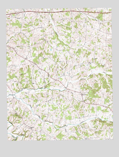
Temple Hill, KY USGS Topographic Map
Click on map above to begin viewing in our Map Viewer.

This topographic map contains these locations and features:
Feature Name Type Latitude Longitude GNIS ID View Map
Bailey BranchStreamN36.8881°W85.8075°486208View Map
Bailey BranchStreamN36.9301°W85.8022°486210View Map
Barbour CemeteryCemeteryN36.9359°W85.8647°486327View Map
Beech Grove ChurchChurchN36.9114°W85.7841°486719View Map
Bethel ChurchChurchN36.9531°W85.8519°486963View Map
Bowles BranchStreamN36.9214°W85.8603°487733View Map
Bowles CemeteryCemeteryN36.9423°W85.8097°487736View Map
Brushy ForkStreamN36.9231°W85.8064°488113View Map
Buckley CemeteryCemeteryN36.9203°W85.8500°488274View Map
Creek Side LandingAirportN36.8941°W85.7765°2444073View Map
East Barren Fire DepartmentBuildingN36.9834°W85.8330°2636985View Map
Eastern SchoolSchoolN36.9817°W85.8319°491513View Map
Eighty EightPopulated PlaceN36.9184°W85.7864°491598View Map
Elbow Spring CreekStreamN36.9270°W85.8294°491613View Map
Glover CreekStreamN36.9187°W85.8664°492924View Map
Happy Hollow BranchStreamN36.8781°W85.8644°493707View Map
KinoPopulated PlaceN36.9478°W85.7775°508392View Map
Lick BranchStreamN36.9289°W85.8022°496399View Map
Lick Branch ChurchChurchN36.9514°W85.7705°496461View Map
Mount Union Number 5 ChurchChurchN36.9703°W85.8283°517246View Map
New Salem ChurchChurchN36.9914°W85.8614°499389View Map
Peden CemeteryCemeteryN36.9125°W85.8722°500345View Map
Peers CemeteryCemeteryN36.9853°W85.7641°500352View Map
Pierce CreekStreamN36.9245°W85.8308°500574View Map
Poplar Spring ChurchChurchN36.9117°W85.8253°501131View Map
Raccoon BranchStreamN36.9926°W85.7797°501494View Map
Temple HillPopulated PlaceN36.8867°W85.8472°505058View Map
Temple Hill DivisionCivilN36.9106°W85.8040°1937289View Map
Temple Hill Fire DepartmentBuildingN36.8884°W85.8503°2636348View Map
Union Number 2 ChurchChurchN36.8753°W85.7825°517303View Map
Whites ChapelChurchN36.9292°W85.8447°506667View Map

Note: Coordinates in the location and feature list above are referenced to NAD83 datum.


Copyright (C) 2008-2024 Ryan Niemi / Sunset Dynamics ... All Rights Reserved