TopoQuest Logo
Do you find TopoQuest useful?
Help keep TopoQuest running and adding new maps/features by donating!
Bitcoin:  19c7KJd3qBynnjoSw5npx9KScwjBe4ifkT
Litecoin:  LXs6TkuXGGXo1vDsWCkWVdjQX94eUKd6ui
Home View Maps Find Maps Find Places Resources & Links


Hiseville, Kentucky Topographic Map

USGS Map Title: Hiseville, KY
USGS Map MRC: 37085A7
DRG (GeoTIFF) Download: o37085a7.tif


Neighboring USGS Topographic Map Quads:


  Horse Cave, KY  
37085B8
 

  Park, KY  
37085B7
 

  Center, KY  
37085B6
 

  Glasgow North, KY  
37085A8
 

  Hiseville, KY  
37085A7
 

  Sulphur Well, KY  
37085A6
 

  Glasgow South, KY  
36085H8
 

  Temple Hill, KY  
36085H7
 

  Summer Shade, KY  
36085H6


Map MRC Location:

N38°
W86°
N38°
W85°
H8 H7 H6 H5 H4 H3 H2 H1
G8 G7 G6 G5 G4 G3 G2 G1
F8 F7 F6 F5 F4 F3 F2 F1
E8 E7 E6 E5 E4 E3 E2 E1
D8 D7 D6 D5 D4 D3 D2 D1
C8 C7 C6 C5 C4 C3 C2 C1
B8 B7 B6 B5 B4 B3 B2 B1
A8 A7 A6 A5 A4 A3 A2 A1
N37°
W86°
N37°
W85°

Hiseville, KY USGS 1:24K Topographic Map Preview:
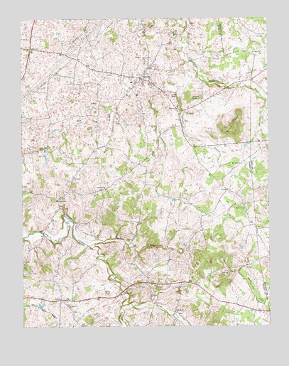
Hiseville, KY USGS Topographic Map
Click on map above to begin viewing in our Map Viewer.

This topographic map contains these locations and features:
Feature Name Type Latitude Longitude GNIS ID View Map
Arnett CemeteryCemeteryN37.0159°W85.8064°1852536View Map
Barren ForkStreamN37.0326°W85.8400°486426View Map
Big Meadow ChurchChurchN37.0478°W85.7619°487220View Map
Blue Spring (historical)SpringN37.0306°W85.8310°2742696View Map
Blue Spring ChurchChurchN37.0662°W85.7639°487552View Map
Buck KnobSummitN37.0823°W85.7661°488228View Map
City of Hiseville (historical)CivilN37.1008°W85.8149°2404705View Map
Coral HillPopulated PlaceN37.0514°W85.8564°507756View Map
Duff BranchStreamN37.0895°W85.8325°491260View Map
GridervillePopulated PlaceN37.1128°W85.8703°508137View Map
HalfwayPopulated PlaceN37.0884°W85.7955°508160View Map
Hickory Grove ChurchChurchN37.0084°W85.8516°494129View Map
HisevillePopulated PlaceN37.1009°W85.8125°494308View Map
Hiseville Census Designated PlaceCensusN37.1008°W85.8149°2629632View Map
Hiseville DivisionCivilN37.0945°W85.8457°1937063View Map
Hiseville Fire DepartmentBuildingN37.1003°W85.8136°2636643View Map
LectaPopulated PlaceN37.0112°W85.8561°508436View Map
Loves KnobSummitN37.0245°W85.7725°497224View Map
Mount Pisgah ChurchChurchN37.0117°W85.8103°498814View Map
Neals ChapelChurchN37.0001°W85.8450°499199View Map
Pleasant Union ChurchChurchN37.0556°W85.8322°500914View Map
Queens ChapelChurchN37.0939°W85.7955°501476View Map
Slick RockPopulated PlaceN37.0059°W85.7980°509076View Map
Strader BranchStreamN37.1023°W85.7986°504543View Map
Swannigan CreekStreamN37.0084°W85.8244°504839View Map
White Oak CreekStreamN37.0231°W85.7641°506619View Map
Winlock KnobSummitN37.0926°W85.7877°506948View Map

Note: Coordinates in the location and feature list above are referenced to NAD83 datum.


Copyright (C) 2008-2025 Ryan Niemi / Sunset Dynamics ... All Rights Reserved