TopoQuest Logo
Do you find TopoQuest useful?
Help keep TopoQuest running and adding new maps/features by donating!
Bitcoin:  19c7KJd3qBynnjoSw5npx9KScwjBe4ifkT
Litecoin:  LXs6TkuXGGXo1vDsWCkWVdjQX94eUKd6ui
Home View Maps Find Maps Find Places Resources & Links


Glass Hill, Oregon Topographic Map

USGS Map Title: Glass Hill, OR
USGS Map MRC: 45118B1
DRG (GeoTIFF) Download: o45118b1.tif


Neighboring USGS Topographic Map Quads:


  Hilgard, OR  
45118C2
 

  La Grande, OR  
45118C1
 

  Conley, OR  
45117C8
 

  La Grande Reservoir, OR  
45118B2
 

  Glass Hill, OR  
45118B1
 

  Craig Mountain, OR  
45117B8
 

  Anthony Butte, OR  
45118A2
 

  Tucker Flat, OR  
45118A1
 

  North Powder, OR  
45117A8


Map MRC Location:

N46°
W119°
N46°
W118°
H8 H7 H6 H5 H4 H3 H2 H1
G8 G7 G6 G5 G4 G3 G2 G1
F8 F7 F6 F5 F4 F3 F2 F1
E8 E7 E6 E5 E4 E3 E2 E1
D8 D7 D6 D5 D4 D3 D2 D1
C8 C7 C6 C5 C4 C3 C2 C1
B8 B7 B6 B5 B4 B3 B2 B1
A8 A7 A6 A5 A4 A3 A2 A1
N45°
W119°
N45°
W118°

Glass Hill, OR USGS 1:24K Topographic Map Preview:
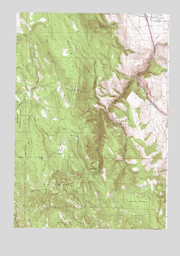
Glass Hill, OR USGS Topographic Map
Click on map above to begin viewing in our Map Viewer.

This topographic map contains these locations and features:
Feature Name Type Latitude Longitude GNIS ID View Map
BaldySummitN45.1635°W118.0149°1136030View Map
Charles Reynolds Safety Rest AreaLocaleN45.2315°W118.0130°1638086View Map
Clay SpringSpringN45.2323°W118.0091°1129455View Map
East Fork Rock CreekStreamN45.2024°W118.1130°1120323View Map
Glass HillSummitN45.2049°W118.0749°1121151View Map
Howard MeadowFlatN45.1726°W118.0858°1122079View Map
Howard Meadow TrailTrailN45.1643°W118.0969°1122080View Map
Ladd CanyonValleyN45.2132°W118.0263°1122883View Map
Ladd Canyon PondLakeN45.1595°W118.0570°1122884View Map
Ladd Canyon Sno-ParkLocaleN45.1932°W118.0516°1952985View Map
Long PrairieFlatN45.2024°W118.0866°1123444View Map
Mann RidgeRidgeN45.1329°W118.0861°1145784View Map
Morris HillSummitN45.1657°W118.1005°1136551View Map
Reinecke CabinLocaleN45.1826°W118.0827°1125939View Map
Spring FlatFlatN45.1499°W118.0208°1127439View Map
Tamarack MountainSummitN45.1426°W118.0180°1127879View Map
Vincent RanchLocaleN45.1793°W118.0747°1128542View Map
West Fork Ladd CreekStreamN45.2338°W118.0118°1164149View Map

Note: Coordinates in the location and feature list above are referenced to NAD83 datum.


Copyright (C) 2008-2024 Ryan Niemi / Sunset Dynamics ... All Rights Reserved