TopoQuest Logo
Do you find TopoQuest useful?
Help keep TopoQuest running and adding new maps/features by donating!
Bitcoin:  19c7KJd3qBynnjoSw5npx9KScwjBe4ifkT
Litecoin:  LXs6TkuXGGXo1vDsWCkWVdjQX94eUKd6ui
Home View Maps Find Maps Find Places Resources & Links


Tucker Flat, Oregon Topographic Map

USGS Map Title: Tucker Flat, OR
USGS Map MRC: 45118A1
DRG (GeoTIFF) Download: o45118a1.tif


Neighboring USGS Topographic Map Quads:


  La Grande Reservoir, OR  
45118B2
 

  Glass Hill, OR  
45118B1
 

  Craig Mountain, OR  
45117B8
 

  Anthony Butte, OR  
45118A2
 

  Tucker Flat, OR  
45118A1
 

  North Powder, OR  
45117A8
 

  Anthony Lakes, OR  
44118H2
 

  Rock Creek, OR  
44118H1
 

  Haines, OR  
44117H8


Map MRC Location:

N46°
W119°
N46°
W118°
H8 H7 H6 H5 H4 H3 H2 H1
G8 G7 G6 G5 G4 G3 G2 G1
F8 F7 F6 F5 F4 F3 F2 F1
E8 E7 E6 E5 E4 E3 E2 E1
D8 D7 D6 D5 D4 D3 D2 D1
C8 C7 C6 C5 C4 C3 C2 C1
B8 B7 B6 B5 B4 B3 B2 B1
A8 A7 A6 A5 A4 A3 A2 A1
N45°
W119°
N45°
W118°

Tucker Flat, OR USGS 1:24K Topographic Map Preview:
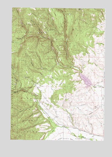
Tucker Flat, OR USGS Topographic Map
Click on map above to begin viewing in our Map Viewer.

This topographic map contains these locations and features:
Feature Name Type Latitude Longitude GNIS ID View Map
Anthony CreekStreamN45.0129°W118.0599°1137257View Map
Anthony GorgeValleyN45.0457°W118.1080°1130900View Map
Baker CreekStreamN45.0282°W118.0830°1153697View Map
Bowman SpringSpringN45.0929°W118.0135°1153695View Map
Carnes DitchCanalN45.0265°W118.0319°1139382View Map
China DiggingsLocaleN45.0949°W118.1161°1161312View Map
Clear CreekStreamN45.0696°W118.0419°1139778View Map
Coughanour DitchCanalN45.0276°W118.0127°1140251View Map
Daley CreekStreamN45.0496°W118.0713°1140604View Map
Dark CanyonValleyN45.0276°W118.0830°1140627View Map
Dutch CreekStreamN45.0454°W118.1152°1141428View Map
East Fork Clear CreekStreamN45.1010°W118.0558°1141545View Map
Elkhorn Wildlife AreaParkN45.0304°W118.0955°1167283View Map
Goff SpringSpringN45.0832°W118.0205°1153696View Map
Henrys ReservoirReservoirN45.0493°W118.0080°1153693View Map
Huddleston ReservoirReservoirN45.0911°W118.0236°1153694View Map
Hunter CampLocaleN45.1040°W118.0763°1143926View Map
King SpringSpringN45.1086°W118.1018°1144617View Map
Lone Pine DitchCanalN45.0265°W118.0716°1145356View Map
Metzler CreekStreamN45.0976°W118.0863°1146122View Map
North Fork Wolf CreekStreamN45.0979°W118.1022°1147026View Map
Pilcher CreekStreamN45.0065°W118.0194°1147665View Map
Pilcher Creek Recreation AreaParkN45.0499°W118.0769°1167273View Map
Pilcher Creek ReservoirReservoirN45.0448°W118.0718°2702779View Map
Pilcher Creek Reservoir Boat RampLocaleN45.0419°W118.0758°2700353View Map
Pilcher Creek Reservoir DamDamN45.0388°W118.0721°2702780View Map
Pilcher Creek Reservoir Recreation SiteLocaleN45.0485°W118.0816°1156529View Map
Red RidgeRidgeN45.1137°W118.0399°1148329View Map
Roger CreekStreamN45.0368°W118.0902°1148689View Map
Shaw MountainSummitN45.1243°W118.0372°1149300View Map
Shingle GulchValleyN45.0718°W118.0630°1149400View Map
Summit SpringSpringN45.1044°W118.0748°1150644View Map
Summit Spring RidgeRidgeN45.1146°W118.0905°1150645View Map
Third CreekStreamN45.0926°W118.1127°1151062View Map
Tucker FlatFlatN45.0582°W118.0674°1151475View Map
West Fork Clear CreekStreamN45.1007°W118.0558°1152060View Map
Wolf Creek DamDamN45.0522°W118.0185°1155680View Map
Wolf Creek ReservoirReservoirN45.0568°W118.0250°1153065View Map
Wolf Creek Reservoir Boat RampLocaleN45.0544°W118.0172°2700363View Map
Wolf Creek Reservoir Recreation SiteLocaleN45.0579°W118.0191°1156530View Map

Note: Coordinates in the location and feature list above are referenced to NAD83 datum.


Copyright (C) 2008-2024 Ryan Niemi / Sunset Dynamics ... All Rights Reserved