TopoQuest Logo
Do you find TopoQuest useful?
Help keep TopoQuest running and adding new maps/features by donating!
Bitcoin:  19c7KJd3qBynnjoSw5npx9KScwjBe4ifkT
Litecoin:  LXs6TkuXGGXo1vDsWCkWVdjQX94eUKd6ui
Home View Maps Find Maps Find Places Resources & Links


Glens, Mississippi Topographic Map

USGS Map Title: Glens, MS
USGS Map MRC: 34088G4
DRG (GeoTIFF) Download: o34088g4.tif


Neighboring USGS Topographic Map Quads:


  Corinth, MS  
34088H5
 

  Kendrick, MS  
34088H4
 

  Doskie, MS  
34088H3
 

  Rienzi, MS  
34088G5
 

  Glens, MS  
34088G4
 

  Burnsville, MS  
34088G3
 

  Booneville, MS  
34088F5
 

  Altitude, MS  
34088F4
 

  Paden, MS  
34088F3


Map MRC Location:

N35°
W89°
N35°
W88°
H8 H7 H6 H5 H4 H3 H2 H1
G8 G7 G6 G5 G4 G3 G2 G1
F8 F7 F6 F5 F4 F3 F2 F1
E8 E7 E6 E5 E4 E3 E2 E1
D8 D7 D6 D5 D4 D3 D2 D1
C8 C7 C6 C5 C4 C3 C2 C1
B8 B7 B6 B5 B4 B3 B2 B1
A8 A7 A6 A5 A4 A3 A2 A1
N34°
W89°
N34°
W88°

Glens, MS USGS 1:24K Topographic Map Preview:
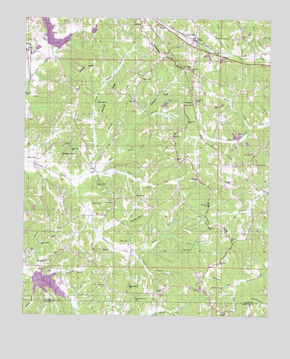
Glens, MS USGS Topographic Map
Click on map above to begin viewing in our Map Viewer.

This topographic map contains these locations and features:
Feature Name Type Latitude Longitude GNIS ID View Map
Alcorn (historical)LocaleN34.8487°W88.4973°684637View Map
Antioch ChurchChurchN34.8609°W88.4959°666335View Map
Arbor CemeteryCemeteryN34.7776°W88.4181°666345View Map
Bain CreekStreamN34.8298°W88.3834°666465View Map
Bennett RidgeRidgeN34.8520°W88.4703°666828View Map
Beoshear CemeteryCemeteryN34.7776°W88.4595°666838View Map
Bloodsaw HillSummitN34.7618°W88.4464°667274View Map
Boone CreekStreamN34.7773°W88.4442°667437View Map
Browder BranchStreamN34.8093°W88.4670°667607View Map
Browder RidgeRidgeN34.8440°W88.4567°667608View Map
Cadle CreekStreamN34.7840°W88.4270°667902View Map
Childers BranchStreamN34.8320°W88.4412°668390View Map
Choate CreekStreamN34.8601°W88.3950°668405View Map
Cooney CreekStreamN34.8320°W88.4412°668805View Map
Floyds Store (historical)BuildingN34.7770°W88.4792°711106View Map
Glen Post OfficePost OfficeN34.8713°W88.4293°1675451View Map
Glen Volunteer Fire DepartmentBuildingN34.8634°W88.4109°2665747View Map
Glendale Baptist ChurchChurchN34.8659°W88.4153°683141View Map
Glendale SchoolSchoolN34.8684°W88.4139°670434View Map
GlensPopulated PlaceN34.8662°W88.4139°670437View Map
Gobblers KnobSummitN34.8176°W88.4737°670445View Map
Gray CemeteryCemeteryN34.7629°W88.4581°670630View Map
Hardwick CemeteryCemeteryN34.8065°W88.3942°670911View Map
Harper BranchStreamN34.7656°W88.4953°670951View Map
Harville BranchStreamN34.8020°W88.3756°670999View Map
Hickory Flat SchoolSchoolN34.7831°W88.4862°671154View Map
Hinton School (historical)SchoolN34.8737°W88.4950°683150View Map
Holly BranchStreamN34.8106°W88.4623°671306View Map
Houston Farris Pond DamDamN34.8401°W88.4250°682813View Map
Howard Little Pond DamDamN34.8268°W88.3900°682810View Map
Indian SpringsPopulated PlaceN34.8404°W88.4148°691957View Map
Indian Springs ChurchChurchN34.8543°W88.4150°671701View Map
JacintoPopulated PlaceN34.7598°W88.4284°671757View Map
Jacinto CemeteryCemeteryN34.7576°W88.4320°705814View Map
Jacinto School (historical)SchoolN34.7604°W88.4281°705815View Map
Jacinto Volunteer Fire DepartmentBuildingN34.7606°W88.4290°2665758View Map
JobesPopulated PlaceN34.8615°W88.4998°691969View Map
Johns CemeteryCemeteryN34.8409°W88.4448°671909View Map
Juliett School (historical)SchoolN34.8195°W88.4753°683156View Map
Kemp Chapel CemeteryCemeteryN34.7801°W88.4912°672091View Map
Liberty Hill ChurchChurchN34.8184°W88.3834°672471View Map
Liberty Hill School (historical)SchoolN34.8145°W88.3889°683161View Map
Little Lake DamDamN34.8268°W88.3884°682809View Map
Lovejoy ChurchChurchN34.7851°W88.3859°672904View Map
Macedonia ChurchChurchN34.7970°W88.4539°673034View Map
Malone CemeteryCemeteryN34.8495°W88.4356°673105View Map
Maness BranchStreamN34.8170°W88.4637°673110View Map
Marlar CreekStreamN34.8298°W88.3834°673142View Map
McWilliams CemeteryCemeteryN34.7723°W88.4928°673449View Map
New Hope ChurchChurchN34.8137°W88.3809°674746View Map
Palmer CemeteryCemeteryN34.7815°W88.4464°675409View Map
Piney Grove CemeteryCemeteryN34.8190°W88.4762°675894View Map
Poplar SpringSpringN34.8393°W88.4628°676230View Map
Railroad BranchStreamN34.8484°W88.4981°676455View Map
Reedy BranchStreamN34.7618°W88.3920°676573View Map
Rider CreekStreamN34.7773°W88.4439°676651View Map
Rinehart BranchStreamN34.7648°W88.4903°676669View Map
Rowland Mills School (historical)SchoolN34.7693°W88.4970°689974View Map
Sand HillSummitN34.8048°W88.4631°677342View Map
Sardis Primitive Baptist ChurchChurchN34.7693°W88.4889°677419View Map
Searcy TownPopulated PlaceN34.8176°W88.4937°692216View Map
Southerland HillSummitN34.7570°W88.4437°678023View Map
Supervisor District 2CivilN34.8442°W88.4194°711765View Map
Taylor CreekStreamN34.8076°W88.4778°678592View Map
Tick CreekStreamN34.8598°W88.4864°678751View Map
Timmons CemeteryCemeteryN34.7970°W88.4603°678767View Map
Town of GlenCivilN34.8585°W88.4199°2406573View Map
Tuscumbia Watershed Structure 8 DamDamN34.8618°W88.4850°682816View Map
Twentieth Century ChurchChurchN34.7518°W88.3970°678997View Map
Union School (historical)SchoolN34.8462°W88.4428°683214View Map
White Oak HollowValleyN34.7902°W88.4470°679630View Map
Whitehurst BranchStreamN34.7631°W88.3878°679625View Map
Whitehurst SpringSpringN34.7618°W88.3978°679627View Map
Wilbanks Lake DamDamN34.8584°W88.4900°682815View Map
Williams CemeteryCemeteryN34.8004°W88.4425°679711View Map
Wilson CemeteryCemeteryN34.8384°W88.4034°679763View Map
Winbush RidgeRidgeN34.8423°W88.4295°679778View Map
Yellow Jacket CreekStreamN34.8195°W88.4500°679945View Map
Zion School (historical)SchoolN34.7851°W88.3850°683223View Map

Note: Coordinates in the location and feature list above are referenced to NAD83 datum.


Copyright (C) 2008-2024 Ryan Niemi / Sunset Dynamics ... All Rights Reserved