TopoQuest Logo
Do you find TopoQuest useful?
Help keep TopoQuest running and adding new maps/features by donating!
Bitcoin:  19c7KJd3qBynnjoSw5npx9KScwjBe4ifkT
Litecoin:  LXs6TkuXGGXo1vDsWCkWVdjQX94eUKd6ui
Home View Maps Find Maps Find Places Resources & Links


Burnsville, Mississippi Topographic Map

USGS Map Title: Burnsville, MS
USGS Map MRC: 34088G3
DRG (GeoTIFF) Download: o34088g3.tif


Neighboring USGS Topographic Map Quads:


  Kendrick, MS  
34088H4
 

  Doskie, MS  
34088H3
 

  Yellow Creek, MS  
34088H2
 

  Glens, MS  
34088G4
 

  Burnsville, MS  
34088G3
 

  Iuka, MS  
34088G2
 

  Altitude, MS  
34088F4
 

  Paden, MS  
34088F3
 

  Tishomingo, MS  
34088F2


Map MRC Location:

N35°
W89°
N35°
W88°
H8 H7 H6 H5 H4 H3 H2 H1
G8 G7 G6 G5 G4 G3 G2 G1
F8 F7 F6 F5 F4 F3 F2 F1
E8 E7 E6 E5 E4 E3 E2 E1
D8 D7 D6 D5 D4 D3 D2 D1
C8 C7 C6 C5 C4 C3 C2 C1
B8 B7 B6 B5 B4 B3 B2 B1
A8 A7 A6 A5 A4 A3 A2 A1
N34°
W89°
N34°
W88°

Burnsville, MS USGS 1:24K Topographic Map Preview:
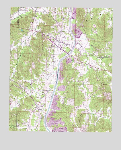
Burnsville, MS USGS Topographic Map
Click on map above to begin viewing in our Map Viewer.

This topographic map contains these locations and features:
Feature Name Type Latitude Longitude GNIS ID View Map
Antioch CemeteryCemeteryN34.8515°W88.3136°689856View Map
Antioch ChurchChurchN34.8512°W88.3139°666334View Map
Berea ChurchChurchN34.7909°W88.3314°666843View Map
Berea CreekStreamN34.7993°W88.3181°666844View Map
Bishop CemeteryCemeteryN34.8129°W88.2636°667187View Map
Blasingame CreekStreamN34.7590°W88.3367°689875View Map
Bluff Springs School (historical)SchoolN34.8465°W88.2812°689876View Map
Boothe CemeteryCemeteryN34.7984°W88.3348°667443View Map
Bryant PondReservoirN34.8517°W88.3609°667713View Map
BurnsvillePopulated PlaceN34.8406°W88.3148°667827View Map
Burnsville Attendance CenterSchoolN34.8370°W88.3139°710766View Map
Burnsville Baptist ChurchChurchN34.8393°W88.3156°689881View Map
Burnsville CemeteryCemeteryN34.8354°W88.3284°667828View Map
Burnsville Fire DepartmentBuildingN34.8422°W88.3197°2665682View Map
Burnsville Overlook AreaParkN34.8223°W88.3062°689882View Map
Burnsville Police DepartmentBuildingN34.8348°W88.3165°2754120View Map
Burnsville Post OfficePost OfficeN34.8348°W88.3165°2760187View Map
Burnsville United Pentecostal ChurchChurchN34.8351°W88.3209°689883View Map
Carpenter CemeteryCemeteryN34.8220°W88.2961°668083View Map
Chapel Hill CemeteryCemeteryN34.8740°W88.3420°668320View Map
Chapel Hill ChurchChurchN34.8712°W88.3445°668335View Map
Chestnut RidgeRidgeN34.7568°W88.2881°668378View Map
Church of ChristChurchN34.8373°W88.3184°689893View Map
Coke Creek Drainage DitchCanalN34.8734°W88.3487°689894View Map
Coke SpurLocaleN34.8620°W88.3742°668649View Map
Dark HollowValleyN34.8731°W88.2515°669112View Map
Dry CreekStreamN34.7951°W88.2848°669450View Map
Ellington CreekStreamN34.8304°W88.2817°669732View Map
Gravel Hill School (historical)SchoolN34.8043°W88.3387°689915View Map
Harvell BranchStreamN34.8737°W88.2512°670996View Map
Hazard BranchStreamN34.8306°W88.2831°671042View Map
Hazard SwitchLocaleN34.8254°W88.2509°671043View Map
Hebron CemeteryCemeteryN34.8048°W88.2681°689919View Map
Hebron ChurchChurchN34.8051°W88.2689°671082View Map
Hines BranchStreamN34.8637°W88.3684°671235View Map
Holder CemeteryCemeteryN34.7904°W88.3064°671281View Map
Holder CemeteryCemeteryN34.8079°W88.3312°671282View Map
Holts SpurLocaleN34.7723°W88.3398°671362View Map
Holtspur Volunteer Fire DepartmentBuildingN34.7715°W88.3446°2666020View Map
Lambert Chapel SchoolSchoolN34.8606°W88.3170°672284View Map
LeedyPopulated PlaceN34.7954°W88.3612°672387View Map
Little Flock CemeteryCemeteryN34.7912°W88.3345°689933View Map
Little Flock ChurchChurchN34.7909°W88.3353°672610View Map
Little Yellow CreekStreamN34.8498°W88.3025°672713View Map
Marlow Creek Drainage DitchCanalN34.8584°W88.3428°689940View Map
McNutt BranchStreamN34.7762°W88.2798°673422View Map
Mount Gilead CemeteryCemeteryN34.8001°W88.2603°689945View Map
Mount Gilead ChurchChurchN34.7984°W88.2625°674007View Map
Mud BranchStreamN34.8468°W88.2995°674426View Map
New Liberty ChurchChurchN34.8662°W88.3453°674771View Map
Newcomb BranchStreamN34.8412°W88.3567°674899View Map
Oak Ridge School (historical)SchoolN34.7712°W88.3048°689954View Map
Opossum Trot CemeteryCemeteryN34.8487°W88.3292°675297View Map
Overton ChapelChurchN34.7712°W88.2603°675340View Map
Pigeon Roost BranchStreamN34.7640°W88.3359°675725View Map
Pleasant Ridge School (historical)SchoolN34.8015°W88.2639°689964View Map
Rowland Mill ChurchChurchN34.7695°W88.3467°676937View Map
Rowland Mills CemeteryCemeteryN34.7693°W88.3456°689973View Map
Sardis CemeteryCemeteryN34.7548°W88.3112°689978View Map
Sardis ChurchChurchN34.7545°W88.3114°677418View Map
Sardis School (historical)SchoolN34.7543°W88.3167°689979View Map
Taylor Chapel (historical)ChurchN34.8348°W88.3737°683208View Map
Town of BurnsvilleCivilN34.8348°W88.3177°2405349View Map
Tucker RidgeRidgeN34.8529°W88.2606°689997View Map
Turnpike HillSummitN34.8526°W88.2962°678982View Map
Walker SidingPopulated PlaceN34.8320°W88.2889°679275View Map
Whitehurst CemeteryCemeteryN34.8745°W88.3637°679626View Map
Yellow Creek Drainage Ditch (historical)CanalN34.8198°W88.3153°690002View Map

Note: Coordinates in the location and feature list above are referenced to NAD83 datum.


Copyright (C) 2008-2025 Ryan Niemi / Sunset Dynamics ... All Rights Reserved