TopoQuest Logo
Do you find TopoQuest useful?
Help keep TopoQuest running and adding new maps/features by donating!
Bitcoin:  19c7KJd3qBynnjoSw5npx9KScwjBe4ifkT
Litecoin:  LXs6TkuXGGXo1vDsWCkWVdjQX94eUKd6ui
Home View Maps Find Maps Find Places Resources & Links


Glenville, Kentucky Topographic Map

USGS Map Title: Glenville, KY
USGS Map MRC: 37087E2
DRG (GeoTIFF) Download: o37087e2.tif


Neighboring USGS Topographic Map Quads:


  Curdsville, KY  
37087F3
 

  Panther, KY  
37087F2
 

  Sutherland, KY  
37087F1
 

  Calhoun, KY  
37087E3
 

  Glenville, KY  
37087E2
 

  Utica, KY  
37087E1
 

  Sacramento, KY  
37087D3
 

  Livermore, KY  
37087D2
 

  Equality, KY  
37087D1


Map MRC Location:

N38°
W88°
N38°
W87°
H8 H7 H6 H5 H4 H3 H2 H1
G8 G7 G6 G5 G4 G3 G2 G1
F8 F7 F6 F5 F4 F3 F2 F1
E8 E7 E6 E5 E4 E3 E2 E1
D8 D7 D6 D5 D4 D3 D2 D1
C8 C7 C6 C5 C4 C3 C2 C1
B8 B7 B6 B5 B4 B3 B2 B1
A8 A7 A6 A5 A4 A3 A2 A1
N37°
W88°
N37°
W87°

Glenville, KY USGS 1:24K Topographic Map Preview:
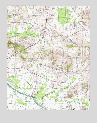
Glenville, KY USGS Topographic Map
Click on map above to begin viewing in our Map Viewer.

This topographic map contains these locations and features:
Feature Name Type Latitude Longitude GNIS ID View Map
Brooks (historical)Populated PlaceN37.5877°W87.2393°2743111View Map
Brush ForkStreamN37.5914°W87.2225°488089View Map
Buck CreekStreamN37.5059°W87.1994°488213View Map
BuelPopulated PlaceN37.5484°W87.1742°507607View Map
GlenvillePopulated PlaceN37.5945°W87.1934°508101View Map
Glenville ChurchChurchN37.6092°W87.1886°492914View Map
Grindstone HillSummitN37.5809°W87.2458°493405View Map
Hanley CreekStreamN37.5145°W87.2089°493544View Map
Livermore DivisionCivilN37.5357°W87.1340°1937106View Map
Mount Pleasant Cumberland Presbyterian ChurchChurchN37.6211°W87.1912°498845View Map
Oak Grove United Methodist ChurchChurchN37.5585°W87.2070°499689View Map
Old Buck Creek Baptist churchChurchN37.5258°W87.1285°499805View Map
Pleasant Hope General Baptist ChurchChurchN37.5501°W87.1677°500883View Map
ReevesPopulated PlaceN37.5880°W87.1726°2743125View Map
Richland Baptist ChurchChurchN37.5007°W87.1675°501816View Map
State Fire Rescue Training Area 3BuildingN37.5500°W87.2394°2637062View Map
Union Camp Site Historical MarkerParkN37.5458°W87.1512°2744599View Map
West Fork Buck CreekStreamN37.5206°W87.1750°506423View Map

Note: Coordinates in the location and feature list above are referenced to NAD83 datum.


Copyright (C) 2008-2025 Ryan Niemi / Sunset Dynamics ... All Rights Reserved