TopoQuest Logo
Do you find TopoQuest useful?
Help keep TopoQuest running and adding new maps/features by donating!
Bitcoin:  19c7KJd3qBynnjoSw5npx9KScwjBe4ifkT
Litecoin:  LXs6TkuXGGXo1vDsWCkWVdjQX94eUKd6ui
Home View Maps Find Maps Find Places Resources & Links


McCullough Creek, Oregon Topographic Map

USGS Map Title: McCullough Creek, OR
USGS Map MRC: 42123G4
DRG (GeoTIFF) Download: o42123g4.tif


Neighboring USGS Topographic Map Quads:


  Live Oak Mountain, OR  
42123H5
 

  Nickel Mountain, OR  
42123H4
 

  Canyonville, OR  
42123H3
 

  Rabbit Mountain, OR  
42123G5
 

  McCullough Creek, OR  
42123G4
 

  Quines Creek, OR  
42123G3
 

  Mount Reuben, OR  
42123F5
 

  Glendale, OR  
42123F4
 

  Golden, OR  
42123F3


Map MRC Location:

N43°
W124°
N43°
W123°
H8 H7 H6 H5 H4 H3 H2 H1
G8 G7 G6 G5 G4 G3 G2 G1
F8 F7 F6 F5 F4 F3 F2 F1
E8 E7 E6 E5 E4 E3 E2 E1
D8 D7 D6 D5 D4 D3 D2 D1
C8 C7 C6 C5 C4 C3 C2 C1
B8 B7 B6 B5 B4 B3 B2 B1
A8 A7 A6 A5 A4 A3 A2 A1
N42°
W124°
N42°
W123°

McCullough Creek, OR USGS 1:24K Topographic Map Preview:
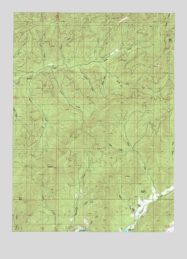
McCullough Creek, OR USGS Topographic Map
Click on map above to begin viewing in our Map Viewer.

This topographic map contains these locations and features:
Feature Name Type Latitude Longitude GNIS ID View Map
Bernstein SpringSpringN42.7730°W123.4022°1134822View Map
Brush CreekStreamN42.8468°W123.4365°1118148View Map
Cedar CampLocaleN42.8665°W123.4742°1118721View Map
Cow Creek Game RefugeParkN42.8410°W123.3926°1119427View Map
Deeds CreekStreamN42.7582°W123.4040°1132264View Map
Deets CreekStreamN42.7957°W123.4134°1134820View Map
Fir PointCapeN42.7793°W123.4115°1120735View Map
Fir Point Christian CampLocaleN42.7796°W123.4078°1638191View Map
Flory SpringSpringN42.7641°W123.4051°1134821View Map
Gravel CreekStreamN42.8448°W123.4628°1121331View Map
GraybackSummitN42.7867°W123.4699°1121351View Map
Grayback TrailTrailN42.7746°W123.4648°1121352View Map
Hayward PondReservoirN42.7500°W123.4134°1134145View Map
Hunter CreekStreamN42.8410°W123.4281°1134819View Map
Lawson CreekStreamN42.7904°W123.3759°1136467View Map
Lunsbury CreekStreamN42.7637°W123.4512°1132263View Map
Martin CreekStreamN42.8368°W123.4926°1123805View Map
Panther ButteSummitN42.7662°W123.4923°1125155View Map
Panther CreekStreamN42.8437°W123.4512°1125157View Map
Peavine CreekStreamN42.8434°W123.4723°1125265View Map
Silver ButteSummitN42.8586°W123.3783°1126959View Map
Smith CreekStreamN42.8421°W123.4792°1127105View Map
South Fork CampLocaleN42.8437°W123.4306°1127264View Map
South Fork Middle CreekStreamN42.8465°W123.4367°1127303View Map
South Fork TrailTrailN42.8287°W123.3845°1158497View Map
Spring CreekStreamN42.7504°W123.4434°1134823View Map
Stag TrailTrailN42.8696°W123.4642°1127514View Map
Wood CreekStreamN42.7682°W123.3915°1129293View Map

Note: Coordinates in the location and feature list above are referenced to NAD83 datum.


Copyright (C) 2008-2025 Ryan Niemi / Sunset Dynamics ... All Rights Reserved