TopoQuest Logo
Do you find TopoQuest useful?
Help keep TopoQuest running and adding new maps/features by donating!
Bitcoin:  19c7KJd3qBynnjoSw5npx9KScwjBe4ifkT
Litecoin:  LXs6TkuXGGXo1vDsWCkWVdjQX94eUKd6ui
Home View Maps Find Maps Find Places Resources & Links


Good Hope, Ohio Topographic Map

USGS Map Title: Good Hope, OH
USGS Map MRC: 39083D3
DRG (GeoTIFF) Download: o39083d3.tif


Neighboring USGS Topographic Map Quads:


  Washington Court House, OH  
39083E4
 

  New Holland, OH  
39083E3
 

  Clarksburg, OH  
39083E2
 

  New Martinsburg, OH  
39083D4
 

  Good Hope, OH  
39083D3
 

  Frankfort, OH  
39083D2
 

  Greenfield, OH  
39083C4
 

  South Salem, OH  
39083C3
 

  Bourneville, OH  
39083C2


Map MRC Location:

N40°
W84°
N40°
W83°
H8 H7 H6 H5 H4 H3 H2 H1
G8 G7 G6 G5 G4 G3 G2 G1
F8 F7 F6 F5 F4 F3 F2 F1
E8 E7 E6 E5 E4 E3 E2 E1
D8 D7 D6 D5 D4 D3 D2 D1
C8 C7 C6 C5 C4 C3 C2 C1
B8 B7 B6 B5 B4 B3 B2 B1
A8 A7 A6 A5 A4 A3 A2 A1
N39°
W84°
N39°
W83°

Good Hope, OH USGS 1:24K Topographic Map Preview:
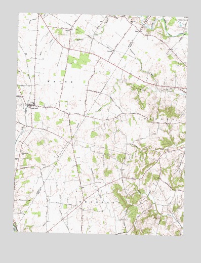
Good Hope, OH USGS Topographic Map
Click on map above to begin viewing in our Map Viewer.

This topographic map contains these locations and features:
Feature Name Type Latitude Longitude GNIS ID View Map
Barton FarmLocaleN39.3833°W83.2967°2724795View Map
Compton CreekStreamN39.4981°W83.2691°1066660View Map
Eyeman-Bryant CemeteryCemeteryN39.4852°W83.3322°1040295View Map
FairviewPopulated PlaceN39.4798°W83.3052°1062756View Map
Fairview School (historical)SchoolN39.4784°W83.3224°1080773View Map
Falama FarmsLocaleN39.4933°W83.2511°2726046View Map
Ghormley School (historical)SchoolN39.4112°W83.3674°1080774View Map
Good HopePopulated PlaceN39.4473°W83.3649°1064739View Map
Good Hope CemeteryCemeteryN39.4478°W83.3707°1055148View Map
Good Hope Census Designated PlaceCensusN39.4467°W83.3594°2628896View Map
Good Hope Post Office (historical)Post OfficeN39.4473°W83.3652°1985365View Map
Good Hope United Methodist ChurchChurchN39.4473°W83.3613°1071571View Map
Heglers (historical)Populated PlaceN39.4570°W83.2513°1065493View Map
Heglers School (historical)SchoolN39.4623°W83.2819°1053660View Map
Maple Grove School (historical)SchoolN39.4959°W83.2921°1080772View Map
Maple Grove United Methodist ChurchChurchN39.4956°W83.2924°1070836View Map
McLeanPopulated PlaceN39.4912°W83.3369°1065728View Map
McLean Post Office (historical)Post OfficeN39.4917°W83.3374°1985355View Map
Mills BranchStreamN39.4998°W83.2888°1043385View Map
Pisgah ChurchChurchN39.4012°W83.3263°1044506View Map
Pisgah School (historical)SchoolN39.4103°W83.3288°1053666View Map
PlanoPopulated PlaceN39.4909°W83.2866°1062943View Map
Ratliff FarmsLocaleN39.3994°W83.3292°2724796View Map
Rogers CemeteryCemeteryN39.4167°W83.3746°1070917View Map
Rogers McElwain CemeteryCemeteryN39.4196°W83.3700°1045157View Map
Rowe School (historical)SchoolN39.4812°W83.2627°1053659View Map
Slagle FarmLocaleN39.3953°W83.3178°2724798View Map
Slate HillSummitN39.3776°W83.2824°1053664View Map
Stuckey CemeteryCemeteryN39.4136°W83.3524°1046776View Map
Thornton (historical)Populated PlaceN39.3920°W83.3249°1049994View Map
Thornton Post Office (historical)Post OfficeN39.3917°W83.3249°2056672View Map
Thornton School (historical)SchoolN39.3906°W83.3269°1053667View Map
Township of WayneCivilN39.4755°W83.3510°1086096View Map
Waugh CemeteryCemeteryN39.4122°W83.2968°1047627View Map
Waugh School (historical)SchoolN39.4076°W83.2819°1053662View Map
Wayne Elementary SchoolSchoolN39.4484°W83.3621°1055161View Map
Wayne Township Fire Department Station 200BuildingN39.4470°W83.3650°2549409View Map
Whetstone RunStreamN39.4578°W83.2721°1067050View Map
Whetstone School (historical)SchoolN39.4406°W83.3038°1053665View Map
Wilson CemeteryCemeteryN39.3848°W83.2674°1047974View Map
Wilson School (historical)SchoolN39.3812°W83.2685°1053663View Map
Young School (historical)SchoolN39.4253°W83.2507°1053661View Map

Note: Coordinates in the location and feature list above are referenced to NAD83 datum.


Copyright (C) 2008-2025 Ryan Niemi / Sunset Dynamics ... All Rights Reserved