TopoQuest Logo
Do you find TopoQuest useful?
Help keep TopoQuest running and adding new maps/features by donating!
Bitcoin:  19c7KJd3qBynnjoSw5npx9KScwjBe4ifkT
Litecoin:  LXs6TkuXGGXo1vDsWCkWVdjQX94eUKd6ui
Home View Maps Find Maps Find Places Resources & Links


New Holland, Ohio Topographic Map

USGS Map Title: New Holland, OH
USGS Map MRC: 39083E3
DRG (GeoTIFF) Download: o39083e3.tif


Neighboring USGS Topographic Map Quads:


  Midway, OH  
39083F4
 

  Mount Sterling, OH  
39083F3
 

  Five Points, OH  
39083F2
 

  Washington Court House, OH  
39083E4
 

  New Holland, OH  
39083E3
 

  Clarksburg, OH  
39083E2
 

  New Martinsburg, OH  
39083D4
 

  Good Hope, OH  
39083D3
 

  Frankfort, OH  
39083D2


Map MRC Location:

N40°
W84°
N40°
W83°
H8 H7 H6 H5 H4 H3 H2 H1
G8 G7 G6 G5 G4 G3 G2 G1
F8 F7 F6 F5 F4 F3 F2 F1
E8 E7 E6 E5 E4 E3 E2 E1
D8 D7 D6 D5 D4 D3 D2 D1
C8 C7 C6 C5 C4 C3 C2 C1
B8 B7 B6 B5 B4 B3 B2 B1
A8 A7 A6 A5 A4 A3 A2 A1
N39°
W84°
N39°
W83°

New Holland, OH USGS 1:24K Topographic Map Preview:
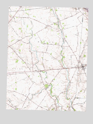
New Holland, OH USGS Topographic Map
Click on map above to begin viewing in our Map Viewer.

This topographic map contains these locations and features:
Feature Name Type Latitude Longitude GNIS ID View Map
Britton Chaffin CemeteryCemeteryN39.5349°W83.2761°1038328View Map
Clough DitchCanalN39.6073°W83.3077°1039195View Map
Compton CemeteryCemeteryN39.5078°W83.2980°1039287View Map
Crooked CreekStreamN39.5298°W83.3049°1039482View Map
Daniels Family FarmLocaleN39.5933°W83.3617°2725941View Map
Dews RunStreamN39.5912°W83.3377°1039694View Map
Eggleton FarmsLocaleN39.5458°W83.2956°2725942View Map
Grub RunStreamN39.5784°W83.2910°1065739View Map
Indian Camp RunStreamN39.5106°W83.3399°1041946View Map
JohnsonPopulated PlaceN39.5473°W83.3305°1070792View Map
Johnson CemeteryCemeteryN39.5515°W83.3308°1055152View Map
Kingfred (historical)Populated PlaceN39.5448°W83.3460°1067392View Map
Lloyd CemeteryCemeteryN39.5600°W83.3138°1070821View Map
ManaraPopulated PlaceN39.6026°W83.3130°1062871View Map
Manara School (historical)SchoolN39.6017°W83.3121°1071576View Map
Manera Post Office (historical)Post OfficeN39.6028°W83.3124°1985354View Map
Marion Township Centralized SchoolSchoolN39.5842°W83.3563°1071577View Map
Messmore CemeteryCemeteryN39.6234°W83.2582°1043236View Map
Mud RunStreamN39.5084°W83.2724°1043698View Map
New HollandPopulated PlaceN39.5540°W83.2569°1070865View Map
New Holland CemeteryCemeteryN39.5595°W83.2616°1071652View Map
New Holland CemeteryCemeteryN39.5598°W83.2616°1963383View Map
New Holland Church of ChristChurchN39.5573°W83.2580°1071653View Map
New Holland Elementary SchoolSchoolN39.5517°W83.2552°1071654View Map
New Holland Fire DepartmentBuildingN39.5540°W83.2586°2549174View Map
New Holland High School (historical)SchoolN39.5506°W83.2557°1084387View Map
New Holland Police DepartmentBuildingN39.5540°W83.2567°2732527View Map
New Holland Post OfficePost OfficeN39.5542°W83.2569°2042426View Map
New Holland United Methodist ChurchChurchN39.5531°W83.2580°1071655View Map
North Fork Compton CreekStreamN39.5551°W83.3316°1043940View Map
PancoastburgPopulated PlaceN39.6245°W83.2655°1070889View Map
Pancoastburg Census Designated PlaceCensusN39.6240°W83.2642°2628950View Map
Pancoastburg Post Office (historical)Post OfficeN39.6237°W83.2652°1985359View Map
Rowe CemeteryCemeteryN39.5042°W83.3121°1045233View Map
Sates Gamble CemeteryCemeteryN39.5865°W83.2874°1070933View Map
Sheperds RunStreamN39.5098°W83.3496°1046183View Map
Stinson FarmsLocaleN39.5017°W83.2811°2726045View Map
Township of MarionCivilN39.5806°W83.3130°1086091View Map
Turkey RunStreamN39.5351°W83.3149°1047192View Map
Village of New HollandCivilN39.5544°W83.2593°2399466View Map
West HollandPopulated PlaceN39.5526°W83.2652°1071589View Map

Note: Coordinates in the location and feature list above are referenced to NAD83 datum.


Copyright (C) 2008-2025 Ryan Niemi / Sunset Dynamics ... All Rights Reserved