TopoQuest Logo
Do you find TopoQuest useful?
Help keep TopoQuest running and adding new maps/features by donating!
Bitcoin:  19c7KJd3qBynnjoSw5npx9KScwjBe4ifkT
Litecoin:  LXs6TkuXGGXo1vDsWCkWVdjQX94eUKd6ui
Home View Maps Find Maps Find Places Resources & Links


South Salem, Ohio Topographic Map

USGS Map Title: South Salem, OH
USGS Map MRC: 39083C3
DRG (GeoTIFF) Download: o39083c3.tif


Neighboring USGS Topographic Map Quads:


  New Martinsburg, OH  
39083D4
 

  Good Hope, OH  
39083D3
 

  Frankfort, OH  
39083D2
 

  Greenfield, OH  
39083C4
 

  South Salem, OH  
39083C3
 

  Bourneville, OH  
39083C2
 

  Rainsboro, OH  
39083B4
 

  Bainbridge, OH  
39083B3
 

  Morgantown, OH  
39083B2


Map MRC Location:

N40°
W84°
N40°
W83°
H8 H7 H6 H5 H4 H3 H2 H1
G8 G7 G6 G5 G4 G3 G2 G1
F8 F7 F6 F5 F4 F3 F2 F1
E8 E7 E6 E5 E4 E3 E2 E1
D8 D7 D6 D5 D4 D3 D2 D1
C8 C7 C6 C5 C4 C3 C2 C1
B8 B7 B6 B5 B4 B3 B2 B1
A8 A7 A6 A5 A4 A3 A2 A1
N39°
W84°
N39°
W83°

South Salem, OH USGS 1:24K Topographic Map Preview:
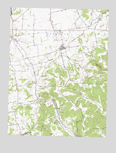
South Salem, OH USGS Topographic Map
Click on map above to begin viewing in our Map Viewer.

This topographic map contains these locations and features:
Feature Name Type Latitude Longitude GNIS ID View Map
Bald KnobSummitN39.2517°W83.3213°1048483View Map
Barton FarmsLocaleN39.3744°W83.3086°2724794View Map
Beech Glen School (historical)SchoolN39.2770°W83.2830°1053652View Map
Benner HillRidgeN39.2573°W83.2777°1066569View Map
Blain School (historical)SchoolN39.3617°W83.3596°1053656View Map
Blueberry Hill FarmLocaleN39.3711°W83.3611°2724800View Map
Brown School (historical)SchoolN39.2798°W83.2569°1053651View Map
Buckskin BridgeBridgeN39.3340°W83.3146°1067103View Map
Buckskin Elementary SchoolSchoolN39.3356°W83.3099°1050002View Map
Caldwell FarmLocaleN39.3292°W83.3242°2724793View Map
Cliff CreekStreamN39.2528°W83.3466°1066655View Map
Crawley LakeReservoirN39.2950°W83.2846°1079268View Map
Crawley Lake DamDamN39.2951°W83.2849°1079267View Map
Dhume School (historical)SchoolN39.3315°W83.2707°1053649View Map
Dolphins RidgeRidgeN39.3190°W83.2730°1039745View Map
Dwyer CemeteryCemeteryN39.2667°W83.3652°1039910View Map
Dwyer School (historical)SchoolN39.2656°W83.3646°1053658View Map
Edginton HillRidgeN39.3087°W83.2799°1070738View Map
FruitdalePopulated PlaceN39.3017°W83.3396°1062773View Map
Fruitdale Post Office (historical)Post OfficeN39.3015°W83.3402°2043386View Map
Grey CemeteryCemeteryN39.2789°W83.3207°1041183View Map
HarperPopulated PlaceN39.3648°W83.2616°1064797View Map
Harper CemeteryCemeteryN39.3659°W83.2613°1963463View Map
Harper School (historical)SchoolN39.3559°W83.2685°1053648View Map
Hixson CemeteryCemeteryN39.3044°W83.2927°1041629View Map
HumboldtPopulated PlaceN39.2773°W83.3138°1064876View Map
Humboldt Post Office (historical)Post OfficeN39.2778°W83.3138°2056652View Map
Hymiller CemeteryCemeteryN39.2790°W83.3204°1041907View Map
LyndonPopulated PlaceN39.3526°W83.3121°1061454View Map
Lyndon Post OfficePost OfficeN39.3528°W83.3124°2043403View Map
Middleton School (historical)SchoolN39.2978°W83.3646°1053657View Map
Morton School (historical)SchoolN39.3167°W83.2807°1053650View Map
Mount Olive School (historical)SchoolN39.2981°W83.3119°1053653View Map
Nevins HillSummitN39.2737°W83.3266°1043811View Map
New Salem (historical)Populated PlaceN39.3284°W83.3582°1067086View Map
North Fork Buckskin CreekStreamN39.3409°W83.3107°1043938View Map
Nuckols CemeteryCemeteryN39.2887°W83.3365°1044012View Map
Old Stone CemeteryCemeteryN39.3429°W83.3688°1044137View Map
Paint Creek DamDamN39.2517°W83.3499°1077639View Map
Paint Creek LakeReservoirN39.2517°W83.3499°1077640View Map
Pricer RidgeRidgeN39.2848°W83.3002°1057938View Map
Ross FieldAirportN39.3650°W83.3586°1082724View Map
RoundtopSummitN39.2903°W83.3282°1045227View Map
Ryan HillRidgeN39.3253°W83.2580°1045304View Map
Satchel CemeteryCemeteryN39.3438°W83.3152°1045969View Map
Shoemaker FarmLocaleN39.2964°W83.3258°2724799View Map
Slate HillSummitN39.2565°W83.3255°1049181View Map
Slate RunStreamN39.3078°W83.3363°1046337View Map
Snyder CemeteryCemeteryN39.2734°W83.3091°1046413View Map
South SalemPopulated PlaceN39.3362°W83.3066°1065354View Map
South Salem CemeteryCemeteryN39.3370°W83.3105°1963470View Map
South Salem Post OfficePost OfficeN39.3362°W83.3069°2056681View Map
Stone RunStreamN39.3720°W83.3735°1046713View Map
Sunnyside ChurchChurchN39.2853°W83.3194°1046865View Map
Sunnyside School (historical)SchoolN39.2856°W83.3194°1053654View Map
ThriftonPopulated PlaceN39.3434°W83.3669°1063058View Map
Thrifton Post Office (historical)Post OfficeN39.3431°W83.3666°2056673View Map
Township of BuckskinCivilN39.3582°W83.3063°1086891View Map
Township of PaintCivilN39.2758°W83.3179°1086901View Map
Turkey RidgeRidgeN39.2998°W83.2702°1058085View Map
Turtlerock FarmLocaleN39.3733°W83.2847°2724797View Map
Valley School (historical)SchoolN39.2590°W83.3007°1053655View Map
Village of South SalemCivilN39.3374°W83.3070°2399858View Map
Weller CemeteryCemeteryN39.2651°W83.3138°1047666View Map

Note: Coordinates in the location and feature list above are referenced to NAD83 datum.


Copyright (C) 2008-2025 Ryan Niemi / Sunset Dynamics ... All Rights Reserved