TopoQuest Logo
Do you find TopoQuest useful?
Help keep TopoQuest running and adding new maps/features by donating!
Bitcoin:  19c7KJd3qBynnjoSw5npx9KScwjBe4ifkT
Litecoin:  LXs6TkuXGGXo1vDsWCkWVdjQX94eUKd6ui
Home View Maps Find Maps Find Places Resources & Links


Gradyville, Kentucky Topographic Map

USGS Map Title: Gradyville, KY
USGS Map MRC: 37085A4
DRG (GeoTIFF) Download: o37085a4.tif


Neighboring USGS Topographic Map Quads:


  Exie, KY  
37085B5
 

  Gresham, KY  
37085B4
 

  Cane Valley, KY  
37085B3
 

  East Fork, KY  
37085A5
 

  Gradyville, KY  
37085A4
 

  Columbia, KY  
37085A3
 

  Edmonton, KY  
36085H5
 

  Breeding, KY  
36085H4
 

  Amandaville, KY  
36085H3


Map MRC Location:

N38°
W86°
N38°
W85°
H8 H7 H6 H5 H4 H3 H2 H1
G8 G7 G6 G5 G4 G3 G2 G1
F8 F7 F6 F5 F4 F3 F2 F1
E8 E7 E6 E5 E4 E3 E2 E1
D8 D7 D6 D5 D4 D3 D2 D1
C8 C7 C6 C5 C4 C3 C2 C1
B8 B7 B6 B5 B4 B3 B2 B1
A8 A7 A6 A5 A4 A3 A2 A1
N37°
W86°
N37°
W85°

Gradyville, KY USGS 1:24K Topographic Map Preview:
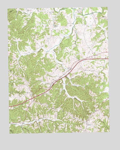
Gradyville, KY USGS Topographic Map
Click on map above to begin viewing in our Map Viewer.

This topographic map contains these locations and features:
Feature Name Type Latitude Longitude GNIS ID View Map
Antioch ChurchChurchN37.0217°W85.3914°485976View Map
Bethany ChapelChurchN37.1148°W85.3786°486927View Map
Big CreekStreamN37.1234°W85.4178°487159View Map
Butlers ForkStreamN37.1178°W85.3977°488519View Map
Carp BranchStreamN37.0056°W85.4833°488953View Map
Clark CemeteryCemeteryN37.0751°W85.3966°489533View Map
Cool Springs CreekStreamN37.0837°W85.4464°490021View Map
Dohoney CemeteryCemeteryN37.1073°W85.4225°490992View Map
England BranchStreamN37.0114°W85.4652°491778View Map
GradyvillePopulated PlaceN37.0634°W85.4225°493073View Map
Gradyville Baptist ChurchChurchN37.0770°W85.3910°493074View Map
Gradyville DivisionCivilN37.0357°W85.4300°1937024View Map
Jones ChapelChurchN37.0606°W85.3966°495485View Map
Leatherwood ChurchChurchN37.0103°W85.4725°496122View Map
Middle Prong Big CreekStreamN37.0551°W85.4341°498147View Map
MilltownPopulated PlaceN37.1223°W85.4075°508609View Map
Milltown ChurchChurchN37.1190°W85.4083°498389View Map
Moore CemeteryCemeteryN37.0409°W85.4752°498540View Map
Morris ChapelChurchN37.0626°W85.4986°498618View Map
Moss CemeteryCemeteryN37.0481°W85.4969°498668View Map
Mount MatneySummitN37.0590°W85.4202°2743390View Map
NellPopulated PlaceN37.0095°W85.4833°508685View Map
New Tarters ChapelChurchN37.1062°W85.4408°499404View Map
PickettPopulated PlaceN37.1226°W85.4755°508816View Map
PortlandPopulated PlaceN37.1206°W85.4461°508859View Map
Reece BranchStreamN37.0081°W85.4852°501689View Map
Richard BranchStreamN37.0581°W85.4305°501795View Map
Robertson CemeteryCemeteryN37.0731°W85.4983°502071View Map
Rowetown CemeteryCemeteryN37.0014°W85.4516°502426View Map
Rowetown SchoolSchoolN37.0003°W85.4427°502427View Map
Shirley BranchStreamN37.1056°W85.4175°503399View Map
Short CreekStreamN37.1206°W85.4355°503440View Map
SparksvillePopulated PlaceN37.0084°W85.4019°509102View Map
Stapp CemeteryCemeteryN37.0534°W85.4458°504264View Map
Sulphur ForkStreamN37.1204°W85.4687°504736View Map
Tarters CemeteryCemeteryN37.0948°W85.4488°504971View Map
Taters Chapel (historical)Populated PlaceN37.0929°W85.4495°2743413View Map
Union CemeteryCemeteryN37.0792°W85.3936°505765View Map
WeedPopulated PlaceN37.0387°W85.4714°509331View Map
Weed CemeteryCemeteryN37.0317°W85.4700°506354View Map
Weed RidgeRidgeN37.0363°W85.4810°2743415View Map
Wheeler CemeteryCemeteryN37.0126°W85.4102°506530View Map

Note: Coordinates in the location and feature list above are referenced to NAD83 datum.


Copyright (C) 2008-2024 Ryan Niemi / Sunset Dynamics ... All Rights Reserved