TopoQuest Logo
Do you find TopoQuest useful?
Help keep TopoQuest running and adding new maps/features by donating!
Bitcoin:  19c7KJd3qBynnjoSw5npx9KScwjBe4ifkT
Litecoin:  LXs6TkuXGGXo1vDsWCkWVdjQX94eUKd6ui
Home View Maps Find Maps Find Places Resources & Links


Cane Valley, Kentucky Topographic Map

USGS Map Title: Cane Valley, KY
USGS Map MRC: 37085B3
DRG (GeoTIFF) Download: o37085b3.tif


Neighboring USGS Topographic Map Quads:


  Greensburg, KY  
37085C4
 

  Campbellsville, KY  
37085C3
 

  Mannsville, KY  
37085C2
 

  Gresham, KY  
37085B4
 

  Cane Valley, KY  
37085B3
 

  Knifley, KY  
37085B2
 

  Gradyville, KY  
37085A4
 

  Columbia, KY  
37085A3
 

  Montpelier, KY  
37085A2


Map MRC Location:

N38°
W86°
N38°
W85°
H8 H7 H6 H5 H4 H3 H2 H1
G8 G7 G6 G5 G4 G3 G2 G1
F8 F7 F6 F5 F4 F3 F2 F1
E8 E7 E6 E5 E4 E3 E2 E1
D8 D7 D6 D5 D4 D3 D2 D1
C8 C7 C6 C5 C4 C3 C2 C1
B8 B7 B6 B5 B4 B3 B2 B1
A8 A7 A6 A5 A4 A3 A2 A1
N37°
W86°
N37°
W85°

Cane Valley, KY USGS 1:24K Topographic Map Preview:
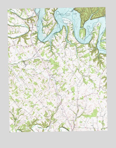
Cane Valley, KY USGS Topographic Map
Click on map above to begin viewing in our Map Viewer.

This topographic map contains these locations and features:
Feature Name Type Latitude Longitude GNIS ID View Map
AbsherPopulated PlaceN37.1687°W85.2591°507369View Map
Asbury ChurchChurchN37.2123°W85.3433°486070View Map
Bridgewater CemeteryCemeteryN37.1920°W85.3719°487893View Map
Bryant CemeteryCemeteryN37.1845°W85.2630°488165View Map
Buckners BendBendN37.2239°W85.3267°2742650View Map
Buffalo CliffCliffN37.2356°W85.2758°488309View Map
Buffalo GapGapN37.2295°W85.2800°488324View Map
Butler CreekStreamN37.2337°W85.3036°488512View Map
Cane ValleyPopulated PlaceN37.1803°W85.3197°488805View Map
Cane Valley CemeteryCemeteryN37.1759°W85.3141°488806View Map
Cane Valley ChurchChurchN37.1617°W85.3108°488807View Map
Cane Valley ChurchChurchN37.1892°W85.3236°488808View Map
Cane Valley DivisionCivilN37.1748°W85.3252°1936914View Map
Charity ChurchChurchN37.2084°W85.2683°489362View Map
CoburgPopulated PlaceN37.2015°W85.3358°507722View Map
Corbin Bend (historical)BendN37.2471°W85.2948°2742652View Map
Cox CemeteryCemeteryN37.1401°W85.3033°490216View Map
Cyclone (historical)Populated PlaceN37.1663°W85.3263°2743194View Map
Dry ForkStreamN37.1940°W85.3647°491185View Map
Egypt Christian ChurchChurchN37.1773°W85.2571°491589View Map
Faulkner CemeteryCemeteryN37.2203°W85.3441°492005View Map
Faulkner Sulphur SpringSpringN37.2159°W85.3316°492006View Map
Ferguson HollowValleyN37.2376°W85.2704°492036View Map
Ferguson HollowValleyN37.2431°W85.2657°2743198View Map
Ferguson RidgeRidgeN37.2442°W85.2775°492037View Map
Fisher BendBendN37.2303°W85.2605°492111View Map
Green River Bridge Historical MarkerParkN37.2371°W85.3523°2744722View Map
Green River HillSummitN37.2370°W85.3425°493291View Map
Green River Hill Confederate CemeteryCemeteryN37.2306°W85.3469°493292View Map
Green River LakeReservoirN37.2485°W85.2920°493295View Map
Griffin CemeteryCemeteryN37.2106°W85.3516°493380View Map
HolmesPopulated PlaceN37.2076°W85.2697°508268View Map
Hutchison BranchStreamN37.1274°W85.2565°494860View Map
Hutchison CemeteryCemeteryN37.1492°W85.3283°494862View Map
Hutchison ChurchChurchN37.1401°W85.3255°494864View Map
Independence Day Fight Historical MarkerParkN37.2304°W85.3468°2744725View Map
Jones BranchStreamN37.2040°W85.2586°495457View Map
KellyvillePopulated PlaceN37.1973°W85.3255°508375View Map
Little Bottom CliffCliffN37.2242°W85.2755°496634View Map
Mill CreekStreamN37.1259°W85.3744°498237View Map
Molton CemeteryCemeteryN37.1814°W85.3730°498477View Map
Mount Pleasant (historical)Populated PlaceN37.1506°W85.2877°2743393View Map
Mount Pleasant ChurchChurchN37.1506°W85.2863°498840View Map
Mount Vernon ChurchChurchN37.1559°W85.3675°498891View Map
Pelham BranchStreamN37.1303°W85.3233°500362View Map
Pike RidgeRidgeN37.2470°W85.3197°500616View Map
Pinch CreekStreamN37.2417°W85.3594°500657View Map
RominePopulated PlaceN37.2356°W85.3502°508965View Map
Russell BranchStreamN37.2178°W85.3225°502498View Map
Sandy CreekStreamN37.2156°W85.2991°502976View Map
Sulphur Spring BranchStreamN37.1351°W85.3672°504755View Map
Sulphur Spring ChurchChurchN37.1373°W85.3672°504756View Map
Tibbs BendBendN37.2434°W85.3739°505263View Map
WGRB-TV (Campbellsville)TowerN37.1681°W85.3089°518041View Map
White Oak CreekStreamN37.2156°W85.2575°506624View Map

Note: Coordinates in the location and feature list above are referenced to NAD83 datum.


Copyright (C) 2008-2024 Ryan Niemi / Sunset Dynamics ... All Rights Reserved