TopoQuest Logo
Do you find TopoQuest useful?
Help keep TopoQuest running and adding new maps/features by donating!
Bitcoin:  19c7KJd3qBynnjoSw5npx9KScwjBe4ifkT
Litecoin:  LXs6TkuXGGXo1vDsWCkWVdjQX94eUKd6ui
Home View Maps Find Maps Find Places Resources & Links


Grammer, Indiana Topographic Map

USGS Map Title: Grammer, IN
USGS Map MRC: 39085B6
DRG (GeoTIFF) Download: o39085b6.tif


Neighboring USGS Topographic Map Quads:


  Hope, IN  
39085C7
 

  Hartsville, IN  
39085C6
 

  Forest Hill, IN  
39085C5
 

  Elizabethtown, IN  
39085B7
 

  Grammer, IN  
39085B6
 

  Westport, IN  
39085B5
 

  Azalia, IN  
39085A7
 

  North Vernon, IN  
39085A6
 

  Butlerville, IN  
39085A5


Map MRC Location:

N40°
W86°
N40°
W85°
H8 H7 H6 H5 H4 H3 H2 H1
G8 G7 G6 G5 G4 G3 G2 G1
F8 F7 F6 F5 F4 F3 F2 F1
E8 E7 E6 E5 E4 E3 E2 E1
D8 D7 D6 D5 D4 D3 D2 D1
C8 C7 C6 C5 C4 C3 C2 C1
B8 B7 B6 B5 B4 B3 B2 B1
A8 A7 A6 A5 A4 A3 A2 A1
N39°
W86°
N39°
W85°

Grammer, IN USGS 1:24K Topographic Map Preview:
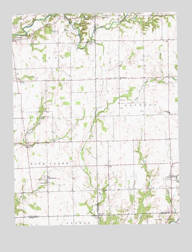
Grammer, IN USGS Topographic Map
Click on map above to begin viewing in our Map Viewer.

This topographic map contains these locations and features:
Feature Name Type Latitude Longitude GNIS ID View Map
AlertPopulated PlaceN39.1603°W85.6783°430058View Map
Bear Creek ChurchChurchN39.1306°W85.6864°430640View Map
BurnsvillePopulated PlaceN39.1728°W85.7403°431858View Map
GrammerPopulated PlaceN39.1528°W85.7250°435295View Map
Little Sand Creek CemeteryCemeteryN39.1891°W85.7285°438145View Map
Middle Fork Fall ForkStreamN39.2445°W85.7061°439101View Map
Mount Olivet CemeteryCemeteryN39.1453°W85.6831°439631View Map
Mount Pisgah CemeteryCemeteryN39.2483°W85.6433°439636View Map
Mount Pleasant CemeteryCemeteryN39.2327°W85.6897°439648View Map
Parkison CemeteryCemeteryN39.1747°W85.7204°440891View Map
SardiniaPopulated PlaceN39.1539°W85.6311°443031View Map
Shirk CemeteryCemeteryN39.2113°W85.6448°443416View Map
Township of CliftyCivilN39.2251°W85.7295°453227View Map
Township of JacksonCivilN39.1963°W85.6453°453439View Map
Township of Rock CreekCivilN39.1604°W85.7489°453808View Map
WaynesburgPopulated PlaceN39.2112°W85.6694°445582View Map
Williams Flying FieldAirportN39.2353°W85.6920°2770219View Map
Wynn CemeteryCemeteryN39.1463°W85.6835°446356View Map

Note: Coordinates in the location and feature list above are referenced to NAD83 datum.


Copyright (C) 2008-2024 Ryan Niemi / Sunset Dynamics ... All Rights Reserved