TopoQuest Logo
Do you find TopoQuest useful?
Help keep TopoQuest running and adding new maps/features by donating!
Bitcoin:  19c7KJd3qBynnjoSw5npx9KScwjBe4ifkT
Litecoin:  LXs6TkuXGGXo1vDsWCkWVdjQX94eUKd6ui
Home View Maps Find Maps Find Places Resources & Links


Grandin, Missouri Topographic Map

USGS Map Title: Grandin, MO
USGS Map MRC: 36090G7
DRG (GeoTIFF) Download: o36090g7.tif


Neighboring USGS Topographic Map Quads:


  Big Spring, MO  
36090H8
 

  Hunter, MO  
36090H7
 

  Ellsinore, MO  
36090H6
 

  Grandin SW, MO  
36090G8
 

  Grandin, MO  
36090G7
 

  Hogan Hollow, MO  
36090G6
 

  Briar, MO  
36090F8
 

  Doniphan North, MO  
36090F7
 

  Flatwoods, MO  
36090F6


Map MRC Location:

N37°
W91°
N37°
W90°
H8 H7 H6 H5 H4 H3 H2 H1
G8 G7 G6 G5 G4 G3 G2 G1
F8 F7 F6 F5 F4 F3 F2 F1
E8 E7 E6 E5 E4 E3 E2 E1
D8 D7 D6 D5 D4 D3 D2 D1
C8 C7 C6 C5 C4 C3 C2 C1
B8 B7 B6 B5 B4 B3 B2 B1
A8 A7 A6 A5 A4 A3 A2 A1
N36°
W91°
N36°
W90°

Grandin, MO USGS 1:24K Topographic Map Preview:
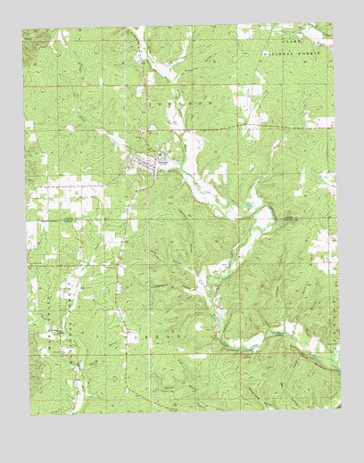
Grandin, MO USGS Topographic Map
Click on map above to begin viewing in our Map Viewer.

This topographic map contains these locations and features:
Feature Name Type Latitude Longitude GNIS ID View Map
Barnett HollowValleyN36.7923°W90.8062°748681View Map
Camp SemocaLocaleN36.7703°W90.7557°749183View Map
Campground HollowValleyN36.7892°W90.8065°749187View Map
Church of JesusChurchN36.7978°W90.8440°749355View Map
City of GrandinCivilN36.8308°W90.8220°2394956View Map
Coon HollowValleyN36.7967°W90.8101°749461View Map
Crossroads SchoolSchoolN36.8237°W90.8657°747664View Map
Devils BackboneRidgeN36.7645°W90.7621°749633View Map
Field HollowValleyN36.7759°W90.7818°749916View Map
Gables RidgeRidgeN36.7926°W90.7626°750012View Map
Good Hope CemeteryCemeteryN36.7990°W90.8746°750068View Map
GrandinPopulated PlaceN36.8292°W90.8229°750100View Map
Grandin CemeteryCemeteryN36.8313°W90.8333°2681408View Map
Grandin Fire DepartmentBuildingN36.8308°W90.8249°2620675View Map
Greenville HollowValleyN36.8576°W90.8140°750155View Map
Jack HollowValleyN36.7698°W90.7840°750474View Map
Johnson HollowValleyN36.7778°W90.7718°750529View Map
Little Black Rural Fire DepartmentBuildingN36.8249°W90.8414°2620409View Map
Macedonia ChurchChurchN36.7773°W90.8626°750899View Map
Macedonia School (historical)SchoolN36.7776°W90.8623°747665View Map
McRone CemeteryCemeteryN36.8434°W90.8126°751905View Map
Middle Fork North Prong Little Black RiverStreamN36.8281°W90.8118°751037View Map
Mill CreekStreamN36.8152°W90.7822°751059View Map
Mud BranchStreamN36.7739°W90.7693°751214View Map
Oak Grove School (historical)SchoolN36.8312°W90.7829°747666View Map
Pothole HollowValleyN36.7764°W90.7785°751728View Map
River of Life ChurchChurchN36.7701°W90.8612°751896View Map
Saint Anne ChurchChurchN36.8389°W90.8276°751998View Map
Sanders CreekStreamN36.7767°W90.8598°752028View Map
Shiloh CemeteryCemeteryN36.7973°W90.7940°752119View Map
Shiloh ChurchChurchN36.7909°W90.7996°752122View Map
Shiloh SchoolSchoolN36.7892°W90.7971°747667View Map
Spring BranchStreamN36.7642°W90.8543°752294View Map
Township of JordanCivilN36.7584°W90.8435°767288View Map
Walnut Grove HollowValleyN36.7503°W90.7796°752742View Map
Way HollowValleyN36.7503°W90.7648°752785View Map

Note: Coordinates in the location and feature list above are referenced to NAD83 datum.


Copyright (C) 2008-2024 Ryan Niemi / Sunset Dynamics ... All Rights Reserved