TopoQuest Logo
Do you find TopoQuest useful?
Help keep TopoQuest running and adding new maps/features by donating!
Bitcoin:  19c7KJd3qBynnjoSw5npx9KScwjBe4ifkT
Litecoin:  LXs6TkuXGGXo1vDsWCkWVdjQX94eUKd6ui
Home View Maps Find Maps Find Places Resources & Links


Auberry, California Topographic Map

USGS Map Title: Auberry, CA
USGS Map MRC: 37119A4
DRG (GeoTIFF) Download: o37119a4.tif


Neighboring USGS Topographic Map Quads:


  North Fork, CA  
37119B5
 

  Cascadel Point, CA  
37119B4
 

  Musick Mountain, CA  
37119B3
 

  Millerton Lake East, CA  
37119A5
 

  Auberry, CA  
37119A4
 

  Shaver Lake, CA  
37119A3
 

  Academy, CA  
36119H5
 

  Humphreys Station, CA  
36119H4
 

  Trimmer, CA  
36119H3


Map MRC Location:

N38°
W120°
N38°
W119°
H8 H7 H6 H5 H4 H3 H2 H1
G8 G7 G6 G5 G4 G3 G2 G1
F8 F7 F6 F5 F4 F3 F2 F1
E8 E7 E6 E5 E4 E3 E2 E1
D8 D7 D6 D5 D4 D3 D2 D1
C8 C7 C6 C5 C4 C3 C2 C1
B8 B7 B6 B5 B4 B3 B2 B1
A8 A7 A6 A5 A4 A3 A2 A1
N37°
W120°
N37°
W119°

Auberry, CA USGS 1:24K Topographic Map Preview:
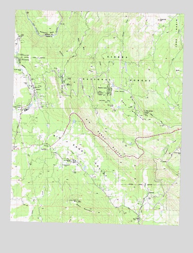
Auberry, CA USGS Topographic Map
Click on map above to begin viewing in our Map Viewer.

This topographic map contains these locations and features:
Feature Name Type Latitude Longitude GNIS ID View Map
Alder SpringsPopulated PlaceN37.0661°W119.4021°1657906View Map
AuberryPopulated PlaceN37.0808°W119.4854°1657963View Map
Auberry Census Designated PlaceCensusN37.0755°W119.4900°2407779View Map
Auberry Elementary SchoolSchoolN37.0791°W119.4862°1667414View Map
Auberry Forest Service StationLocaleN37.0986°W119.4965°1667413View Map
Auberry GuardLocaleN37.0986°W119.4965°256369View Map
Auberry Hydro Service Center HeliportAirportN37.0647°W119.4851°1653233View Map
Auberry Indian MissionChurchN37.0816°W119.4637°256370View Map
Auberry Post OfficePost OfficeN37.0740°W119.4861°1811536View Map
Auberry Volunteer Fire DepartmentBuildingN37.0817°W119.4874°2624071View Map
Backbone CreekStreamN37.1105°W119.4715°256405View Map
Backbone Creek Research Natural AreaAreaN37.0922°W119.4701°276374View Map
Backbone MountainSummitN37.0741°W119.4654°256407View Map
Bald Mill CreekStreamN37.1144°W119.4690°1667845View Map
Bald MountainSummitN37.0622°W119.4004°256456View Map
Bald Mountain Volunteer Fire DepartmentBuildingN37.0808°W119.4227°2623802View Map
Big Sandy BluffCliffN37.0502°W119.4365°257004View Map
Big Sandy RancheriaCivilN37.0853°W119.4655°1667416View Map
Black MountainSummitN37.0133°W119.4526°257129View Map
Black Mountain LookoutLocaleN37.0130°W119.4524°276377View Map
Camp Mo-Wa-HaLocaleN37.0430°W119.4785°1667419View Map
Carpenteria Botanical AreaAreaN37.0541°W119.4276°276378View Map
Corlew MeadowsFlatN37.0791°W119.4260°266600View Map
DRFM Radio StationTowerN37.0749°W119.4332°276373View Map
Foothill Middle SchoolSchoolN37.0661°W119.4910°1811548View Map
Fresno County Sheriff's Office SubstationBuildingN37.0767°W119.4855°2755934View Map
Horseshoe BendBendN37.1102°W119.4799°261520View Map
Jose BasinBasinN37.1038°W119.3787°262022View Map
KFCF-FM (Fresno)TowerN37.0730°W119.4318°1662879View Map
KFNO-FM (Fresno)TowerN37.0738°W119.4321°1662877View Map
KFSN-TV (Fresno)TowerN37.0772°W119.4343°1663166View Map
KFTV-TV (Hanford)TowerN37.0733°W119.4293°1663169View Map
KFYE-FM (Fresno)TowerN37.0788°W119.4307°1662880View Map
KJEO-TV (Fresno)TowerN37.0705°W119.4262°1663168View Map
KKDJ-FM (Fresno)TowerN37.0730°W119.4318°1662878View Map
KMSG-TV (Sanger)TowerN37.0738°W119.4321°1663205View Map
KNAX-FM (Fresno)TowerN37.0747°W119.4321°1662874View Map
KQPW-FM (Fresno)TowerN37.0736°W119.4321°1662875View Map
KVPR-FM (Fresno)TowerN37.0736°W119.4321°1662876View Map
KXDR-FM (Auberry)TowerN37.0736°W119.4321°1662799View Map
Lerona Fire LaneLocaleN37.1216°W119.4229°262415View Map
Meadow LakesPopulated PlaceN37.0802°W119.4307°1659095View Map
Musick CreekStreamN37.0913°W119.3824°263987View Map
New AuberryPopulated PlaceN37.0933°W119.4971°1659213View Map
Sierra Elementary SchoolSchoolN37.0038°W119.4065°266161View Map
Sierra High SchoolSchoolN37.0368°W119.4552°266159View Map
Sugarloaf HillSummitN37.1211°W119.3940°267871View Map
TollhousePopulated PlaceN37.0188°W119.3993°1660011View Map
Tollhouse CemeteryCemeteryN37.0124°W119.4049°1811588View Map
Tollhouse CreekStreamN37.0408°W119.3971°268328View Map
Tollhouse Post OfficePost OfficeN37.0159°W119.4012°2781001View Map
Wish-I-Ah SanatoriumHospitalN37.1094°W119.4976°1660196View Map

Note: Coordinates in the location and feature list above are referenced to NAD83 datum.


Copyright (C) 2008-2024 Ryan Niemi / Sunset Dynamics ... All Rights Reserved