TopoQuest Logo
Do you find TopoQuest useful?
Help keep TopoQuest running and adding new maps/features by donating!
Bitcoin:  19c7KJd3qBynnjoSw5npx9KScwjBe4ifkT
Litecoin:  LXs6TkuXGGXo1vDsWCkWVdjQX94eUKd6ui
Home View Maps Find Maps Find Places Resources & Links


Humphreys Station, California Topographic Map

USGS Map Title: Humphreys Station, CA
USGS Map MRC: 36119H4
DRG (GeoTIFF) Download: o36119h4.tif


Neighboring USGS Topographic Map Quads:


  Millerton Lake East, CA  
37119A5
 

  Auberry, CA  
37119A4
 

  Shaver Lake, CA  
37119A3
 

  Academy, CA  
36119H5
 

  Humphreys Station, CA  
36119H4
 

  Trimmer, CA  
36119H3
 

  Round Mountain, CA  
36119G5
 

  Piedra, CA  
36119G4
 

  Pine Flat Dam, CA  
36119G3


Map MRC Location:

N37°
W120°
N37°
W119°
H8 H7 H6 H5 H4 H3 H2 H1
G8 G7 G6 G5 G4 G3 G2 G1
F8 F7 F6 F5 F4 F3 F2 F1
E8 E7 E6 E5 E4 E3 E2 E1
D8 D7 D6 D5 D4 D3 D2 D1
C8 C7 C6 C5 C4 C3 C2 C1
B8 B7 B6 B5 B4 B3 B2 B1
A8 A7 A6 A5 A4 A3 A2 A1
N36°
W120°
N36°
W119°

Humphreys Station, CA USGS 1:24K Topographic Map Preview:
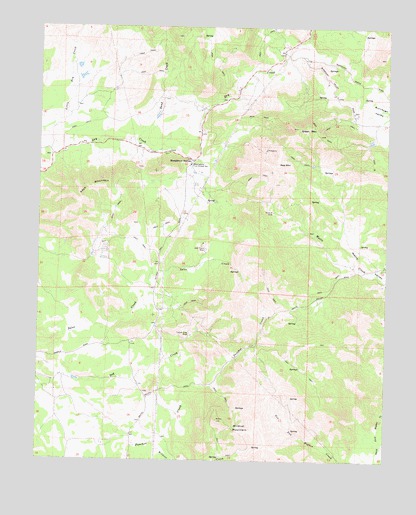
Humphreys Station, CA USGS Topographic Map
Click on map above to begin viewing in our Map Viewer.

This topographic map contains these locations and features:
Feature Name Type Latitude Longitude GNIS ID View Map
Blasingame Fire Control StationLocaleN36.9602°W119.4460°1654178View Map
Clara H MineMineN36.9469°W119.4162°221144View Map
Copper King MineMineN36.9108°W119.4454°221540View Map
Fresno County Fire Protection District BlasingameBuildingN36.9599°W119.4470°2624526View Map
Green MountainSummitN36.9711°W119.4076°224550View Map
Hawkins School (historical)SchoolN36.9305°W119.3768°1670179View Map
Humphreys StationLocaleN36.9616°W119.4457°225765View Map
Jack Thorn MineMineN36.9363°W119.4404°226043View Map
Keys MountainSummitN36.9538°W119.4821°226556View Map
KJFX-FM (Fresno)TowerN36.9486°W119.4868°1662872View Map
Mechanicsville School (historical)SchoolN36.9691°W119.4426°1702952View Map
Red MountainSummitN36.9608°W119.4146°231344View Map
Sand CreekStreamN36.9672°W119.4660°265808View Map
Sentinel (historical)Populated PlaceN36.9641°W119.4929°1702956View Map
Wildcat MountainSummitN36.8833°W119.4304°237799View Map

Note: Coordinates in the location and feature list above are referenced to NAD83 datum.


Copyright (C) 2008-2025 Ryan Niemi / Sunset Dynamics ... All Rights Reserved