TopoQuest Logo
Do you find TopoQuest useful?
Help keep TopoQuest running and adding new maps/features by donating!
Bitcoin:  19c7KJd3qBynnjoSw5npx9KScwjBe4ifkT
Litecoin:  LXs6TkuXGGXo1vDsWCkWVdjQX94eUKd6ui
Home View Maps Find Maps Find Places Resources & Links


Graveyard Hill, Montana Topographic Map

USGS Map Title: Graveyard Hill, MT
USGS Map MRC: 46104G5
DRG (GeoTIFF) Download: o46104g5.tif


Neighboring USGS Topographic Map Quads:


  Upper Magpie Reservoir, MT  
46104H6
 

  Twin Forks Reservoir, MT  
46104H5
 

  Hodges, MT  
46104H4
 

  Graveyard Hill SW, MT  
46104G6
 

  Graveyard Hill, MT  
46104G5
 

  Hodges SW, MT  
46104G4
 

  Dorothy Draw, MT  
46104F6
 

  Ayer Spring NE, MT  
46104F5
 

  Rocking Chair Butte, MT  
46104F4


Map MRC Location:

N47°
W105°
N47°
W104°
H8 H7 H6 H5 H4 H3 H2 H1
G8 G7 G6 G5 G4 G3 G2 G1
F8 F7 F6 F5 F4 F3 F2 F1
E8 E7 E6 E5 E4 E3 E2 E1
D8 D7 D6 D5 D4 D3 D2 D1
C8 C7 C6 C5 C4 C3 C2 C1
B8 B7 B6 B5 B4 B3 B2 B1
A8 A7 A6 A5 A4 A3 A2 A1
N46°
W105°
N46°
W104°

Graveyard Hill, MT USGS 1:24K Topographic Map Preview:
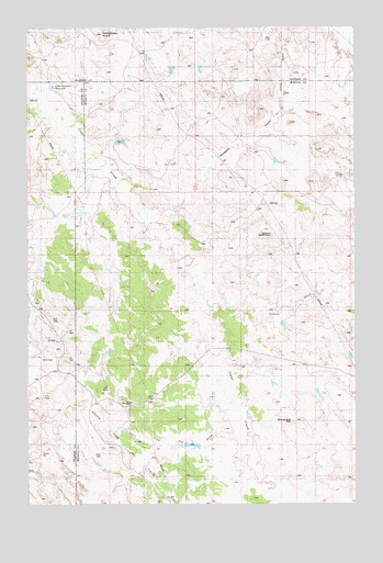
Graveyard Hill, MT USGS Topographic Map
Click on map above to begin viewing in our Map Viewer.

This topographic map contains these locations and features:
Feature Name Type Latitude Longitude GNIS ID View Map
01S58E09ABB_01 WellWellN46.7842°W104.5575°818283View Map
12N56E24CABD01 WellWellN46.7775°W104.6194°818241View Map
12N56E25CBDB01 WellWellN46.7631°W104.6247°818142View Map
13N56E27BC__01 WellWellN46.8531°W104.6213°818809View Map
13N56E27BC__02 WellWellN46.8531°W104.6213°818810View Map
13N57E21CA__01 WellWellN46.8678°W104.5088°818946View Map
Gibson DitchStreamN46.8045°W104.5547°771762View Map
Graveyard HillSummitN46.7717°W104.5252°799209View Map
JJ Blakenship Number 3 DamDamN46.7967°W104.5288°796167View Map
Kelly DrawValleyN46.8528°W104.5283°799204View Map
Little Garrison ReservoirReservoirN46.8595°W104.6157°799205View Map
Little Gertison DamDamN46.8567°W104.6122°795703View Map
Maggie DrawValleyN46.8264°W104.5761°799206View Map
Minutemen DamDamN46.8233°W104.6055°798196View Map
Mount McKinleySummitN46.8206°W104.5327°799207View Map
Pine HillSummitN46.7767°W104.5883°799208View Map
Pine Hill DrawValleyN46.7675°W104.5433°799201View Map
Rattlesnake ButteSummitN46.8733°W104.5966°799203View Map

Note: Coordinates in the location and feature list above are referenced to NAD83 datum.


Copyright (C) 2008-2025 Ryan Niemi / Sunset Dynamics ... All Rights Reserved