TopoQuest Logo
Do you find TopoQuest useful?
Help keep TopoQuest running and adding new maps/features by donating!
Bitcoin:  19c7KJd3qBynnjoSw5npx9KScwjBe4ifkT
Litecoin:  LXs6TkuXGGXo1vDsWCkWVdjQX94eUKd6ui
Home View Maps Find Maps Find Places Resources & Links


Graveyard Hill SW, Montana Topographic Map

USGS Map Title: Graveyard Hill SW, MT
USGS Map MRC: 46104G6
DRG (GeoTIFF) Download: o46104g6.tif


Neighboring USGS Topographic Map Quads:


  Hoyt, MT  
46104H7
 

  Upper Magpie Reservoir, MT  
46104H6
 

  Twin Forks Reservoir, MT  
46104H5
 

  Simons Butte, MT  
46104G7
 

  Graveyard Hill SW, MT  
46104G6
 

  Graveyard Hill, MT  
46104G5
 

  Mildred NE, MT  
46104F7
 

  Dorothy Draw, MT  
46104F6
 

  Ayer Spring NE, MT  
46104F5


Map MRC Location:

N47°
W105°
N47°
W104°
H8 H7 H6 H5 H4 H3 H2 H1
G8 G7 G6 G5 G4 G3 G2 G1
F8 F7 F6 F5 F4 F3 F2 F1
E8 E7 E6 E5 E4 E3 E2 E1
D8 D7 D6 D5 D4 D3 D2 D1
C8 C7 C6 C5 C4 C3 C2 C1
B8 B7 B6 B5 B4 B3 B2 B1
A8 A7 A6 A5 A4 A3 A2 A1
N46°
W105°
N46°
W104°

Graveyard Hill SW, MT USGS 1:24K Topographic Map Preview:
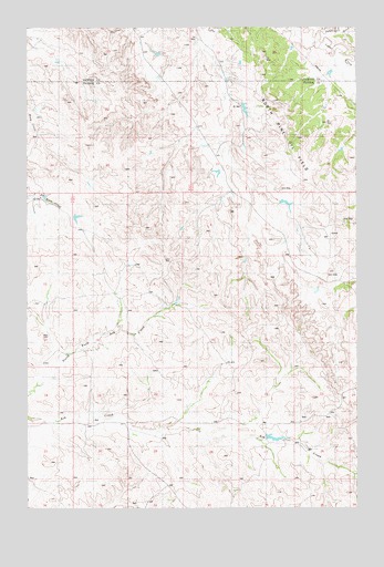
Graveyard Hill SW, MT USGS Topographic Map
Click on map above to begin viewing in our Map Viewer.

This topographic map contains these locations and features:
Feature Name Type Latitude Longitude GNIS ID View Map
10N55E25CDCD01 WellWellN46.7583°W104.7450°818121View Map
12N55E12DB__01 WellWellN46.8070°W104.7408°818423View Map
12N55E13DC__01 WellWellN46.7889°W104.7408°818321View Map
12N55E19CDCD01 WellWellN46.7731°W104.7252°818205View Map
12N55E24CDDD01 WellWellN46.7742°W104.7461°818215View Map
12N55E25CDCC01 WellWellN46.7597°W104.7461°818130View Map
12N55E25DD__01 WellWellN46.7597°W104.7355°818129View Map
12N56E02CC__01 WellWellN46.8175°W104.6458°818515View Map
12N56E10ACDA01 WellWellN46.8103°W104.6563°818449View Map
12N56E18CD__01 WellWellN46.7886°W104.7247°818314View Map
12N56E19CD__01 WellWellN46.7717°W104.7200°818203View Map
12N56E23CCDA01 WellWellN46.7739°W104.6458°818212View Map
12N56E23DCCA01 WellWellN46.7733°W104.6355°818208View Map
12N56E26AB__01 WellWellN46.7703°W104.6352°818192View Map
12N56E26DB__01 WellWellN46.7631°W104.6352°818143View Map
12N56E29AC__01 WellWellN46.7667°W104.6983°818167View Map
12N56E30CD__01 WellWellN46.7595°W104.7247°818127View Map
13N55E22BD__01 WellWellN46.8706°W104.7430°818969View Map
13N55E23ADC_01 WellWellN46.8686°W104.7130°818953View Map
13N55E25DA__01 WellWellN46.8525°W104.6900°818803View Map
Ash Creek School (historical)SchoolN46.7578°W104.6444°1715669View Map
Irion School (historical)SchoolN46.7556°W104.6975°1715709View Map
Judith Branch Ash CreekStreamN46.7628°W104.6408°1715837View Map
Labelle DitchStreamN46.8708°W104.6397°773166View Map
Little Fork Ash CreekStreamN46.7820°W104.7458°1715838View Map

Note: Coordinates in the location and feature list above are referenced to NAD83 datum.


Copyright (C) 2008-2025 Ryan Niemi / Sunset Dynamics ... All Rights Reserved