TopoQuest Logo
Do you find TopoQuest useful?
Help keep TopoQuest running and adding new maps/features by donating!
Bitcoin:  19c7KJd3qBynnjoSw5npx9KScwjBe4ifkT
Litecoin:  LXs6TkuXGGXo1vDsWCkWVdjQX94eUKd6ui
Home View Maps Find Maps Find Places Resources & Links


Upper Magpie Reservoir, Montana Topographic Map

USGS Map Title: Upper Magpie Reservoir, MT
USGS Map MRC: 46104H6
DRG (GeoTIFF) Download: o46104h6.tif


Neighboring USGS Topographic Map Quads:


  Forest Park, MT  
47104A7
 

  Glendive, MT  
47104A6
 

  Allard, MT  
47104A5
 

  Hoyt, MT  
46104H7
 

  Upper Magpie Reservoir, MT  
46104H6
 

  Twin Forks Reservoir, MT  
46104H5
 

  Simons Butte, MT  
46104G7
 

  Graveyard Hill SW, MT  
46104G6
 

  Graveyard Hill, MT  
46104G5


Map MRC Location:

N47°
W105°
N47°
W104°
H8 H7 H6 H5 H4 H3 H2 H1
G8 G7 G6 G5 G4 G3 G2 G1
F8 F7 F6 F5 F4 F3 F2 F1
E8 E7 E6 E5 E4 E3 E2 E1
D8 D7 D6 D5 D4 D3 D2 D1
C8 C7 C6 C5 C4 C3 C2 C1
B8 B7 B6 B5 B4 B3 B2 B1
A8 A7 A6 A5 A4 A3 A2 A1
N46°
W105°
N46°
W104°

Upper Magpie Reservoir, MT USGS 1:24K Topographic Map Preview:
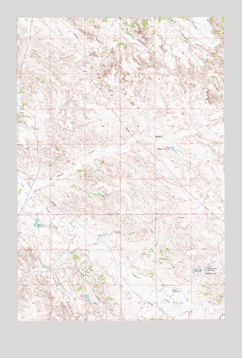
Upper Magpie Reservoir, MT USGS Topographic Map
Click on map above to begin viewing in our Map Viewer.

This topographic map contains these locations and features:
Feature Name Type Latitude Longitude GNIS ID View Map
13N56E30CCBC01 WellWellN46.8828°W104.6886°819067View Map
14N55E27CD__01 WellWellN46.9347°W104.7438°819482View Map
14N55E27CDDB01 WellWellN46.9347°W104.7436°819481View Map
14N56E09ADDB01 WellWellN46.9856°W104.6277°819945View Map
14N56E21ABAD01 WellWellN46.9617°W104.6305°819726View Map
Abbot DrawValleyN46.8992°W104.6894°1715470View Map
Bailer ReservoirReservoirN46.9154°W104.7393°768445View Map
Bailer Reservoir DamDamN46.9150°W104.7388°798197View Map
Basin View DamDamN46.9097°W104.7019°768547View Map
Big Drop ReservoirReservoirN46.8954°W104.6445°768781View Map
Camp ReservoirReservoirN46.8938°W104.6372°769547View Map
Ceder Bell Number 2 DamDamN46.8783°W104.6255°797967View Map
Dead Horse DamDamN46.8892°W104.6625°770509View Map
Forks ReservoirReservoirN46.8873°W104.6577°771497View Map
Gas City Oil FieldOilfieldN46.9211°W104.7380°771728View Map
Gertison DamDamN46.9036°W104.7186°771744View Map
Gertison DamDamN46.9033°W104.7188°795700View Map
Juniper DamDamN46.9114°W104.6922°772920View Map
Magpie CreekStreamN46.9295°W104.7416°773812View Map
North Pine Oil FieldOilfieldN46.8892°W104.7055°774845View Map
Prairie Goat DamDamN46.8967°W104.6372°795701View Map
Prairie Goat ReservoirReservoirN46.8971°W104.6359°775442View Map
Twin Buttes Retention DamDamN46.8850°W104.7088°797285View Map
Upper Magpie ReservoirReservoirN46.9454°W104.6560°777930View Map
Upper Magpie Reservoir DamDamN46.9550°W104.6538°797968View Map
Upper Prairie Goat DamDamN46.9000°W104.6305°795705View Map

Note: Coordinates in the location and feature list above are referenced to NAD83 datum.


Copyright (C) 2008-2025 Ryan Niemi / Sunset Dynamics ... All Rights Reserved