TopoQuest Logo
Do you find TopoQuest useful?
Help keep TopoQuest running and adding new maps/features by donating!
Bitcoin:  19c7KJd3qBynnjoSw5npx9KScwjBe4ifkT
Litecoin:  LXs6TkuXGGXo1vDsWCkWVdjQX94eUKd6ui
Home View Maps Find Maps Find Places Resources & Links


Auburn, West Virginia Topographic Map

USGS Map Title: Auburn, WV
USGS Map MRC: 39080A7
DRG (GeoTIFF) Download: o39080a7.tif


Neighboring USGS Topographic Map Quads:


  Pullman, WV  
39080B8
 

  Oxford, WV  
39080B7
 

  New Milton, WV  
39080B6
 

  Burnt House, WV  
39080A8
 

  Auburn, WV  
39080A7
 

  Vadis, WV  
39080A6
 

  Tanner, WV  
38080H8
 

  Glenville, WV  
38080H7
 

  Gilmer, WV  
38080H6


Map MRC Location:

N40°
W81°
N40°
W80°
H8 H7 H6 H5 H4 H3 H2 H1
G8 G7 G6 G5 G4 G3 G2 G1
F8 F7 F6 F5 F4 F3 F2 F1
E8 E7 E6 E5 E4 E3 E2 E1
D8 D7 D6 D5 D4 D3 D2 D1
C8 C7 C6 C5 C4 C3 C2 C1
B8 B7 B6 B5 B4 B3 B2 B1
A8 A7 A6 A5 A4 A3 A2 A1
N39°
W81°
N39°
W80°

Auburn, WV USGS 1:24K Topographic Map Preview:
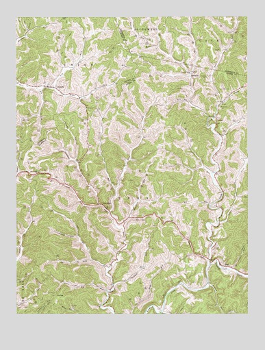
Auburn, WV USGS Topographic Map
Click on map above to begin viewing in our Map Viewer.

This topographic map contains these locations and features:
Feature Name Type Latitude Longitude GNIS ID View Map
AuburnPopulated PlaceN39.0956°W80.8562°1553764View Map
Auburn CemeteryCemeteryN39.0962°W80.8532°1688919View Map
Auburn Post OfficePost OfficeN39.0957°W80.8557°1688920View Map
Bear ForkStreamN39.0826°W80.7712°1535366View Map
Bear Fork School (historical)SchoolN39.1226°W80.7807°1689439View Map
Big RunStreamN39.0456°W80.7701°1535927View Map
Big RunStreamN39.0951°W80.8643°1535928View Map
Big RunStreamN39.0740°W80.7645°1535947View Map
Big Run CemeteryCemeteryN39.0804°W80.7584°1535957View Map
Bloody RunStreamN39.0220°W80.7709°1536108View Map
Bloody Run School (historical)SchoolN39.0270°W80.7801°1689645View Map
Brake HollowValleyN39.0645°W80.8426°1536301View Map
Brannon CemeteryCemeteryN39.0998°W80.7718°1536309View Map
Buckhorn RunStreamN39.0359°W80.8182°1536602View Map
Buckhorn School (historical)SchoolN39.0490°W80.8084°1689648View Map
Chestnut RunStreamN39.0331°W80.8418°1537301View Map
ConingsPopulated PlaceN39.0798°W80.7668°1537569View Map
Cove CreekStreamN39.0204°W80.7712°1537723View Map
Coxcamp ForkStreamN39.0426°W80.8248°1537762View Map
Coxs MillsPopulated PlaceN39.0445°W80.8268°1537763View Map
Coxs Mills Post OfficePost OfficeN39.0459°W80.8295°1689655View Map
Crane RunStreamN39.0587°W80.7698°1537794View Map
De Kalb-Troy DistrictCivilN39.0007°W80.8712°1928203View Map
Ellis RunStreamN39.0009°W80.7970°1538680View Map
Fishpot RunStreamN39.0190°W80.7582°1539009View Map
Gilmer County Volunteer Fire Department Troy StationBuildingN39.0201°W80.7627°2577936View Map
Hall CemeteryCemeteryN39.0817°W80.8382°1539859View Map
Horn Creek ChurchChurchN39.0604°W80.8634°1540465View Map
Keister CemeteryCemeteryN39.0729°W80.7815°1541115View Map
Left Fork Bone CreekStreamN39.0948°W80.8545°1541635View Map
Lick RunStreamN39.0887°W80.7818°1541921View Map
Lick Run School (historical)SchoolN39.0879°W80.7948°1689695View Map
Little Cove CreekStreamN39.0381°W80.7662°1542059View Map
Low GapGapN39.0079°W80.8540°1542495View Map
Low Gap School (historical)SchoolN39.0079°W80.8540°1689699View Map
Lower Big RunStreamN39.0095°W80.8257°1542526View Map
Lower Rush Run School (historical)SchoolN39.0898°W80.7634°1689702View Map
Lowther CemeteryCemeteryN39.1098°W80.7654°1542599View Map
Lynn ForkStreamN39.0229°W80.8337°1542644View Map
Moonrise School (historical)SchoolN39.1084°W80.8226°1689101View Map
Mount Earnest CemeteryCemeteryN39.0867°W80.7651°1543636View Map
Mount Earnest ChurchChurchN39.0829°W80.7676°1543637View Map
Mount Union ChurchChurchN39.1131°W80.8043°1543780View Map
Mudlick RunStreamN39.0126°W80.7718°1543974View Map
Osborne School (historical)SchoolN39.0559°W80.7670°1689716View Map
Pawpaw School (historical)SchoolN39.0704°W80.7979°1689717View Map
Pikecamp RunStreamN39.0459°W80.8301°1544850View Map
Pleasant Valley ChurchChurchN39.1020°W80.7801°1545030View Map
Right Fork Bone CreekStreamN39.0948°W80.8545°1545615View Map
Rocky Pond School (historical)SchoolN39.0534°W80.7562°1689727View Map
Rush RunStreamN39.0887°W80.7640°1546183View Map
Springston School (historical)SchoolN39.0134°W80.7854°1689734View Map
SpurgeonPopulated PlaceN39.1009°W80.7804°1549936View Map
Stonelick RunStreamN39.0523°W80.8212°1547484View Map
Town of AuburnCivilN39.0962°W80.8562°2390710View Map
TroyPopulated PlaceN39.0198°W80.7632°1555827View Map
Troy Elementary SchoolSchoolN39.0204°W80.7650°1689748View Map
Troy Post OfficePost OfficeN39.0201°W80.7642°1689749View Map
Troy-International Order of Odd Fellows CemeteryCemeteryN39.0283°W80.7678°2586254View Map
Upper Big RunStreamN39.0181°W80.8254°1548504View Map
Upper Big Run School (historical)SchoolN39.0334°W80.8418°1689752View Map
Upper Rush Run School (historical)SchoolN39.1231°W80.7551°1689618View Map
Wolfpen RunStreamN39.0123°W80.8229°1549345View Map

Note: Coordinates in the location and feature list above are referenced to NAD83 datum.


Copyright (C) 2008-2024 Ryan Niemi / Sunset Dynamics ... All Rights Reserved