TopoQuest Logo
Do you find TopoQuest useful?
Help keep TopoQuest running and adding new maps/features by donating!
Bitcoin:  19c7KJd3qBynnjoSw5npx9KScwjBe4ifkT
Litecoin:  LXs6TkuXGGXo1vDsWCkWVdjQX94eUKd6ui
Home View Maps Find Maps Find Places Resources & Links


Glenville, West Virginia Topographic Map

USGS Map Title: Glenville, WV
USGS Map MRC: 38080H7
DRG (GeoTIFF) Download: o38080h7.tif


Neighboring USGS Topographic Map Quads:


  Burnt House, WV  
39080A8
 

  Auburn, WV  
39080A7
 

  Vadis, WV  
39080A6
 

  Tanner, WV  
38080H8
 

  Glenville, WV  
38080H7
 

  Gilmer, WV  
38080H6
 

  Normantown, WV  
38080G8
 

  Cedarville, WV  
38080G7
 

  Burnsville, WV  
38080G6


Map MRC Location:

N39°
W81°
N39°
W80°
H8 H7 H6 H5 H4 H3 H2 H1
G8 G7 G6 G5 G4 G3 G2 G1
F8 F7 F6 F5 F4 F3 F2 F1
E8 E7 E6 E5 E4 E3 E2 E1
D8 D7 D6 D5 D4 D3 D2 D1
C8 C7 C6 C5 C4 C3 C2 C1
B8 B7 B6 B5 B4 B3 B2 B1
A8 A7 A6 A5 A4 A3 A2 A1
N38°
W81°
N38°
W80°

Glenville, WV USGS 1:24K Topographic Map Preview:
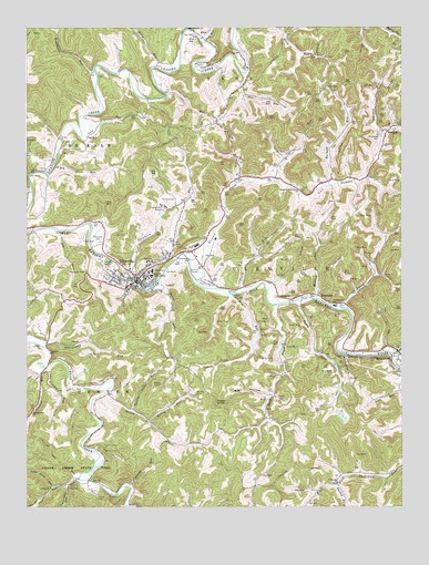
Glenville, WV USGS Topographic Map
Click on map above to begin viewing in our Map Viewer.

This topographic map contains these locations and features:
Feature Name Type Latitude Longitude GNIS ID View Map
AlicePopulated PlaceN38.9976°W80.8159°1549560View Map
Alice CemeteryCemeteryN38.9970°W80.8187°1534875View Map
Bailey School (historical)SchoolN38.9865°W80.8382°1689636View Map
BaldwinPopulated PlaceN38.9729°W80.7545°1553790View Map
Baldwin ChurchChurchN38.9693°W80.7557°1535171View Map
Barnett RunStreamN38.9593°W80.7723°1535268View Map
Bear RunStreamN38.9284°W80.7859°1535391View Map
Bear Run School (historical)SchoolN38.9079°W80.7698°1689639View Map
Big HollowValleyN38.9040°W80.7951°1535861View Map
Big RunStreamN38.9476°W80.8654°1535920View Map
Big RunStreamN38.9620°W80.8682°1535921View Map
Bloody RunStreamN38.8812°W80.8398°1536107View Map
Cather School (historical)SchoolN38.9634°W80.8651°1689649View Map
Cedar Creek State ParkParkN38.8818°W80.8623°1537131View Map
Chestnut RunStreamN38.9823°W80.8279°1537299View Map
City DistrictCivilN38.9103°W80.7946°1928191View Map
Collins RunStreamN38.9604°W80.7920°1537533View Map
Crooked RunStreamN38.9112°W80.8695°1537856View Map
Crooked Run ChurchChurchN38.8995°W80.8726°1537861View Map
Dawson ChurchChurchN38.9151°W80.8665°1538074View Map
Dawson School (historical)SchoolN38.9195°W80.8676°1689658View Map
DoraPopulated PlaceN38.9106°W80.7893°1689662View Map
Dry RunStreamN38.9309°W80.8076°1538372View Map
Dry Run School (historical)SchoolN38.9193°W80.7973°1689664View Map
Duck CreekStreamN38.9276°W80.7920°1538395View Map
Duck Creek School (historical)SchoolN38.8965°W80.7979°1689665View Map
Duskcamp ChurchChurchN38.8818°W80.7715°1538459View Map
Ellis Run School (historical)SchoolN38.9984°W80.7876°1689670View Map
Federal Correctional Institute Gilmer Satellite CampBuildingN38.9132°W80.7856°2634795View Map
Federal Correctional Institution GilmerBuildingN38.9160°W80.7837°2634734View Map
Flat RunStreamN38.9881°W80.8023°1539057View Map
Fort Moore (historical)MilitaryN38.9367°W80.8322°1689672View Map
Gilmer CountyCivilN38.9241°W80.8571°1689673View Map
Gilmer County Ambulance Service 75BuildingN38.9370°W80.8415°2581103View Map
Gilmer County CourthouseBuildingN38.9346°W80.8373°2727844View Map
Gilmer County High SchoolSchoolN38.9390°W80.8344°1689674View Map
Gilmer County Sheriff's OfficeBuildingN38.9346°W80.8364°2727918View Map
Gilmer County Volunteer Fire Department Glenville StationBuildingN38.9436°W80.8487°2577762View Map
GlenvillePopulated PlaceN38.9343°W80.8376°1539468View Map
Glenville Elementary SchoolSchoolN38.9433°W80.8119°1689677View Map
Glenville Golf ClubLocaleN38.9548°W80.8274°2634089View Map
Glenville Police DepartmentBuildingN38.9338°W80.8366°2727917View Map
Glenville Post OfficePost OfficeN38.9330°W80.8369°1689678View Map
Glenville State CollegeSchoolN38.9353°W80.8334°1539469View Map
Glenville State College Department of Public SafetyBuildingN38.9350°W80.8335°2727919View Map
Glenville Truss BridgeBridgeN38.9335°W80.8390°2635397View Map
Gluck RunStreamN38.9309°W80.8034°1539477View Map
Gluck Run School (historical)SchoolN38.9418°W80.7976°1689679View Map
Grandcamp RunStreamN38.9176°W80.8695°1539569View Map
Grassy RunStreamN38.9601°W80.8045°1539639View Map
Horn CreekStreamN38.9995°W80.8218°1540464View Map
I L "Ike" Morris BridgeBridgeN38.9284°W80.7865°2635396View Map
Kelley RunStreamN38.8976°W80.8337°1541130View Map
Leading Creek ChurchChurchN38.9998°W80.8215°1541580View Map
Let (historical)Populated PlaceN38.8923°W80.8276°1689691View Map
Lick RunStreamN38.9723°W80.8568°1541917View Map
Little Crooked RunStreamN38.9112°W80.8682°1542078View Map
Long Lick RunStreamN38.8801°W80.8659°1542387View Map
Lower Stewart Creek ChurchChurchN38.9579°W80.7834°1542576View Map
Lynch RunStreamN38.9265°W80.7690°1542630View Map
Lynch Run School (historical)SchoolN38.9331°W80.7523°1689704View Map
Messenger CemeteryCemeteryN38.9715°W80.7570°1543139View Map
Mikes RunStreamN38.9895°W80.8320°1543247View Map
Mudlick RunStreamN38.9295°W80.7790°1543962View Map
Nutter RunStreamN38.9334°W80.8315°1544262View Map
O'donnell Number Two Mine Slurry DamDamN38.9084°W80.7682°1557439View Map
Old Glenville CemeteryCemeteryN38.9355°W80.8322°2726464View Map
Otterbein ChurchChurchN38.9301°W80.7918°1544468View Map
Park View TrailTrailN38.8859°W80.8448°1544577View Map
Powell KnobSummitN38.9018°W80.8123°1545218View Map
Rhodes CemeteryCemeteryN38.9051°W80.8187°1545527View Map
Richbottom RunStreamN38.9887°W80.8515°1545556View Map
Road RunStreamN38.9965°W80.8154°1545832View Map
Sand ForkStreamN38.9154°W80.7532°1546352View Map
Sand Fork Post OfficePost OfficeN38.9152°W80.7501°1689731View Map
Sperry Cabin RunStreamN38.9001°W80.8401°1547131View Map
Spruce RunStreamN38.9051°W80.8482°1547273View Map
Spruce Run School (historical)SchoolN38.8923°W80.8270°1689735View Map
Spruce School (historical)SchoolN38.9048°W80.8479°1689736View Map
Stalnaker CemeteryCemeteryN38.9442°W80.8512°1547319View Map
Stewart CreekStreamN38.9343°W80.8182°1547405View Map
Stewart Creek School (historical)SchoolN38.9593°W80.7870°1689739View Map
Sugar Grove School (historical)SchoolN38.9556°W80.8201°1689743View Map
Sugarcamp RunStreamN38.8809°W80.8618°1547691View Map
Sycamore RunStreamN38.9362°W80.8404°1547843View Map
Tank HillSummitN38.9368°W80.8320°1689744View Map
Town of GlenvilleCivilN38.9380°W80.8339°2390210View Map
Town RunStreamN38.9337°W80.8390°1548183View Map
TruebadaPopulated PlaceN38.9301°W80.7776°1555829View Map
Turkey ForkStreamN38.8812°W80.7715°1548343View Map
Turkey Fork School (historical)SchoolN38.8806°W80.7718°1689751View Map
Turkey RunStreamN38.9348°W80.8390°1548354View Map
Two RunStreamN38.8820°W80.8595°1548414View Map
Upper Two RunStreamN38.8829°W80.8573°1548570View Map
West Virginia State Police Troop 3 - Glenville DetachmentBuildingN38.9151°W80.7629°2727916View Map
Whitting CemeteryCemeteryN38.9356°W80.8443°1549118View Map
Wolfpen RunStreamN38.9726°W80.7565°1549343View Map

Note: Coordinates in the location and feature list above are referenced to NAD83 datum.


Copyright (C) 2008-2025 Ryan Niemi / Sunset Dynamics ... All Rights Reserved