TopoQuest Logo
Do you find TopoQuest useful?
Help keep TopoQuest running and adding new maps/features by donating!
Bitcoin:  19c7KJd3qBynnjoSw5npx9KScwjBe4ifkT
Litecoin:  LXs6TkuXGGXo1vDsWCkWVdjQX94eUKd6ui
Home View Maps Find Maps Find Places Resources & Links


Green River Lakes, Wyoming Topographic Map

USGS Map Title: Green River Lakes, WY
USGS Map MRC: 43109C7
DRG (GeoTIFF) Download: o43109c7.tif


Neighboring USGS Topographic Map Quads:


  Fish Creek Park, WY  
43109D8
 

  Union Peak, WY  
43109D7
 

  Simpson Lake, WY  
43109D6
 

  Big Sheep Mountain, WY  
43109C8
 

  Green River Lakes, WY  
43109C7
 

  Downs Mountain, WY  
43109C6
 

  Kendall Mountain, WY  
43109B8
 

  Squaretop Mountain, WY  
43109B7
 

  Gannett Peak, WY  
43109B6


Map MRC Location:

N44°
W110°
N44°
W109°
H8 H7 H6 H5 H4 H3 H2 H1
G8 G7 G6 G5 G4 G3 G2 G1
F8 F7 F6 F5 F4 F3 F2 F1
E8 E7 E6 E5 E4 E3 E2 E1
D8 D7 D6 D5 D4 D3 D2 D1
C8 C7 C6 C5 C4 C3 C2 C1
B8 B7 B6 B5 B4 B3 B2 B1
A8 A7 A6 A5 A4 A3 A2 A1
N43°
W110°
N43°
W109°

Green River Lakes, WY USGS 1:24K Topographic Map Preview:
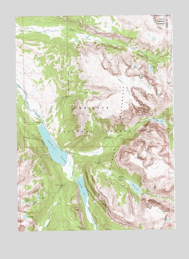
Green River Lakes, WY USGS Topographic Map
Click on map above to begin viewing in our Map Viewer.

This topographic map contains these locations and features:
Feature Name Type Latitude Longitude GNIS ID View Map
Alexander ParkFlatN43.3555°W109.7802°1597708View Map
Clear CreekStreamN43.2897°W109.8327°1598786View Map
Clear Creek FallsFallsN43.2947°W109.8292°1597154View Map
Clear Creek Natural BridgeArchN43.3038°W109.7996°1598791View Map
Clear Creek TrailTrailN43.2961°W109.8140°1604810View Map
Clear LakeLakeN43.3132°W109.7621°1598794View Map
Elbow Lake Number 2LakeN43.2555°W109.7550°1605274View Map
Fish Bowl SpringSpringN43.2805°W109.7943°1599716View Map
Flat Top MountainSummitN43.2919°W109.7796°1599757View Map
G P Bar RanchLocaleN43.3127°W109.8577°1599884View Map
Green River Lake CampgroundLocaleN43.3119°W109.8604°1608769View Map
Green River LakesLakeN43.2741°W109.8235°1600087View Map
Lake GadsbyLakeN43.2585°W109.8693°1599887View Map
Lakeside TrailTrailN43.2997°W109.8524°1600816View Map
Lost Eagle PeakSummitN43.2611°W109.7607°1601140View Map
Mill CreekStreamN43.3149°W109.8532°1601450View Map
Native LakeLakeN43.3440°W109.7672°1601660View Map
Osborn MountainSummitN43.3241°W109.7877°1601949View Map
Porcupine CreekStreamN43.2830°W109.8310°1602265View Map
Porcupine Creek FallsFallsN43.2763°W109.8385°1602269View Map
Ram PassGapN43.2861°W109.7743°1602370View Map
Roaring Fork BasinBasinN43.3661°W109.8610°1602553View Map
Roaring Fork TrailTrailN43.3624°W109.8096°1604690View Map
Shirley LakeLakeN43.2665°W109.8643°1602898View Map
Slide CreekStreamN43.2952°W109.8107°1602980View Map
Slide Creek FallsFallsN43.2888°W109.8079°1602981View Map
Slide FallsFallsN43.2833°W109.8174°1597153View Map
Slide LakeLakeN43.2747°W109.7814°1602983View Map
Slide Lake TrailTrailN43.2852°W109.8032°1604811View Map
Twin LakesLakeN43.2682°W109.8586°1603831View Map
Valaite LakeLakeN43.2669°W109.8698°1603900View Map
White RockCliffN43.2655°W109.8057°1604146View Map

Note: Coordinates in the location and feature list above are referenced to NAD83 datum.


Copyright (C) 2008-2025 Ryan Niemi / Sunset Dynamics ... All Rights Reserved