TopoQuest Logo
Do you find TopoQuest useful?
Help keep TopoQuest running and adding new maps/features by donating!
Bitcoin:  19c7KJd3qBynnjoSw5npx9KScwjBe4ifkT
Litecoin:  LXs6TkuXGGXo1vDsWCkWVdjQX94eUKd6ui
Home View Maps Find Maps Find Places Resources & Links


Simpson Lake, Wyoming Topographic Map

USGS Map Title: Simpson Lake, WY
USGS Map MRC: 43109D6
DRG (GeoTIFF) Download: o43109d6.tif


Neighboring USGS Topographic Map Quads:


  Warm Spring Mountain, WY  
43109E7
 

  Dubois, WY  
43109E6
 

  Mason Draw, WY  
43109E5
 

  Union Peak, WY  
43109D7
 

  Simpson Lake, WY  
43109D6
 

  Torrey Lake, WY  
43109D5
 

  Green River Lakes, WY  
43109C7
 

  Downs Mountain, WY  
43109C6
 

  Ink Wells, WY  
43109C5


Map MRC Location:

N44°
W110°
N44°
W109°
H8 H7 H6 H5 H4 H3 H2 H1
G8 G7 G6 G5 G4 G3 G2 G1
F8 F7 F6 F5 F4 F3 F2 F1
E8 E7 E6 E5 E4 E3 E2 E1
D8 D7 D6 D5 D4 D3 D2 D1
C8 C7 C6 C5 C4 C3 C2 C1
B8 B7 B6 B5 B4 B3 B2 B1
A8 A7 A6 A5 A4 A3 A2 A1
N43°
W110°
N43°
W109°

Simpson Lake, WY USGS 1:24K Topographic Map Preview:
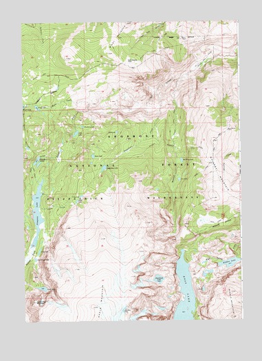
Simpson Lake, WY USGS Topographic Map
Click on map above to begin viewing in our Map Viewer.

This topographic map contains these locations and features:
Feature Name Type Latitude Longitude GNIS ID View Map
Alice LakeLakeN43.4536°W109.7194°1597710View Map
Ann LakeLakeN43.4341°W109.6604°1597769View Map
Big Horn Claims MineMineN43.4680°W109.7190°1704378View Map
Big Horn Number One MineMineN43.4694°W109.7188°1704377View Map
Blanket LakesLakeN43.4425°W109.7421°1598242View Map
Blueberry LakeLakeN43.4562°W109.7154°1598269View Map
Boone LakeLakeN43.4439°W109.7098°1598303View Map
C M TrailTrailN43.4800°W109.6521°1604371View Map
Cabin CreekStreamN43.4227°W109.7410°1598550View Map
Cliff LakeLakeN43.4253°W109.7192°1598808View Map
Cony LakeLakeN43.4273°W109.7167°1598883View Map
Dead Horse LakeLakeN43.4010°W109.7435°1599144View Map
Dish LakeLakeN43.4540°W109.6959°1599264View Map
Dyke CreekStreamN43.4441°W109.7290°1599432View Map
East Fork MineMineN43.4466°W109.6407°1704381View Map
Grass LakeLakeN43.4644°W109.7415°1600042View Map
Hidden LakeLakeN43.3989°W109.6318°1600318View Map
Jakeys Fork TrailTrailN43.4938°W109.6679°1600589View Map
Long LakeLakeN43.4044°W109.7412°1601110View Map
Lost LakeLakeN43.3889°W109.7397°1601143View Map
Middle MountainSummitN43.3766°W109.6310°1601421View Map
Moon CreekStreamN43.4630°W109.7118°1601521View Map
Noon RocksSummitN43.4544°W109.6321°1601708View Map
Old Ram LakeLakeN43.3793°W109.6935°1601911View Map
Red Wing LakeLakeN43.4420°W109.6589°1602468View Map
Ross LakeLakeN43.3863°W109.6581°1602632View Map
Ross Lake TrailTrailN43.4533°W109.6352°1602633View Map
Salt Barrels ParkFlatN43.4828°W109.6887°1602691View Map
Simpson LakeLakeN43.4203°W109.7424°1602932View Map
Snowband LakeLakeN43.3924°W109.6730°1603032View Map
Soapstone CreekStreamN43.4705°W109.6735°1603042View Map
Soapstone LakeLakeN43.4390°W109.7037°1603043View Map
Square Top MountainSummitN43.3833°W109.7438°1603297View Map
Wasson CreekStreamN43.4755°W109.6599°1604004View Map
Whiskey Mountain Mining Company Number One and Six MineMineN43.4505°W109.6457°1704380View Map
Whiskey Mountain Number Two MineMineN43.4502°W109.6457°1704382View Map
Whiskey Mountain TrailTrailN43.4472°W109.6610°1604533View Map
Whiskey Peak Mining Company MineMineN43.4327°W109.6402°1704379View Map
Windy MountainSummitN43.4925°W109.6960°1604244View Map

Note: Coordinates in the location and feature list above are referenced to NAD83 datum.


Copyright (C) 2008-2025 Ryan Niemi / Sunset Dynamics ... All Rights Reserved