TopoQuest Logo
Do you find TopoQuest useful?
Help keep TopoQuest running and adding new maps/features by donating!
Bitcoin:  19c7KJd3qBynnjoSw5npx9KScwjBe4ifkT
Litecoin:  LXs6TkuXGGXo1vDsWCkWVdjQX94eUKd6ui
Home View Maps Find Maps Find Places Resources & Links


Union Peak, Wyoming Topographic Map

USGS Map Title: Union Peak, WY
USGS Map MRC: 43109D7
DRG (GeoTIFF) Download: o43109d7.tif


Neighboring USGS Topographic Map Quads:


  Fish Lake, WY  
43109E8
 

  Warm Spring Mountain, WY  
43109E7
 

  Dubois, WY  
43109E6
 

  Fish Creek Park, WY  
43109D8
 

  Union Peak, WY  
43109D7
 

  Simpson Lake, WY  
43109D6
 

  Big Sheep Mountain, WY  
43109C8
 

  Green River Lakes, WY  
43109C7
 

  Downs Mountain, WY  
43109C6


Map MRC Location:

N44°
W110°
N44°
W109°
H8 H7 H6 H5 H4 H3 H2 H1
G8 G7 G6 G5 G4 G3 G2 G1
F8 F7 F6 F5 F4 F3 F2 F1
E8 E7 E6 E5 E4 E3 E2 E1
D8 D7 D6 D5 D4 D3 D2 D1
C8 C7 C6 C5 C4 C3 C2 C1
B8 B7 B6 B5 B4 B3 B2 B1
A8 A7 A6 A5 A4 A3 A2 A1
N43°
W110°
N43°
W109°

Union Peak, WY USGS 1:24K Topographic Map Preview:
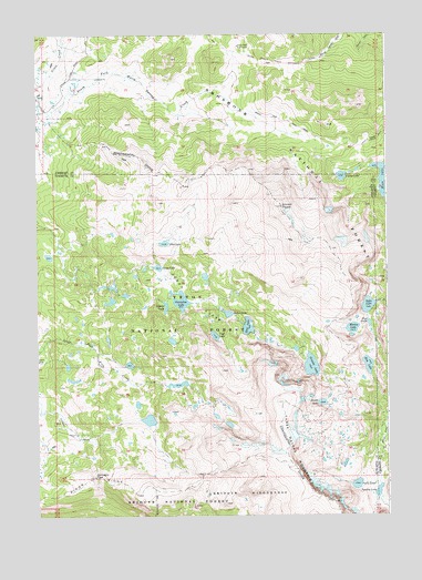
Union Peak, WY USGS Topographic Map
Click on map above to begin viewing in our Map Viewer.

This topographic map contains these locations and features:
Feature Name Type Latitude Longitude GNIS ID View Map
Abosko LakeLakeN43.4291°W109.8293°1597677View Map
Cliff LakeLakeN43.4218°W109.8118°1598807View Map
Deep LakeLakeN43.4240°W109.8001°1599187View Map
Divide LakeLakeN43.4042°W109.7738°1599271View Map
Dollar LakeLakeN43.4275°W109.8072°1599285View Map
Dubois Claim MineMineN43.5000°W109.7618°1704403View Map
Dyke LakeLakeN43.4294°W109.7572°1599433View Map
Flat LakeLakeN43.4458°W109.8297°1599755View Map
Granite LakeLakeN43.4137°W109.7776°1600030View Map
Grass LakeLakeN43.4395°W109.8320°1600041View Map
Gunsight PassGapN43.3849°W109.8546°1600140View Map
Highline TrailTrailN43.3977°W109.8652°1589559View Map
Horseshoe LakeLakeN43.4308°W109.8240°1600427View Map
Long Shot Number Four MineMineN43.4597°W109.7843°1704383View Map
Marion LakeLakeN43.4236°W109.7628°1601255View Map
Moon LakeLakeN43.4627°W109.7518°1601522View Map
Moon Lake TrailTrailN43.4775°W109.7871°1601523View Map
Peat LakeLakeN43.4248°W109.7567°1602073View Map
Pinto LakeLakeN43.3829°W109.7616°1602187View Map
Rim LakeLakeN43.4140°W109.7573°1602530View Map
Sandra LakeLakeN43.3811°W109.7540°1602723View Map
Seven LakesLakeN43.4313°W109.8188°1602801View Map
Three Waters MountainRidgeN43.3936°W109.7857°1603660View Map
Union LakeLakeN43.4631°W109.7664°1603860View Map
Union Pass Cow CampLocaleN43.4969°W109.8032°1603862View Map
Union PeakSummitN43.4555°W109.7877°1603864View Map
Union Peak MineMineN43.4602°W109.7838°1704384View Map

Note: Coordinates in the location and feature list above are referenced to NAD83 datum.


Copyright (C) 2008-2024 Ryan Niemi / Sunset Dynamics ... All Rights Reserved