TopoQuest Logo
Do you find TopoQuest useful?
Help keep TopoQuest running and adding new maps/features by donating!
Bitcoin:  19c7KJd3qBynnjoSw5npx9KScwjBe4ifkT
Litecoin:  LXs6TkuXGGXo1vDsWCkWVdjQX94eUKd6ui
Home View Maps Find Maps Find Places Resources & Links


Greenbrier, Tennessee Topographic Map

USGS Map Title: Greenbrier, TN
USGS Map MRC: 36086D7
DRG (GeoTIFF) Download: o36086d7.tif


Neighboring USGS Topographic Map Quads:


  Springfield North, TN  
36086E8
 

  Youngville, TN  
36086E7
 

  Orlinda, TN  
36086E6
 

  Springfield South, TN  
36086D8
 

  Greenbrier, TN  
36086D7
 

  White House, TN  
36086D6
 

  Forest Grove, TN  
36086C8
 

  Whites Creek, TN  
36086C7
 

  Goodlettsville, TN  
36086C6


Map MRC Location:

N37°
W87°
N37°
W86°
H8 H7 H6 H5 H4 H3 H2 H1
G8 G7 G6 G5 G4 G3 G2 G1
F8 F7 F6 F5 F4 F3 F2 F1
E8 E7 E6 E5 E4 E3 E2 E1
D8 D7 D6 D5 D4 D3 D2 D1
C8 C7 C6 C5 C4 C3 C2 C1
B8 B7 B6 B5 B4 B3 B2 B1
A8 A7 A6 A5 A4 A3 A2 A1
N36°
W87°
N36°
W86°

Greenbrier, TN USGS 1:24K Topographic Map Preview:
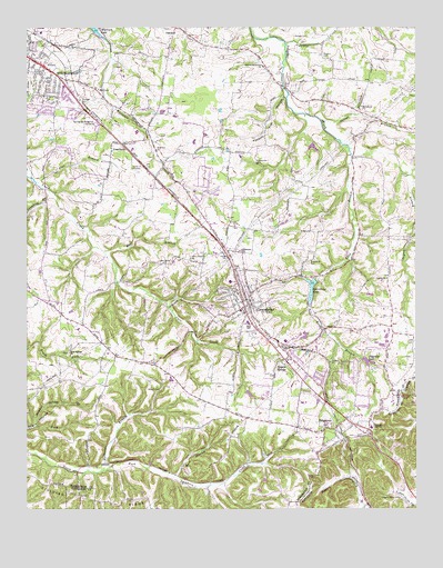
Greenbrier, TN USGS Topographic Map
Click on map above to begin viewing in our Map Viewer.

This topographic map contains these locations and features:
Feature Name Type Latitude Longitude GNIS ID View Map
Baggett CemeteryCemeteryN36.4931°W86.7794°1276081View Map
Bell CemeteryCemeteryN36.4837°W86.8514°1276922View Map
Bell CemeteryCemeteryN36.4898°W86.8464°1644167View Map
Bell CemeteryCemeteryN36.4712°W86.8430°1644170View Map
Ben HollowValleyN36.3840°W86.8274°1276990View Map
Bethlehem CemeteryCemeteryN36.4800°W86.7667°1644174View Map
Bethlehem ChurchChurchN36.4800°W86.7672°1305179View Map
Bethlehem School (historical)SchoolN36.4792°W86.7675°1316472View Map
Bloodworth CemeteryCemeteryN36.4656°W86.8014°1277704View Map
Bowen CemeteryCemeteryN36.4067°W86.8361°1305358View Map
Browing CemeteryCemeteryN36.4667°W86.8344°1644184View Map
Calvary ChurchChurchN36.4417°W86.8114°1305612View Map
Chambliss CemeteryCemeteryN36.4703°W86.8644°1644196View Map
City of RidgetopCivilN36.4047°W86.7682°2404618View Map
City of SpringfieldCivilN36.4944°W86.8706°2405511View Map
Coggin CemeteryCemeteryN36.3939°W86.7686°1644204View Map
Coggins-Greer CemeteryCemeteryN36.3787°W86.7555°1280874View Map
Commissioner District 3CivilN36.4705°W86.7532°2464191View Map
Commissioner District 4CivilN36.3778°W86.8163°2464081View Map
Commissioner District 5CivilN36.4209°W86.8099°2464487View Map
Commissioner District 9CivilN36.4957°W86.8466°2464741View Map
CourtlandPopulated PlaceN36.4700°W86.8442°1281393View Map
Crawford BranchStreamN36.4575°W86.8678°1281574View Map
Crossroads School (historical)SchoolN36.4414°W86.8686°1316478View Map
Dickerson BranchStreamN36.3850°W86.8503°1282432View Map
Dorris CemeteryCemeteryN36.4187°W86.8236°1644231View Map
Dorris CemeteryCemeteryN36.4506°W86.7958°1282653View Map
Duncan CemeteryCemeteryN36.4964°W86.8500°1644240View Map
Ebenezer ChurchChurchN36.4420°W86.8056°1283482View Map
Eidson CemeteryCemeteryN36.4548°W86.8178°1644250View Map
Elmore CemeteryCemeteryN36.4656°W86.7950°1644254View Map
First Assembly of God ChurchChurchN36.4898°W86.8711°1316482View Map
First Call Ambulance ServiceBuildingN36.4893°W86.8557°2697395View Map
Flat BranchStreamN36.4600°W86.8714°1284371View Map
Gideon CemeteryCemeteryN36.4350°W86.7594°1644275View Map
Gideon ChurchChurchN36.4348°W86.7592°1285362View Map
GreenbrierPopulated PlaceN36.4275°W86.8047°1286141View Map
Greenbrier CemeteryCemeteryN36.4395°W86.7839°1286148View Map
Greenbrier Elementary SchoolSchoolN36.4264°W86.8064°1316488View Map
Greenbrier Fire DepartmentBuildingN36.4264°W86.8062°2653660View Map
Greenbrier First Baptist ChurchChurchN36.4259°W86.8050°1644282View Map
Greenbrier High SchoolSchoolN36.4234°W86.8039°1316489View Map
Greenbrier LakeReservoirN36.4316°W86.7837°1286154View Map
Greenbrier Lake DamDamN36.4348°W86.7817°1307204View Map
Greenbrier Middle SchoolSchoolN36.4339°W86.8097°1316490View Map
Greenbrier Police DepartmentBuildingN36.4265°W86.8059°2765780View Map
Greenbrier Post OfficePost OfficeN36.4163°W86.7955°1650473View Map
Greenbrier Recreation Club DamDamN36.4084°W86.7983°1302576View Map
Greenbrier Recreation Club LakeReservoirN36.4084°W86.7983°1302577View Map
Hall CemeteryCemeteryN36.4267°W86.8364°1644286View Map
Hygeia SpringsPopulated PlaceN36.4131°W86.7911°1288890View Map
Hygeia Springs Post Office (historical)Post OfficeN36.4131°W86.7911°1926758View Map
Kelly Willis School (historical)SchoolN36.4223°W86.7578°1316494View Map
Krisle CemeteryCemeteryN36.4803°W86.7994°1644332View Map
Lights Chapel CemeteryCemeteryN36.4400°W86.8225°1291271View Map
Long BranchStreamN36.4670°W86.7703°1291894View Map
McMurray CemeteryCemeteryN36.4823°W86.7980°1644347View Map
New Meyer ChurchChurchN36.4389°W86.8308°1295605View Map
Oakland-Bethlehem SchoolSchoolN36.4900°W86.7986°1296188View Map
Oppossum ForkStreamN36.4620°W86.7536°1310495View Map
Our Lady of Lourdes Catholic ChurchChurchN36.4917°W86.8739°1316501View Map
Paradise LakeReservoirN36.4184°W86.8350°1302581View Map
Paradise Lake DamDamN36.4184°W86.8350°1302580View Map
Perry ParkPopulated PlaceN36.4834°W86.8519°1310496View Map
Peyton BranchStreamN36.4600°W86.7506°1297288View Map
Pinson CemeteryCemeteryN36.4634°W86.8064°1644387View Map
Pinson School (historical)SchoolN36.4614°W86.8106°1316502View Map
Plainview School (historical)SchoolN36.4473°W86.7808°1316503View Map
Pole Bridge BranchStreamN36.4292°W86.7833°1298027View Map
Possum Trot HollowValleyN36.4822°W86.7920°1298303View Map
Reeder School (historical)SchoolN36.4067°W86.8556°1316505View Map
RidgetopPopulated PlaceN36.3950°W86.7794°1299405View Map
Ridgetop First Baptist ChurchChurchN36.3964°W86.7772°1644408View Map
Ridgetop LakeReservoirN36.4134°W86.7655°1299406View Map
Ridgetop Lake DamDamN36.4139°W86.7672°1307203View Map
Ridgetop Police DepartmentBuildingN36.3969°W86.7672°2766032View Map
Ridgetop Post OfficePost OfficeN36.3960°W86.7675°1650487View Map
Ridgetop Volunteer Fire DepartmentBuildingN36.3968°W86.7671°2653862View Map
Rock Springs CemeteryCemeteryN36.4153°W86.8617°1644413View Map
Rock Springs ChurchChurchN36.4156°W86.8606°1299800View Map
Santee CreekStreamN36.4962°W86.7911°1300784View Map
Savage BranchStreamN36.4762°W86.7800°1300815View Map
Savage CemeteryCemeteryN36.4978°W86.7842°1300816View Map
Springfield Fire Department David N Greer Fire Station 2BuildingN36.4894°W86.8576°2653851View Map
Springfield Memorial GardensCemeteryN36.4750°W86.8519°1271144View Map
Springfield-Greenbrier Division (historical)CensusN36.4695°W86.8436°1648931View Map
Sulphur Spring BranchStreamN36.3970°W86.8719°1271807View Map
Town of GreenbrierCivilN36.4237°W86.7974°2406611View Map
Wartrace ChurchChurchN36.4689°W86.8331°1304390View Map
Watauga High SchoolSchoolN36.3967°W86.7644°1304401View Map
White House Community Volunteer Fire Department Station 52BuildingN36.4189°W86.8524°2653723View Map
Wolf BranchStreamN36.4414°W86.8494°1274934View Map
Worsham CemeteryCemeteryN36.4767°W86.8000°1644480View Map

Note: Coordinates in the location and feature list above are referenced to NAD83 datum.


Copyright (C) 2008-2024 Ryan Niemi / Sunset Dynamics ... All Rights Reserved