TopoQuest Logo
Do you find TopoQuest useful?
Help keep TopoQuest running and adding new maps/features by donating!
Bitcoin:  19c7KJd3qBynnjoSw5npx9KScwjBe4ifkT
Litecoin:  LXs6TkuXGGXo1vDsWCkWVdjQX94eUKd6ui
Home View Maps Find Maps Find Places Resources & Links


Youngville, Tennessee Topographic Map

USGS Map Title: Youngville, TN
USGS Map MRC: 36086E7
DRG (GeoTIFF) Download: o36086e7.tif


Neighboring USGS Topographic Map Quads:


  Dot, KY  
36086F8
 

  Adairville, KY  
36086F7
 

  Prices Mill, KY  
36086F6
 

  Springfield North, TN  
36086E8
 

  Youngville, TN  
36086E7
 

  Orlinda, TN  
36086E6
 

  Springfield South, TN  
36086D8
 

  Greenbrier, TN  
36086D7
 

  White House, TN  
36086D6


Map MRC Location:

N37°
W87°
N37°
W86°
H8 H7 H6 H5 H4 H3 H2 H1
G8 G7 G6 G5 G4 G3 G2 G1
F8 F7 F6 F5 F4 F3 F2 F1
E8 E7 E6 E5 E4 E3 E2 E1
D8 D7 D6 D5 D4 D3 D2 D1
C8 C7 C6 C5 C4 C3 C2 C1
B8 B7 B6 B5 B4 B3 B2 B1
A8 A7 A6 A5 A4 A3 A2 A1
N36°
W87°
N36°
W86°

Youngville, TN USGS 1:24K Topographic Map Preview:
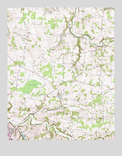
Youngville, TN USGS Topographic Map
Click on map above to begin viewing in our Map Viewer.

This topographic map contains these locations and features:
Feature Name Type Latitude Longitude GNIS ID View Map
Adams CemeteryCemeteryN36.5064°W86.7753°1644150View Map
Armstrong CemeteryCemeteryN36.5528°W86.7750°1644154View Map
AshburnPopulated PlaceN36.6212°W86.8286°1275936View Map
Beards ChapelChurchN36.5428°W86.8372°1305024View Map
Beaver Dam CreekStreamN36.5245°W86.8481°1276715View Map
Benton SchoolSchoolN36.5534°W86.8686°1277032View Map
Bobwhite (historical)Populated PlaceN36.5437°W86.7653°1310481View Map
Brick SchoolSchoolN36.6225°W86.8572°1278328View Map
Bridge Hill ChurchChurchN36.5667°W86.7956°1305412View Map
Clark CemeteryCemeteryN36.5020°W86.8097°1644202View Map
Commissioner District 8CivilN36.5784°W86.8126°2464695View Map
Cook CemeteryCemeteryN36.5359°W86.7653°1644207View Map
Corinth ChurchChurchN36.6203°W86.8253°1281309View Map
Couts CemeteryCemeteryN36.5373°W86.8439°1644212View Map
Couts CemeteryCemeteryN36.5473°W86.8294°1644213View Map
Couts CemeteryCemeteryN36.5389°W86.8355°1644214View Map
Couts CemeteryCemeteryN36.5320°W86.8258°1644215View Map
Couts CemeteryCemeteryN36.5070°W86.7944°1644216View Map
Dean CemeteryCemeteryN36.5989°W86.8628°1644225View Map
Dean CemeteryCemeteryN36.5959°W86.8150°1644226View Map
Dorris CemeteryCemeteryN36.5695°W86.7919°1644230View Map
Doss CemeteryCemeteryN36.5731°W86.7572°1644233View Map
Dozier ChurchChurchN36.5595°W86.8325°1282768View Map
Doziers School (historical)SchoolN36.5600°W86.8328°1316479View Map
Draughan CemeteryCemeteryN36.6006°W86.8139°1644236View Map
Durham CemeteryCemeteryN36.5409°W86.8544°1644245View Map
Durrett CemeteryCemeteryN36.5261°W86.7864°1644246View Map
Eastland Heights Baptist ChurchChurchN36.5100°W86.8686°1644248View Map
Fisher CemeteryCemeteryN36.5861°W86.7794°1644263View Map
Fisher CemeteryCemeteryN36.5870°W86.7519°1644264View Map
Green ValleyPopulated PlaceN36.5200°W86.7636°1310485View Map
Hart CemeteryCemeteryN36.6006°W86.8497°1287043View Map
Hendley CemeteryCemeteryN36.5986°W86.7625°1644293View Map
Henry CemeteryCemeteryN36.5548°W86.7667°1644294View Map
Henry CemeteryCemeteryN36.5611°W86.7547°1644295View Map
Herring CemeteryCemeteryN36.5348°W86.8586°1644296View Map
Holenthawall AirportAirportN36.6139°W86.8100°2675499View Map
Holman CemeteryCemeteryN36.5725°W86.7833°1644308View Map
Holman CemeteryCemeteryN36.5806°W86.8333°1644309View Map
Hopewell Baptist ChurchChurchN36.5714°W86.7986°1288321View Map
Hopewell BranchStreamN36.5973°W86.7911°1288290View Map
Hopewell CemeteryCemeteryN36.5717°W86.7980°1644312View Map
Howard CemeteryCemeteryN36.5770°W86.7714°1644314View Map
HubertvillePopulated PlaceN36.5556°W86.8003°1288582View Map
Huey CemeteryCemeteryN36.5967°W86.8069°1644315View Map
Janie Bell CemeteryCemeteryN36.5689°W86.7703°1289300View Map
Johnson CemeteryCemeteryN36.5409°W86.7750°1644327View Map
Johnson CemeteryCemeteryN36.5078°W86.8350°1644328View Map
Jones CemeteryCemeteryN36.5778°W86.7842°1644330View Map
Krisle Elementary SchoolSchoolN36.5412°W86.8308°1648406View Map
LakeviewPopulated PlaceN36.5548°W86.8094°1315345View Map
LamontPopulated PlaceN36.6242°W86.7572°1290559View Map
Lunsford CemeteryCemeteryN36.5861°W86.7805°1644336View Map
McIntosh CemeteryCemeteryN36.5220°W86.8675°1644346View Map
McMurry CemeteryCemeteryN36.5181°W86.8033°1644348View Map
MilldalePopulated PlaceN36.5900°W86.7636°1293898View Map
North Robertson SchoolSchoolN36.5570°W86.8631°1295944View Map
Nuckolls CemeteryCemeteryN36.5267°W86.8236°1644371View Map
OaklandPopulated PlaceN36.5006°W86.8306°1296179View Map
Oakland Baptist ChurchChurchN36.5009°W86.8294°1644373View Map
Oakland CemeteryCemeteryN36.5002°W86.8298°1644374View Map
Oakland School (historical)SchoolN36.5006°W86.8286°1310188View Map
Owen CemeteryCemeteryN36.5375°W86.7894°1644378View Map
Owens CemeteryCemeteryN36.5195°W86.7686°1644379View Map
Owens ChapelChurchN36.5200°W86.7644°1296579View Map
Payne CemeteryCemeteryN36.5034°W86.7583°1644383View Map
Pitt CemeteryCemeteryN36.5461°W86.8192°1644388View Map
Pope CemeteryCemeteryN36.5703°W86.8639°1644392View Map
Porter CemeteryCemeteryN36.5117°W86.8489°1644395View Map
Porter CemeteryCemeteryN36.5200°W86.8600°1644396View Map
Randolph CemeteryCemeteryN36.5945°W86.7803°1644402View Map
Randolph CemeteryCemeteryN36.5814°W86.7819°1644403View Map
Reid Farm Airport (historical)AirportN36.5645°W86.8647°1301437View Map
Robertson CountyCivilN36.5255°W86.8706°1639786View Map
Robertson County Vocational CenterSchoolN36.5098°W86.8569°1316509View Map
Santee Creek HollowValleyN36.5062°W86.7514°1300785View Map
Smelser CemeteryCemeteryN36.6070°W86.8592°1644430View Map
Springfield High SchoolSchoolN36.5092°W86.8544°1316514View Map
The SwampsSwampN36.5507°W86.8473°1272448View Map
True CemeteryCemeteryN36.5539°W86.7536°1644446View Map
Walton CemeteryCemeteryN36.5553°W86.7875°1644452View Map
Wartrace CreekStreamN36.5134°W86.8661°1304391View Map
Wartrace LakeReservoirN36.5026°W86.8558°1652589View Map
Wartrace Lake DamDamN36.5067°W86.8583°1302649View Map
Wells CemeteryCemeteryN36.5317°W86.8361°1644457View Map
Widick CemeteryCemeteryN36.5575°W86.8375°1644460View Map
Wiliams Chapel CemeteryCemeteryN36.6239°W86.7592°1644465View Map
Wilkerson CemeteryCemeteryN36.5581°W86.8675°1644462View Map
Williams ChapelChurchN36.6234°W86.7592°1304604View Map
Willis CemeteryCemeteryN36.6134°W86.8411°1644466View Map
Wilson CemeteryCemeteryN36.6209°W86.8294°1644468View Map
Winkler CemeteryCemeteryN36.5770°W86.8336°1644469View Map
Woodard CemeteryCemeteryN36.5773°W86.8528°1644478View Map
Woodard CemeteryCemeteryN36.5320°W86.8219°1644479View Map
YoungvillePopulated PlaceN36.5853°W86.8258°1275343View Map
Zech CemeteryCemeteryN36.5636°W86.7958°1644485View Map

Note: Coordinates in the location and feature list above are referenced to NAD83 datum.


Copyright (C) 2008-2024 Ryan Niemi / Sunset Dynamics ... All Rights Reserved