TopoQuest Logo
Do you find TopoQuest useful?
Help keep TopoQuest running and adding new maps/features by donating!
Bitcoin:  19c7KJd3qBynnjoSw5npx9KScwjBe4ifkT
Litecoin:  LXs6TkuXGGXo1vDsWCkWVdjQX94eUKd6ui
Home View Maps Find Maps Find Places Resources & Links


Greenfield, Illinois Topographic Map

USGS Map Title: Greenfield, IL
USGS Map MRC: 39090C2
DRG (GeoTIFF) Download: o39090c2.tif


Neighboring USGS Topographic Map Quads:


  Roodhouse East, IL  
39090D3
 

  Athensville, IL  
39090D2
 

  Scottville, IL  
39090D1
 

  Daum, IL  
39090C3
 

  Greenfield, IL  
39090C2
 

  Hettick, IL  
39090C1
 

  Jerseyville North, IL  
39090B3
 

  Medora, IL  
39090B2
 

  Summerville, IL  
39090B1


Map MRC Location:

N40°
W91°
N40°
W90°
H8 H7 H6 H5 H4 H3 H2 H1
G8 G7 G6 G5 G4 G3 G2 G1
F8 F7 F6 F5 F4 F3 F2 F1
E8 E7 E6 E5 E4 E3 E2 E1
D8 D7 D6 D5 D4 D3 D2 D1
C8 C7 C6 C5 C4 C3 C2 C1
B8 B7 B6 B5 B4 B3 B2 B1
A8 A7 A6 A5 A4 A3 A2 A1
N39°
W91°
N39°
W90°

Greenfield, IL USGS 1:24K Topographic Map Preview:
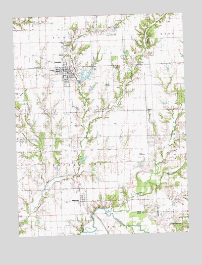
Greenfield, IL USGS Topographic Map
Click on map above to begin viewing in our Map Viewer.

This topographic map contains these locations and features:
Feature Name Type Latitude Longitude GNIS ID View Map
Burroughs School (historical)SchoolN39.3675°W90.2398°405272View Map
Cannedy CemeteryCemeteryN39.3028°W90.2084°2026080View Map
Charity ChurchChurchN39.3528°W90.2134°1748353View Map
Chism CemeteryCemeteryN39.2687°W90.1354°1764597View Map
City of GreenfieldCivilN39.3443°W90.2080°2394987View Map
Coles LakeReservoirN39.3336°W90.1933°1692081View Map
Coles Lake DamDamN39.3317°W90.1951°1692080View Map
Douglas School (historical)SchoolN39.3064°W90.2084°407345View Map
Elm Grove School (historical)SchoolN39.3348°W90.2426°407924View Map
FayettePopulated PlaceN39.3200°W90.1537°408306View Map
Franklin School (historical)SchoolN39.2873°W90.2473°408683View Map
GreenfieldPopulated PlaceN39.3437°W90.2126°409429View Map
Greenfield Elementary SchoolSchoolN39.3506°W90.2148°1811016View Map
Greenfield Fire DepartmentBuildingN39.3430°W90.2105°2640347View Map
Greenfield High SchoolSchoolN39.3425°W90.2079°1748366View Map
Greenfield Police DepartmentBuildingN39.3442°W90.2110°2759076View Map
Greenfield Post OfficePost OfficeN39.3414°W90.2112°1811017View Map
Hermitage CemeteryCemeteryN39.3678°W90.1757°1748371View Map
Hodges CreekStreamN39.2634°W90.1854°410335View Map
Horseshoe LakeLakeN39.2740°W90.1525°410572View Map
Hudson CemeteryCemeteryN39.2909°W90.2329°1748377View Map
Ireland School (historical)SchoolN39.3056°W90.1259°410914View Map
Joes CreekStreamN39.2809°W90.1523°411127View Map
Lions ParkParkN39.3573°W90.2123°1748384View Map
Mitchell CemeteryCemeteryN39.3309°W90.2476°1748389View Map
Oakwood CemeteryCemeteryN39.3595°W90.2118°1748398View Map
Pinoak School (historical)SchoolN39.2945°W90.1773°415722View Map
Pleasant Hill School (historical)SchoolN39.3459°W90.1732°415842View Map
Rives CemeteryCemeteryN39.2881°W90.1604°1748412View Map
Rives LakeLakeN39.2837°W90.1609°416737View Map
RockbridgePopulated PlaceN39.2692°W90.2043°416840View Map
Rockbridge Post OfficePost OfficeN39.2705°W90.2005°2788892View Map
Rose Hill West CemeteryCemeteryN39.3464°W90.2296°1748415View Map
Rubican CemeteryCemeteryN39.3714°W90.1701°1748416View Map
Rubicon ChurchChurchN39.3717°W90.1707°417021View Map
Rubicon CreekStreamN39.3089°W90.1982°417022View Map
Saint Michaels ChurchChurchN39.3439°W90.2201°1748419View Map
Shady Eighty Acres LakeReservoirN39.2934°W90.2051°1691911View Map
Shady Eighty Acres Lake DamDamN39.2934°W90.2051°1691910View Map
Sunset Landing Strip (historical)AirportN39.2948°W90.1604°1748426View Map
Tiger Landing Strip (historical)AirportN39.3637°W90.1773°1748430View Map
Township of RockbridgeCivilN39.2885°W90.2161°429653View Map
Village of RockbridgeCivilN39.2693°W90.2066°2399103View Map
Weisner CemeteryCemeteryN39.3125°W90.2157°1748437View Map
Witt CemeteryCemeteryN39.2617°W90.2054°1748446View Map
Witt Number 1 CemeteryCemeteryN39.2559°W90.2115°1748445View Map

Note: Coordinates in the location and feature list above are referenced to NAD83 datum.


Copyright (C) 2008-2024 Ryan Niemi / Sunset Dynamics ... All Rights Reserved