TopoQuest Logo
Do you find TopoQuest useful?
Help keep TopoQuest running and adding new maps/features by donating!
Bitcoin:  19c7KJd3qBynnjoSw5npx9KScwjBe4ifkT
Litecoin:  LXs6TkuXGGXo1vDsWCkWVdjQX94eUKd6ui
Home View Maps Find Maps Find Places Resources & Links


Hettick, Illinois Topographic Map

USGS Map Title: Hettick, IL
USGS Map MRC: 39090C1
DRG (GeoTIFF) Download: o39090c1.tif


Neighboring USGS Topographic Map Quads:


  Athensville, IL  
39090D2
 

  Scottville, IL  
39090D1
 

  Palmyra, IL  
39089D8
 

  Greenfield, IL  
39090C2
 

  Hettick, IL  
39090C1
 

  Carlinville West, IL  
39089C8
 

  Medora, IL  
39090B2
 

  Summerville, IL  
39090B1
 

  Plainview, IL  
39089B8


Map MRC Location:

N40°
W91°
N40°
W90°
H8 H7 H6 H5 H4 H3 H2 H1
G8 G7 G6 G5 G4 G3 G2 G1
F8 F7 F6 F5 F4 F3 F2 F1
E8 E7 E6 E5 E4 E3 E2 E1
D8 D7 D6 D5 D4 D3 D2 D1
C8 C7 C6 C5 C4 C3 C2 C1
B8 B7 B6 B5 B4 B3 B2 B1
A8 A7 A6 A5 A4 A3 A2 A1
N39°
W91°
N39°
W90°

Hettick, IL USGS 1:24K Topographic Map Preview:
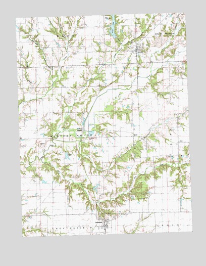
Hettick, IL USGS Topographic Map
Click on map above to begin viewing in our Map Viewer.

This topographic map contains these locations and features:
Feature Name Type Latitude Longitude GNIS ID View Map
Bear CreekStreamN39.2937°W90.1098°404022View Map
Bethel Bapyist CemeteryCemeteryN39.3367°W90.0732°1992537View Map
Bethel CemeteryCemeteryN39.3356°W90.0929°2011617View Map
Bethel ChurchChurchN39.3345°W90.0918°404304View Map
Bunn LakeReservoirN39.3684°W90.0537°1764590View Map
Carroll Island (historical)IslandN39.3356°W90.0668°422209View Map
ChesterfieldPopulated PlaceN39.2550°W90.0632°422545View Map
Chesterfield Post OfficePost OfficeN39.2541°W90.0635°2788387View Map
City ParkParkN39.3531°W90.0384°1764601View Map
Crossland CemeteryCemeteryN39.3020°W90.1095°1764603View Map
EnosPopulated PlaceN39.3012°W90.0076°422673View Map
Eureka School (historical)SchoolN39.3059°W90.0537°408088View Map
Gilead Baptist CemeteryCemeteryN39.3589°W90.0387°1994170View Map
HagamanPopulated PlaceN39.3103°W90.0782°422770View Map
HettickPopulated PlaceN39.3550°W90.0371°410123View Map
Hettick Post OfficePost OfficeN39.3547°W90.0368°2788875View Map
Hettick Volunteer Fire DepartmentBuildingN39.3550°W90.0381°2640221View Map
Hickory Grove CemeteryCemeteryN39.3395°W90.0032°1994482View Map
Jacobie SchoolReservoirN39.2955°W90.0905°1764636View Map
Keller Family CemeteryCemeteryN39.2623°W90.1104°1764638View Map
Keller School (historical)SchoolN39.2625°W90.1087°411358View Map
Lick CreekStreamN39.3053°W90.0812°412054View Map
Lumpkin CemeteryCemeteryN39.2698°W90.0343°1764647View Map
Matodd BranchStreamN39.3289°W90.1159°413125View Map
Mount Regan School (historical)SchoolN39.3689°W90.0609°414076View Map
Mount Vernon School (historical)SchoolN39.3345°W90.0837°414098View Map
Nassa CreekStreamN39.3428°W90.0257°414294View Map
Northwestern Area Ambulance and Rescue ServiceBuildingN39.3550°W90.0381°2673850View Map
Oak Grove School (historical)SchoolN39.3337°W90.0179°414799View Map
Otter CreekStreamN39.2937°W90.1098°415216View Map
Peebles CemeteryCemeteryN39.2584°W90.0645°1764676View Map
Piney School (historical)SchoolN39.3337°W90.1184°415711View Map
Prairie BranchStreamN39.3584°W90.0473°416096View Map
ReaderPopulated PlaceN39.3056°W90.0409°423105View Map
Reader CemeteryCemeteryN39.2987°W90.0470°2002779View Map
Ribble Airport (historical)AirportN39.3717°W90.0593°427369View Map
Saint Catherine CemeteryCemeteryN39.3053°W90.0743°1764691View Map
Saint Catherine ChurchChurchN39.3103°W90.0784°1764692View Map
Shiloh Baptist CemeteryCemeteryN39.2934°W90.0168°1764695View Map
Shiloh Church (historical)ChurchN39.2937°W90.0187°418415View Map
Smith - Kirby CemeteryCemeteryN39.2609°W90.0509°1764598View Map
Solomon CreekStreamN39.3095°W90.0948°418699View Map
Steer CreekStreamN39.3375°W90.0984°419090View Map
Steidley BranchStreamN39.3612°W90.0857°419092View Map
Stultz CemeteryCemeteryN39.3539°W90.0820°419235View Map
Sulphur Spring School (historical)SchoolN39.2839°W90.0740°419335View Map
Township of Western MoundCivilN39.3044°W90.0926°429914View Map
Union School (historical)SchoolN39.2614°W90.0276°420099View Map
Upton Family CemeteryCemeteryN39.3198°W90.0768°1764715View Map
Village of ChesterfieldCivilN39.2566°W90.0668°2397617View Map
Village of HettickCivilN39.3557°W90.0374°2398498View Map
Washington School (historical)SchoolN39.3681°W90.1226°420586View Map
Witt CemeteryCemeteryN39.3681°W90.0765°1764728View Map

Note: Coordinates in the location and feature list above are referenced to NAD83 datum.


Copyright (C) 2008-2024 Ryan Niemi / Sunset Dynamics ... All Rights Reserved