TopoQuest Logo
Do you find TopoQuest useful?
Help keep TopoQuest running and adding new maps/features by donating!
Bitcoin:  19c7KJd3qBynnjoSw5npx9KScwjBe4ifkT
Litecoin:  LXs6TkuXGGXo1vDsWCkWVdjQX94eUKd6ui
Home View Maps Find Maps Find Places Resources & Links


Scottville, Illinois Topographic Map

USGS Map Title: Scottville, IL
USGS Map MRC: 39090D1
DRG (GeoTIFF) Download: o39090d1.tif


Neighboring USGS Topographic Map Quads:


  Nortonville, IL  
39090E2
 

  Franklin, IL  
39090E1
 

  Waverly, IL  
39089E8
 

  Athensville, IL  
39090D2
 

  Scottville, IL  
39090D1
 

  Palmyra, IL  
39089D8
 

  Greenfield, IL  
39090C2
 

  Hettick, IL  
39090C1
 

  Carlinville West, IL  
39089C8


Map MRC Location:

N40°
W91°
N40°
W90°
H8 H7 H6 H5 H4 H3 H2 H1
G8 G7 G6 G5 G4 G3 G2 G1
F8 F7 F6 F5 F4 F3 F2 F1
E8 E7 E6 E5 E4 E3 E2 E1
D8 D7 D6 D5 D4 D3 D2 D1
C8 C7 C6 C5 C4 C3 C2 C1
B8 B7 B6 B5 B4 B3 B2 B1
A8 A7 A6 A5 A4 A3 A2 A1
N39°
W91°
N39°
W90°

Scottville, IL USGS 1:24K Topographic Map Preview:
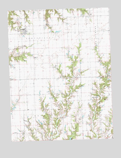
Scottville, IL USGS Topographic Map
Click on map above to begin viewing in our Map Viewer.

This topographic map contains these locations and features:
Feature Name Type Latitude Longitude GNIS ID View Map
Andrew CemeteryCemeteryN39.4162°W90.0187°1764577View Map
Asbury Church (historical)ChurchN39.3834°W90.1179°403654View Map
BarrPopulated PlaceN39.4048°W90.1043°422436View Map
Bethel School (historical)SchoolN39.4523°W90.0037°404321View Map
Crum CemeteryCemeteryN39.4331°W90.0137°1764604View Map
Goose CreekStreamN39.3773°W90.0790°409159View Map
Goshen School (historical)SchoolN39.4125°W90.0418°409205View Map
Hettick Point CemeteryCemeteryN39.4542°W90.0943°1764628View Map
Hettick Point School (historical)SchoolN39.4520°W90.0946°410124View Map
Hicks CreekStreamN39.4320°W90.0468°410194View Map
Hollingsworth CemeteryCemeteryN39.4498°W90.0148°410397View Map
Howser CemeteryCemeteryN39.4453°W90.0682°1764634View Map
James W Andrew Airport (historical)AirportN39.4145°W90.0221°427643View Map
Land CemeteryCemeteryN39.4348°W90.1240°411794View Map
Landreth School (historical)SchoolN39.4775°W90.0168°411797View Map
Little Negro LickStreamN39.4584°W90.1212°412383View Map
Maxfield School (historical)SchoolN39.4095°W90.1234°413142View Map
Miller BranchStreamN39.3984°W90.0640°413567View Map
Miller CemeteryCemeteryN39.4212°W90.0770°413575View Map
Mount Moriah School (historical)SchoolN39.4564°W90.0501°413999View Map
Mount Olive School (historical)SchoolN39.3759°W90.0140°414025View Map
MSDGC Dam Number 5DamN39.4584°W90.0718°1692635View Map
Nifong CemeteryCemeteryN39.4934°W90.0245°414518View Map
Northwestern Area Ambulance and Rescue ServiceBuildingN39.4783°W90.0990°2673912View Map
Oak Hill CemeteryCemeteryN39.4384°W90.0018°1764673View Map
Panther Creek CemeteryCemeteryN39.4859°W90.0782°407700View Map
Range CemeteryCemeteryN39.4123°W90.0079°1764686View Map
Ross CemeteryCemeteryN39.4173°W90.0043°1764688View Map
Ruyle CemeteryCemeteryN39.4517°W90.1062°1764690View Map
ScottvillePopulated PlaceN39.4803°W90.1048°418152View Map
Scottville - Modesto Rural Fire Protection DistrictBuildingN39.4780°W90.0993°2640828View Map
Scottville Post OfficePost OfficeN39.4806°W90.1043°1821361View Map
Solomon A M CemeteryCemeteryN39.3975°W90.0565°2003348View Map
Solomon G O CemeteryCemeteryN39.3948°W90.0398°2003347View Map
Township of BarrCivilN39.3904°W90.0944°428636View Map
Township of ScottvilleCivilN39.4775°W90.0956°429725View Map
Victory School (historical)SchoolN39.4050°W90.0798°420299View Map
Village of ScottvilleCivilN39.4777°W90.1038°2399777View Map
Wills CemeteryCemeteryN39.4264°W90.0373°1764727View Map
Workman School (historical)SchoolN39.4928°W90.0426°421504View Map

Note: Coordinates in the location and feature list above are referenced to NAD83 datum.


Copyright (C) 2008-2025 Ryan Niemi / Sunset Dynamics ... All Rights Reserved