TopoQuest Logo
Do you find TopoQuest useful?
Help keep TopoQuest running and adding new maps/features by donating!
Bitcoin:  19c7KJd3qBynnjoSw5npx9KScwjBe4ifkT
Litecoin:  LXs6TkuXGGXo1vDsWCkWVdjQX94eUKd6ui
Home View Maps Find Maps Find Places Resources & Links


Roodhouse East, Illinois Topographic Map

USGS Map Title: Roodhouse East, IL
USGS Map MRC: 39090D3
DRG (GeoTIFF) Download: o39090d3.tif


Neighboring USGS Topographic Map Quads:


  Alsey, IL  
39090E4
 

  Manchester, IL  
39090E3
 

  Nortonville, IL  
39090E2
 

  Roodhouse West, IL  
39090D4
 

  Roodhouse East, IL  
39090D3
 

  Athensville, IL  
39090D2
 

  Carrollton, IL  
39090C4
 

  Daum, IL  
39090C3
 

  Greenfield, IL  
39090C2


Map MRC Location:

N40°
W91°
N40°
W90°
H8 H7 H6 H5 H4 H3 H2 H1
G8 G7 G6 G5 G4 G3 G2 G1
F8 F7 F6 F5 F4 F3 F2 F1
E8 E7 E6 E5 E4 E3 E2 E1
D8 D7 D6 D5 D4 D3 D2 D1
C8 C7 C6 C5 C4 C3 C2 C1
B8 B7 B6 B5 B4 B3 B2 B1
A8 A7 A6 A5 A4 A3 A2 A1
N39°
W91°
N39°
W90°

Roodhouse East, IL USGS 1:24K Topographic Map Preview:
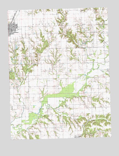
Roodhouse East, IL USGS Topographic Map
Click on map above to begin viewing in our Map Viewer.

This topographic map contains these locations and features:
Feature Name Type Latitude Longitude GNIS ID View Map
American Legion ParkParkN39.4812°W90.3640°1748341View Map
Barnett Number 1 CemeteryCemeteryN39.4675°W90.2568°1748342View Map
Batty School (historical)SchoolN39.3859°W90.3187°403967View Map
Bear CreekStreamN39.4045°W90.3210°404013View Map
Bending Oak School (historical)SchoolN39.4737°W90.3493°404166View Map
Benear School (historical)SchoolN39.4156°W90.3560°404167View Map
Birch CreekStreamN39.4445°W90.2696°404457View Map
Birch School (historical)SchoolN39.4553°W90.2740°404458View Map
City of RoodhouseCivilN39.4841°W90.3740°2396424View Map
Community ParkParkN39.4659°W90.3646°1748354View Map
Crooked RunStreamN39.3909°W90.3740°406818View Map
Emmanuel Baptist ChurchChurchN39.4820°W90.3660°1962273View Map
First Baptist ChurchChurchN39.4825°W90.3712°1962274View Map
Jericho School (historical)SchoolN39.4045°W90.2726°411096View Map
Jones CemeteryCemeteryN39.4464°W90.3202°1748380View Map
Lick CreekStreamN39.4878°W90.2535°412055View Map
Little Bear CreekStreamN39.3917°W90.2796°412279View Map
Martin Prairie School (historical)SchoolN39.4967°W90.2829°413075View Map
Martins Prairie CemeteryCemeteryN39.4978°W90.2835°1748386View Map
Martins Prairie ChurchChurchN39.4837°W90.2826°413074View Map
Negro LickStreamN39.4412°W90.2651°414519View Map
New Shiloh School (historical)SchoolN39.4412°W90.3212°414468View Map
Oakland Church (historical)ChurchN39.4553°W90.3498°414895View Map
Prospect School (historical)SchoolN39.4506°W90.3632°416243View Map
RoodhousePopulated PlaceN39.4839°W90.3715°416907View Map
Roodhouse Christian ChurchChurchN39.4820°W90.3718°1962278View Map
Roodhouse LakeReservoirN39.4617°W90.3651°1692297View Map
Roodhouse Lake DamDamN39.4617°W90.3651°1692296View Map
Roodhouse Police DepartmentBuildingN39.4844°W90.3715°2758984View Map
Roodhouse Post OfficePost OfficeN39.4829°W90.3728°1811022View Map
Sanders CemeteryCemeteryN39.4562°W90.2948°1748420View Map
Shanklin School (historical)SchoolN39.4728°W90.3026°418282View Map
Shiloh Church (historical)ChurchN39.4475°W90.3210°418418View Map
Short CemeteryCemeteryN39.4117°W90.2534°1748422View Map
Township of RoodhouseCivilN39.4914°W90.3571°429667View Map
Township of WrightsCivilN39.3891°W90.3197°429960View Map
Tunnison CemeteryCemeteryN39.4973°W90.3401°1748432View Map
Union Prather CemeteryCemeteryN39.4391°W90.2507°1748433View Map
Wesley Church (historical)ChurchN39.4262°W90.3515°420772View Map
Wolf RunStreamN39.3934°W90.3732°421395View Map
WrightsPopulated PlaceN39.3759°W90.2943°421532View Map
Wrights Post OfficePost OfficeN39.3762°W90.2946°1811024View Map

Note: Coordinates in the location and feature list above are referenced to NAD83 datum.


Copyright (C) 2008-2025 Ryan Niemi / Sunset Dynamics ... All Rights Reserved