TopoQuest Logo
Do you find TopoQuest useful?
Help keep TopoQuest running and adding new maps/features by donating!
Bitcoin:  19c7KJd3qBynnjoSw5npx9KScwjBe4ifkT
Litecoin:  LXs6TkuXGGXo1vDsWCkWVdjQX94eUKd6ui
Home View Maps Find Maps Find Places Resources & Links


Bowler, Wisconsin Topographic Map

USGS Map Title: Bowler, WI
USGS Map MRC: 44088G8
DRG (GeoTIFF) Download: o44088g8.tif


Neighboring USGS Topographic Map Quads:


  Regina, WI  
44089H1
 

  Burney Lake, WI  
44088H8
 

  Neopit, WI  
44088H7
 

  Shepley, WI  
44089G1
 

  Bowler, WI  
44088G8
 

  Gresham, WI  
44088G7
 

  Tigerton, WI  
44089F1
 

  Marion, WI  
44088F8
 

  Clintonville North, WI  
44088F7


Map MRC Location:

N45°
W89°
N45°
W88°
H8 H7 H6 H5 H4 H3 H2 H1
G8 G7 G6 G5 G4 G3 G2 G1
F8 F7 F6 F5 F4 F3 F2 F1
E8 E7 E6 E5 E4 E3 E2 E1
D8 D7 D6 D5 D4 D3 D2 D1
C8 C7 C6 C5 C4 C3 C2 C1
B8 B7 B6 B5 B4 B3 B2 B1
A8 A7 A6 A5 A4 A3 A2 A1
N44°
W89°
N44°
W88°

Bowler, WI USGS 1:24K Topographic Map Preview:
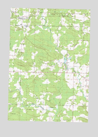
Bowler, WI USGS Topographic Map
Click on map above to begin viewing in our Map Viewer.

This topographic map contains these locations and features:
Feature Name Type Latitude Longitude GNIS ID View Map
Bethany ChurchChurchN44.8050°W88.9001°1566883View Map
BowlerPopulated PlaceN44.8630°W88.9821°1562100View Map
Bowler Area Fire DistrictBuildingN44.8560°W88.9807°2696855View Map
Bowler Elementary SchoolSchoolN44.8563°W88.9822°2713351View Map
Bowler High SchoolSchoolN44.8563°W88.9823°2713295View Map
Bowler PondLakeN44.8633°W88.9829°2784228View Map
Hennig CreekStreamN44.8680°W88.9523°1566302View Map
Logemanns CreekStreamN44.7630°W88.9226°1568496View Map
Maas Field (historical)AirportN44.8194°W88.9084°1582239View Map
Pony CreekStreamN44.8147°W88.9151°1571754View Map
Seneca CemeteryCemeteryN44.7900°W88.8793°1573900View Map
Strassburg CreekStreamN44.8653°W88.9979°1574971View Map
TilledaPopulated PlaceN44.8155°W88.9112°1575453View Map
Tilleda 1885C281 DamDamN44.8150°W88.9134°1792046View Map
Tilleda Census Designated PlaceCensusN44.8156°W88.9124°2585077View Map
Tilleda Pond 53ReservoirN44.8182°W88.9127°1792047View Map
Town of SenecaCivilN44.8118°W88.9201°1584123View Map
Village of BowlerCivilN44.8629°W88.9815°1582847View Map
Weasel Dam School (historical)SchoolN44.7678°W88.9454°1876821View Map

Note: Coordinates in the location and feature list above are referenced to NAD83 datum.


Copyright (C) 2008-2024 Ryan Niemi / Sunset Dynamics ... All Rights Reserved